
Near Winchester in Frederick County, Virginia — The American South (Mid-Atlantic)
Sandy Ridge
Heart of the Lower Valley Viewshed
Photographed by Bradley Owen, August 29, 2026
1. Sandy Ridge Marker
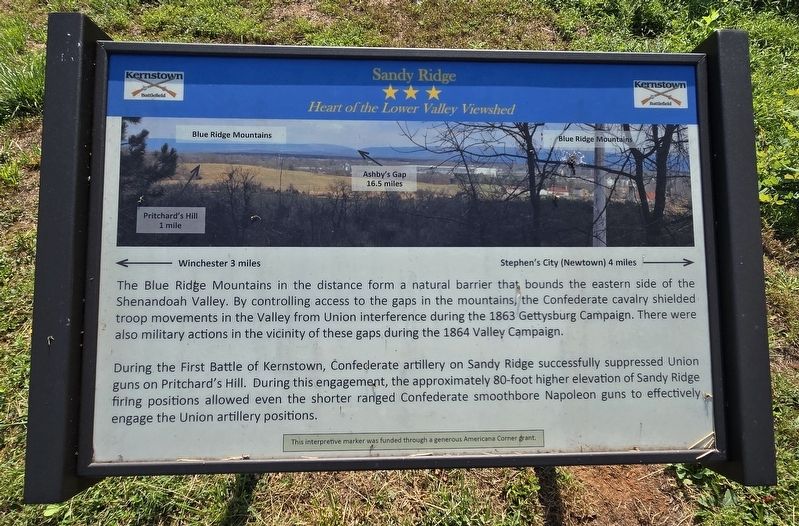
The Blue Ridge Mountains in the distance form a natural barrier that bounds the eastern side of the Shenandoah Valley. By controlling access to the gaps in the mountains, the Confederate cavalry shielded troop movements in the Valley from Union interference during the 1863 Gettysburg Campaign. There were also military actions in the vicinity of these gaps during the 1864 Valley Campaign.
During the First Battle of Kernstown, Confederate artillery on Sandy Ridge successfully suppressed Union guns on Pritchard's Hill. During this engagement, the approximately 80-foot higher elevation of Sandy Ridge firing positions allowed even the shorter ranged Confederate smoothbore Napoleon guns to effectively, engage the Union artillery positions.
Erected 2026 by Shenandoah Valley Battlefields Association.
Topics. This historical marker is listed in this topic list: War, US Civil. A significant historical year for this entry is 1863.
Location. 39° 8.794′ N, 78° 12.68′ W. Marker is near Winchester, Virginia, in Frederick County. It can be reached from Jones Road (Virginia Route 621) 0.4 miles south of Cedar Creek Grade ( Route
this page online

Regionally, this marker is in Virginia’s Shenandoah Valley. It is also in the American South, specifically in the Upper South, and in the Mid-Atlantic. Globally, it is in North America, the Western Hemisphere, the Western World, and the Anglosphere. Historically, it finds itself in what was once the territory of the Mississippian Culture, one of the original Thirteen Colonies, one of the Confederate States of America, and the Antebellum South.
Other nearby markers. At least 8 other markers are within walking distance of this marker: Other Actions On Sandy Ridge (within shouting distance of this marker); Caring For the Wounded and Dead (within shouting distance of this marker); Actions on the Confederate Right & Death of Col. Murray
Photographed by Bradley Owen, August 29, 2026
2. Sandy Ridge Marker
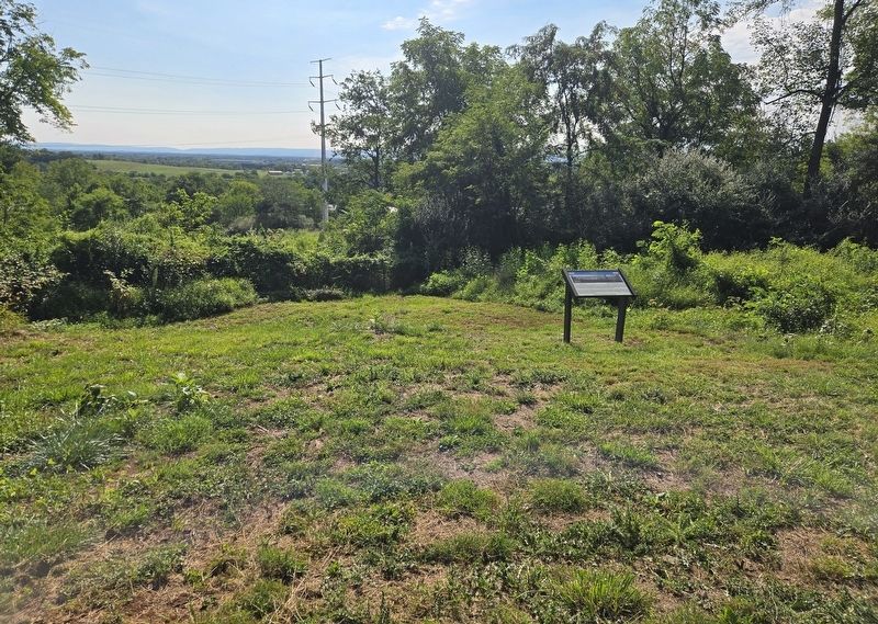
The Blue Ridge Mountains can be seen at the distant left horizon with Pritchard's Hill in the open clearing in front of them.
Regarding Sandy Ridge. Marker includes a labeled photograph of landmarks viewed from this location.
Credits. This page was last revised on September 7, 2026. It was originally submitted on September 7, 2026, by Bradley Owen of Morgantown, West Virginia. This page has been viewed 10 times since then. Photos: 1, 2. submitted on September 7, 2026, by Bradley Owen of Morgantown, West Virginia.
