Ironton in Lawrence County, Ohio — The American Midwest (Great Lakes)
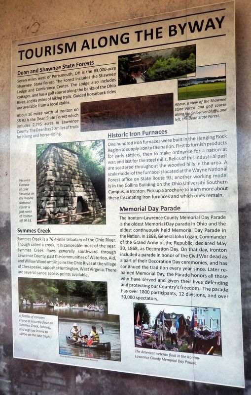
Tourism Along the Byway
Photographed by Cosmos Mariner, August 28, 2021
1. Tourism Along the Byway Marker
Dean and Shawnee State Forests
Seven miles west of Portsmouth, OH is the 63,000-acre Shawnee State Forest. The Forest includes the Shawnee Lodge and Conference Center. The Lodge also includes cottages, and has a golf course along the banks of the Ohio River, and 65 miles of hiking trails. Guided horseback rides are available from a local stable.
About 16 miles north of Ironton on SR 93 is the Dean State Forest which includes 2,745 acres in Lawrence County. The Dean has 20 miles of trails for hiking and horse-riding.
Symmes Creek
Symmes Creek is a 76.4-mile tributary of the Ohio River. Though called a creek, it is canoeable most of the year. Symmes Creek flows generally southward through Lawrence County, past the communities of Waterloo, Aid, and Willow Wood until it joins the Ohio River at the village of Chesapeake, opposite Huntington, West Virginia. There are several canoe access points available.
Historic Iron Furnaces
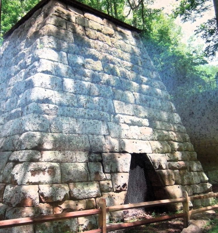
One hundred iron furnaces were built in the Hanging Rock Region to supply iron to the nation. First to furnish products for early settlers, then to make ordnance for a nation at war, and last for the steel mills. Relics of his industrial past are scattered throughout the wooded hills in the area. A scale model of the furnace is located at the Wayne National Forest office on State Route 93; another working model is in the Collins Building on the Ohio University Southern Campus, in Ironton. Pick up a brochure to learn more about these fascinating iron furnaces and which ones remain.
Memorial Day Parade
The Ironton—Lawrence County Memorial Day Parade is the oldest Memorial Day parade in Ohio and the oldest continuously held Memorial Day Parade in the Nation. In 1868, General John Logan, Commander of the Grand Army of the Republic, declared May 30, 1868, as Decoration Day. On that day, Ironton included
this page online
[photo captions]
• A view of the Shawnee State Forest and golf course along the Ohio River bluffs.
• The Dean State Forest.
• A flotilla of canoers enjoys a leisurely float on Symmes Creek.
• A group learns to canoe at the lake.
• The American veteran float in the Ironton-Lawrence County Memorial Day Parade.
Erected by Ohio River Scenic Byways & Federal Highway Administration.
Topics. This historical marker is listed in these topic lists: Industry & Commerce • Parks & Recreational Areas • Patriots & Patriotism • War, US Civil. A significant historical date for this entry is May 30, 1868.
Location. 38° 32.209′ N, 82° 40.62′ W. Marker is in Ironton, Ohio, in Lawrence County. It can be reached from the intersection of South 9th Street and Washington Street, on the right when
2. Marker detail: Vesuvius Furnace
Vesuvius Furnace at Lake Vesuvius in the Wayne National Forest is just north of Ironton off SR 93.

Regionally, this marker is in the Kyova Tri-State Region. It is also in the American Midwest, in the Ohio River Valley, in Appalachia, and specifically in Northern Appalachia. Globally, it is in North America, the Western Hemisphere, the Western World, and the Anglosphere. Historically, it finds itself in what was once the Haudenosaunee (Iroquois) Confederacy, the territory of the Mississippian Culture, and the Northwest Territory.
Other nearby markers. At least 8 other markers are within walking distance of this marker: John Campbell (here, next to this marker); Did You Know? (here, next to this marker); Hanging Rock Iron Furnace Region (here, next to this marker); There is Much to See on the Ohio River Scenic Byway (here, next to this marker); Commerce on the Big River (here, next to this marker); Ironton and the Ohio River (here, next to this
Photographed by Cosmos Mariner, August 28, 2021
3. Tourism Along the Byway Marker
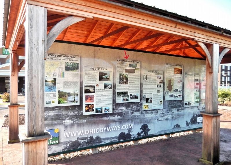
This marker is the third panel from the left on the north side of the Ohio River Scenic Byway interpretive kiosk.
Related markers. Click here for a list of markers that are related to this marker.
Credits. This page was last revised on September 8, 2026. It was originally submitted on September 7, 2026, by Cosmos Mariner of Cape Canaveral, Florida. This page has been viewed 18 times since then. Photos: 1. submitted on September 7, 2026, by Cosmos Mariner of Cape Canaveral, Florida. 2, 3. submitted on September 8, 2026, by Cosmos Mariner of Cape Canaveral, Florida.
