Near Richmond in Henrico County, Virginia — The American South (Mid-Atlantic)
Battle of Darbytown Road
Lee’s Last Advance North of the James
Photographed by Bill Coughlin, April 25, 2007
1. Battle of Darbytown Road marker
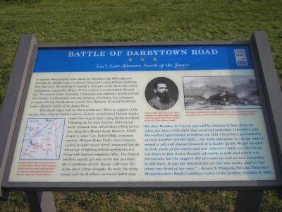
The attack began well for the Confederates. With the support of the cavalry, Gen. Charles Field’s infantry division overwhelmed Federal cavalry under Gen. August Kautz along Darbytown Road. Following up his early success, Field turned south to attack Gen. Alfred Terry’s Federal division along New Market Road. However, Field’s support, under Gen. Robert Hoke, remained inactive. Without Hoke, Field’s three brigades pushed straight ahead. Terry’s command had the advantage of fighting behind earthworks and firing with Spencer repeating rifles. The Federal artillery quickly got into
this page online
“My dear Brother, As I know you will be anxious to hear from me when you hear of the fight that occurred yesterday, I therefore take the earliest opportunity to inform you that I have been permitted to survive another terrible fight…the order was given to charge and we raised a yell and dashed forward at a double quick. We got up within forty yards of the enemy and was ordered to halt, our line being cut down so fast it was thought advisable to halt and await reinforcements, but the support did not come up and we was compelled to fall back. It was the heaviest fire we ever was under, and we lost about one third of our men.” - James S. Wingard, Palmetto Sharpshooters, South Carolina. Letter to his brother, October 8, 1864
(captions)
Despite initial success here on the Darbytown Road, Field's advance stalled and then was repulsed after the failed attack against the Union defense along the New Market Road.
John Gregg, commanding the Texas Brigade, was killed while leading his command against the Union position just north of New Market Road.
This image, published shortly after the battle in Harper’s Weekly magazine, was based on an eyewitness sketch drawn by combat artist William Waud.
Erected by Virginia
Photographed by Bill Coughlin, April 25, 2007
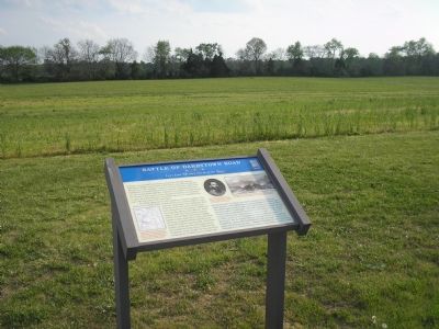
2. Civil War Trails marker for Battle of Darbytown Road
Topics and series. This historical marker is listed in this topic list: War, US Civil. In addition, it is included in the Virginia Civil War Trails series list. A significant historical date for this entry is October 7, 1864.
Location. This marker has been replaced by another marker nearby. It was located near 37° 28.358′ N, 77° 20.342′ W. Marker was near Richmond, Virginia, in Henrico County. It was at the intersection of Darbytown Road (County Route 600) and Dorey Park Road, on the right when traveling east on Darbytown Road. Marker is at the entrance to Dorey Park, east of Laburnum Avenue. Touch for map. Marker was at or near this postal address: 2999 Darbytown Rd, Henrico VA 23231, United States of America. Touch for directions.

Regionally, this marker was in the Piedmont and in Central Virginia. It was also in the American South, specifically in the Upper South, and on the Eastern Seaboard. Globally, it was in the North Atlantic Region, North America, the Western Hemisphere, the Western World, and the Anglosphere. Historically, it found itself in what was once the territory of the Mississippian Culture, one of the original Thirteen Colonies, one of the Confederate States of America, and the Antebellum South.
Other nearby markers. At least 8 other markers are within 2 miles of this location, measured as the crow flies: One Last Advance (here, next to this marker); Second Battle of Fair Oaks (here, next to this marker); Richmond Defences (approx. 0.2 miles away); The Dorey Family (approx. ¼ mile away); Darbytown Road / Pioneer Baptist Church (approx. 0.3 miles away); a different marker also named Richmond Defences (approx. one mile away); Defenses of Richmond (approx. 1.2 miles away); 1862 Peninsula Campaign (approx. 1.2 miles away). Touch for a list and map of all markers in Richmond.
Credits. This page was last revised on September 8, 2026. It was originally submitted on November 19, 2007, by Bill Coughlin of Woodland Park, New Jersey. This page has been viewed 4,410 times since then and 142 times this year. Last updated on September 7, 2026, by Mark P. Brock-Cancellieri of Baltimore, Maryland. Photos: 1, 2. submitted on November 19, 2007, by Bill Coughlin of Woodland Park, New Jersey. • Bernard Fisher was the editor who published this page.
