Near Richmond in Henrico County, Virginia — The American South (Mid-Atlantic)
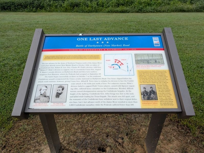
One Last Advance
Battle of Darbytown (New Market) Road
| — | Siege of Petersburg & Richmond 1864-1865 | — |
Photographed by Mark P. Brock-Cancellieri, August 30, 2026
1. One Last Advance Marker
The last advance by the Army of Northern Virginia north of the James River took place directly across New Market Road in October 1864, on orders of Confederate Gen. Robert E. Lee. Gen. Charles W. Field's division, with Gen. Robert F. Hoke's division in support, was to overwhelm Union Gen. August V. Kautz's cavalry division on Darbytown Road and then turn south to recapture Fort Harrison, which the Federals hod occupied on September 29.
The battle began successfully at dawn on October 7 as the combined Confederate assault overpowered the Union cavalry stationed on Darbytown Road.
this page online
(sidebar)
The Union victory at the Battle of Darbytown Road can be attributed in part to advanced weapon technology. Most of Gen. Joseph C Abbott's infantry regiments in Terry's division were equipped with Spencer rifles—a magazine-fed, lever-action weapon utilizing metal cartridges. The rifles had a firing rate of one shot every three seconds, far faster than the single-shot rifles that most Confederates carried. James Spencer designed the rifle in 1860, but the U.S. Army did not begin introducing them until 1863; carbines came later. Capt. Albert Maxfield, 11th Maine Infantry, wrote that it seemed as if the Spencer rifles fired "seven volleys in one...The rebels stopped broke and feel back to cover, leaving the woods piled with their dead and dying."
(captions)
Gen Alfred H. Terry Courtesy Library of Congress
Gen John Gregg Courtesy Library of Congress
Federals near New Market Road repulse Confederate infantry during the Battle of Darbytown Road Courtesy Library of Congress
Unidentified Union soldiers holding Spencer carbines Courtesy Library of Congress
Erected by Virginia
Photographed by Mark P. Brock-Cancellieri, August 30, 2026
2. One Last Advance Marker
Topics and series. This historical marker is listed in this topic list: War, US Civil. In addition, it is included in the Virginia Civil War Trails series list. A significant historical date for this entry is October 7, 1864.
Location. 37° 28.358′ N, 77° 20.34′ W. Marker is near Richmond, Virginia, in Henrico County. It is at the intersection of Darbytown Road (County Route 600) and Dorey Park Road, on the right when traveling west on Darbytown Road. Marker is at the entrance to Dorey Park, east of Laburnum Avenue. Touch for map. Marker is at or near this postal address: 2999 Darbytown Rd, Henrico VA 23231, United States of America. Touch for directions.

Regionally, this marker is in the Piedmont and in Central Virginia. It is also in the American South, specifically in the Upper South, and on the Eastern Seaboard. Globally, it is in the North Atlantic Region, North America, the Western Hemisphere, the Western World, and the Anglosphere. Historically, it finds itself in what was once the territory of the Mississippian Culture, one of the original Thirteen Colonies, one of the Confederate States of America, and the Antebellum South.
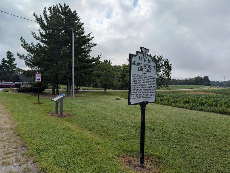
Other nearby markers. At least 8 other markers are within 2 miles of this marker, measured as the crow flies: Second Battle of Fair Oaks (a few steps from this marker); Richmond Defences (approx. 0.2 miles away); The Dorey Family (approx. ¼ mile away); Darbytown Road / Pioneer Baptist Church (approx. ¼ mile away); a different marker also named Richmond Defences (approx. one mile away); Defenses of Richmond (approx. 1.2 miles away); 1862 Peninsula Campaign (approx. 1.2 miles away); Lee vs. Grant (approx. 1.2 miles away). Touch for a list and map of all markers in Richmond.
Another marker is no longer nearby. Battle of Darbytown Road (was here, next to this marker but has been replaced with another marker now near it).
Credits. This page was last revised on September 8, 2026. It was originally submitted on September 7, 2026, by Mark P. Brock-Cancellieri of Baltimore, Maryland. This page has been viewed 14 times since then. Photos: 1, 2. submitted on September 7, 2026, by Mark P. Brock-Cancellieri of Baltimore, Maryland. • Bernard Fisher was the editor who published this page.
