THE HISTORICAL
MARKER DATABASE
“Bite-Size Bits of Local, National, and Global History”
Goleta in Santa Barbara County, California — The American West (Pacific Coastal)
 

Gaviota Timeline: 8) Gaviota Grows
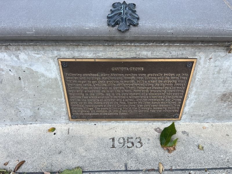
 
 
Gaviota Grows Marker image. Click for full size.
Photographed by Adam Margolis, May 31, 2026
1. Gaviota Grows Marker
Inscription. Following statehood, many Mexican ranchos were gradually broken up into smaller land holdings. Ranchers and farmers from Gaviota and the Santa Ynez Valley eager to get their produce to market, built a wharf for shipping wool, grain and cattle. Until the 1920s, cattle were herded along the highway through Gaviota Pass on their way to Gaviota Wharf. Passenger steamships also made regularly scheduled calls at the wharf. Petroleum processing operations, beginning in the 1890s, led to the development of a community just out of Gaviota Pass which eventually included a refinery and a wharf for oil tankers, as well as the townsite of Alcatraz and a school. Another community, Las Cruces, grew up on the inland side of the Pass. Nearby Hollister Ranch maintained its unofficial headquarters at the old Gaviota Store, later developed commercially as Gaviota Village. The years following World War II brought increasing traffic to the Highway 101 corridor. In 1953 a new era for Gaviota Pass was inaugurated with the completion of the Gaviota Tunnel.
 
Topics. This historical marker is listed in these topic lists: Industry & Commerce
Paid Advertisement
Click or scan to see
this page online
• Roads & Vehicles • Waterways & Vessels. A significant historical year for this entry is 1953.
 
Location. 34° 29.116′ N, 120° 13.704′ W. Marker is in Goleta, California, in Santa Barbara County. It is on U.S. 101, on the right when traveling north. The marker is located in the northbound rest area. Touch for map. Marker is at or near this postal address: 1595 US-101, Goleta CA 93117, United States of America. Touch for directions.

Regionally, this marker is on the Central Coast, specifically on the Coast Ranges, and specifically in the Transverse Ranges. It is also on the American Pacific Coast. Globally, it is in North America, on the Ring of Fire, on the Pacific Rim, in the Western Hemisphere, in the Western World, and in the Anglosphere. Historically, it finds itself in what was once New Spain and also Mexico’s Alta California.

Other nearby markers. At least 8 other markers are within walking distance of this marker: Gaviota Timeline: 7) Highways and Byways (here, next to this marker); Gaviota Timeline: 6) America Expands (here, next to this marker); Gaviota Timeline: 5) California Ranchos (here, next to this marker);
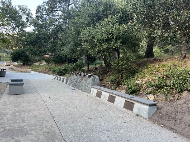
Gaviota Grows Marker image. Click for full size.
Photographed by Adam Margolis, May 31, 2026
2. Gaviota Grows Marker
Gaviota Timeline: 4) Missions and Trade (here, next to this marker); Gaviota Timeline: 3) Expeditions by Land (a few steps from this marker); Gaviota Timeline: 2) Exploration by Sea (a few steps from this marker); Gaviota Pass (a few steps from this marker); Gaviota Timeline: 1) Prehistoric Gaviota (a few steps from this marker). Touch for a list and map of all markers in Goleta.
 
 
Credits. This page was last revised on September 17, 2026. It was originally submitted on September 7, 2026, by Adam Margolis of Mission Viejo, California. This page has been viewed 8 times since then. Photos:   1, 2. submitted on September 7, 2026, by Adam Margolis of Mission Viejo, California. • Andrew Ruppenstein was the editor who published this page.

m=310312

CeraNet Cloud Computing sponsors the Historical Marker Database.
This website earns income from purchases you make after using our links to Amazon.com. We appreciate your support.
Paid Advertisement
Oct. 6, 2026