
Near Winchester in Frederick County, Virginia — The American South (Mid-Atlantic)
The Advance of Tyler's Brigade
Photographed by Bradley Owen, August 29, 2026
1. The Advance of Tyler's Brigade Marker
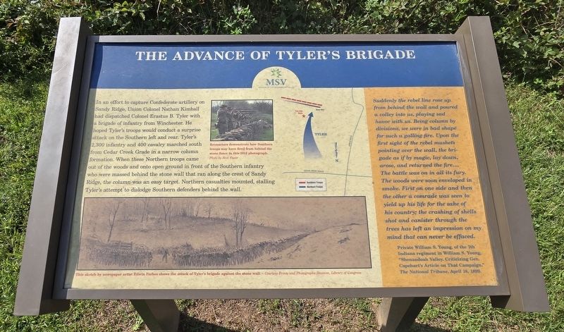
In an effort to capture Confederate artillery on Sandy Ridge, Union Colonel Nathan Kimball had dispatched Colonel Erastus B. Tyler with a brigade of infantry from Winchester. He hoped Tyler's troops would conduct a surprise attack on the Southern left and rear. Tyler's 2,300 infantry and 400 cavalry marched south from Cedar Creek Grade in a narrow column formation. When these Northern troops came out of the woods and onto open ground in front of the Southern infantry who were massed behind the stone wall that ran along the crest of Sandy Ridge, the column was an easy target. Northern casualties mounted, stalling Tyler's attempt to dislodge Southern defenders behind the wall.
(Sidebar):
Suddenly the rebel line rose up from behind the wall and poured a volley into us, playing sad havoc with us. Being column by divisions, we were in bad shape for such a galling fire. Upon the first sight of the rebel muskets pointing over the wall, the brigade as if by magic, lay down, arose, and returned the fire.... The battle was on in all its fury. The woods were soon enveloped in smoke. First on one side and then the other a comrade was seen to yield up his life for the sake of his country; the crashing of shells shot and canister through the trees has left an impression on my mind that can never be effaced.
PrivateWilliam S. Young, of the 7th Indiana regiment in William S. Young, "Shenandoah Valley. Criticizing Gen. Capehart's Article on That Campaign." The National Tribune, April 18, 1899.
Click or scan to see
this page online
(Captions):
Reenactors demonstrate how Southern troops may have fired from behind the stone fence in this 2012 photograph.
Photo by Rick Foster
This sketch by newspaper artist Edwin Forbes shows the attack of Tyler's brigade against the stone wall - Courtesy Prints and Photographs Division, Library of Congress
Erected by Museum of the Shenandoah Valley.
Topics. This historical marker is listed in this topic list: War, US Civil. A significant historical date for this entry is April 18, 1899.
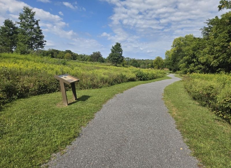
Location. 39° 9.174′ N, 78° 12.85′ W. Marker is near Winchester, Virginia, in Frederick County. It can be reached from Jones Road (Virginia Route 621) 0.4 miles south of Cedar Creek Grade ( Route 622), on the left when traveling south. Marker is located on the Main Loop Trail at Rose Hill Park. Touch for map. Marker is at or near this postal address: 1871 Jones Road, Winchester VA 22602, United States of America. Touch for directions.

Regionally, this marker is in Virginia’s
Photographed by Bradley Owen, August 29, 2026
2. The Advance of Tyler's Brigade Marker
Other nearby markers. At least 8 other markers are within walking distance of this marker: A different marker also named The Defense of the Stone Wall (about 600 feet away); The Order For Retreat (approx. 0.2 miles away); Fight for the High Ground (approx. 0.2 miles away); a different marker also named Northern Victory, Southern Defeat (approx. ¼ mile away); War In The Backyard (approx. 0.3 miles away); Rose Hill (approx. 0.3 miles away); The First Battle Of Kernstown (approx. 0.3 miles away); Caring For the Wounded and Dead (approx. 0.4 miles away). Touch for a list and map of all markers in Winchester.
Other markers no longer nearby. The Order for Retreat (was about 400 feet away, measured in a direct line but
Photographed by Bradley Owen, August 29, 2026
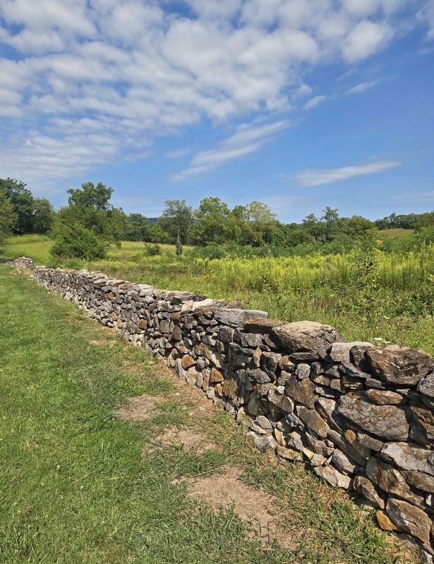
3. Reconstructed Stone Wall
Located on a spur off the Main Loop Trail.
Related marker. Click here for another marker that is related to this marker. This marker has replaced the linked marker.
Credits. This page was last revised on September 8, 2026. It was originally submitted on September 8, 2026, by Bradley Owen of Morgantown, West Virginia. This page has been viewed 5 times since then. Photos: 1, 2, 3. submitted on September 8, 2026, by Bradley Owen of Morgantown, West Virginia.
