Richmond on Staten Island in Richmond County, New York — The American Northeast (Mid-Atlantic)
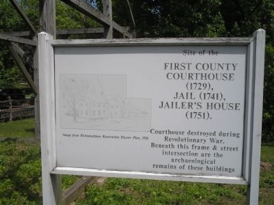
Site of the First County Courthouse (1729), Jail (1741), Jailer’s House (1751).
Photographed by Bill Coughlin, May 16, 2010
1. Site of 18th century structures Marker
Courthouse destroyed during the Revolutionary War. Beneath this frame & street intersection are the archaeological remains of these buildings.
Topics. This historical marker is listed in these topic lists: Anthropology & Archaeology • Colonial Era • Government & Politics • War, US Revolutionary. A significant historical year for this entry is 1729.
Location. 40° 34.325′ N, 74° 8.804′ W. Marker is on Staten Island, New York, in Richmond County. It is in Richmond. It is at the intersection of Richmond Road and Arthur Kill Road, on the right when traveling west on Richmond Road. Marker is located in Historic Richmondtown. Touch for map. Marker is at or near this postal address: 3752 Richmond Rd, Staten Island NY 10306, United States of America. Touch for directions.

Regionally, this marker is in New York City. It is also in the American Northeast, in the Mid-Atlantic, and on the Eastern Seaboard. Globally, it is in the North Atlantic Region, North America, the Western Hemisphere, the Western World, and the Anglosphere. Historically, it finds itself in what was once New Netherland and also one of the
this page online
Other nearby markers. At least 8 other markers are within walking distance of this marker: Site of Richmond County Hall and the Parish House of St. Andrew's Church (a few steps from this marker); Site of the Lighthouse Restaurant (within shouting distance of this marker); Where Does Your Grain Go? (within shouting distance of this marker); "Grist" for the Mills (within shouting distance of this marker); Treasure House (within shouting distance of this marker); Mills of Staten Island: Making Use of Natural Resources (within shouting distance of this marker); Staten Island Connections (within shouting distance of this marker); Site of the Second County Courthouse (within shouting distance of this marker). Touch for a list and map of all markers in Staten Island.
More about this marker. The left of the marker features an “Image from Richmondtown Restoration Master Plan, 1956.”
Also see . . . Historic Richmond Town. Website homepage (Submitted on May 18, 2010, by Bill Coughlin of Woodland Park, New Jersey.)
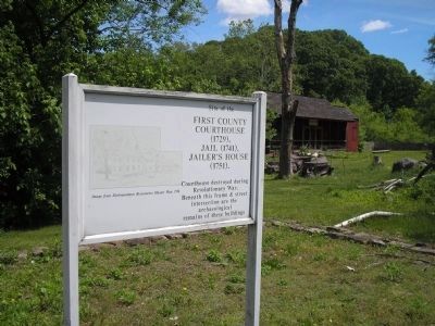
Photographed by Bill Coughlin, May 16, 2010
2. Staten Island Marker
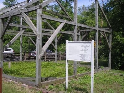
Photographed by Bill Coughlin, May 16, 2010
3. Marker at Historic Richmond Town
The First Court-house was destroyed by the British the in 1776. The other buildings burned down in 1895.
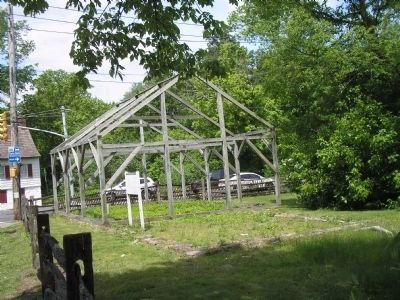
Photographed by Bill Coughlin, May 16, 2010
4. Site of 18th century structures Marker
The footprint of the structures can be seen in this photo, taken from Richmond Road.
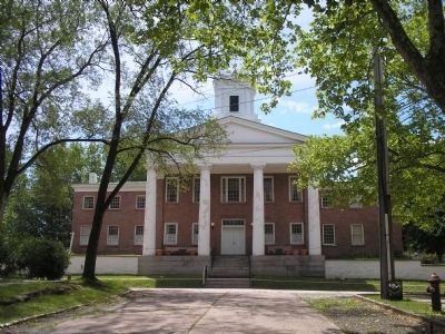
Photographed by Bill Coughlin, May 16, 2010
5. 3rd County Courthouse
This Greek Revival building served as the third Richmond County Courthouse from 1837 until 1919. It is located a short distance from the marker.
Credits. This page was last revised on September 10, 2026. It was originally submitted on May 18, 2010, by Bill Coughlin of Woodland Park, New Jersey. This page has been viewed 974 times since then and 35 times this year. Last updated on September 9, 2026, by Carl Gordon Moore Jr. of North East, Maryland. Photos: 1, 2, 3, 4, 5. submitted on May 18, 2010, by Bill Coughlin of Woodland Park, New Jersey. • Devry Becker Jones was the editor who published this page.
