
Dayton's Bluff in Saint Paul in Ramsey County, Minnesota — The American Midwest (Upper Plains)
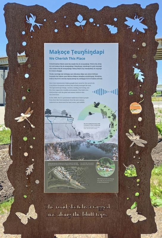
Maḳoc̣e Ṭueŋḣiŋdapi
We Cherish This Place
Photographed by McGhiever, June 13, 2026
1. Maḳoc̣e Ṭueŋḣiŋdapi Marker

Ómaḳa opawiŋġe aḳe ṡahdoġaŋ sam wikcemna ṡákpe sam yámni héehaŋn Isaŋṭaŋka kiŋ Daḳota oyate Mnisota Maḳoc̣e detaŋhaŋ wic̣akaḣapapi. Hetaŋhaŋ, maḳoc̣e kiŋ de k'a mni kiŋ taŋyaŋ ḳuwap ṡni, ahokip̣api ṡni k'a ḣ'aŋhiya yuṡicapi.
In the 1860s, the U.S. government exiled most Daḳota people from their Mní Sota homeland. Over the next century, industrial use desecrated the land, water, and wildlife.
• Ames & Hoyt Sawmill
• Sanford Sawmill
• Brewers' homes
• Brewery cave
• North Star Brewery
• Shanties
• Lime house
• Waḳaŋ Ṭípi Cave
Topics.
this page online
Location. 44° 57.138′ N, 93° 4.45′ W. Marker is in Saint Paul, Minnesota, in Ramsey County. It is in Dayton's Bluff. It can be reached from the intersection of Commercial Street and 4th Street E.. The marker is next to the Waḳaŋ Ṭípi Center. Touch for map. Marker is at or near this postal address: 590 4th Street E, Saint Paul MN 55106, United States of America. Touch for directions.

Regionally, this marker is in the Twin Cities Metropolitan Area. It is also in the American Midwest, in the Corn Belt, and in the Great River Road Region. Globally, it is in North America, the Western Hemisphere, the Western World, and the Anglosphere. Historically, it finds itself in what was once Rupert’s Land, the territory of the Mississippian Culture, and the Louisiana Purchase.
Other nearby markers. At least 8 other markers are within walking distance of this marker: Waḳaŋ Ṭípi (here, next to this marker); Wic̣oḣ'aŋ
Photographed by McGhiever, June 13, 2026
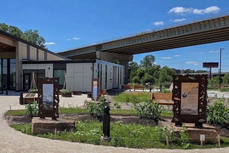
2. Maḳoc̣e Ṭueŋḣiŋdapi Marker (left) in front of the Waḳaŋ Ṭípi Center
Other markers no longer nearby. A time of environmental and cultural change (was within shouting distance of this marker but has been permanently removed); Dakota life along Wakpa Tanka (was within shouting distance of this marker but has been permanently removed).
Credits. This page was last revised on September 9, 2026. It was originally submitted on September 9, 2026, by McGhiever of Minneapolis, Minnesota. This page has been viewed 3 times since then. Photos: 1. submitted on September 9, 2026, by McGhiever of Minneapolis, Minnesota. 2. submitted on August 2, 2026, by McGhiever of Minneapolis, Minnesota.
