Near Dallesport in Klickitat County, Washington — The American West (Northwest)
Nix luv dix - The Trading Place
Photographed by Barry Swackhamer, June 12, 2026
1. Nix luv dix - The Trading Place Marker
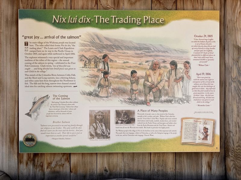
Captions: (bottom center) "Wishham Bride," Edward S. Curtis. 1910; Basketmaker at Wishram, Early 1900s.
The main village of the Wishram people was located here. The tribe called their home Nix lit dix, "the trading place". The Lewis and Clark Expedition camped here on its way to the Pacific Ocean in October 1805, and again while east bound in April 1806.
The explorers witnessed a very special and important tradition of the tribes of this region - the annual coming of the salmon in spring - celebrated in the First Fish Ceremony. Clark wrote, "one of those fish was cought ... and being diviided into Small pieces was given to each Child in the village."
This stretch of the Columbia River, between Cello Falls and the Short and Long narrows, was a thriving fishery, and tribes came here from throughout the Northwest to fish. The falls and the long, narrow river channel created ideal sites for catching salmon swimming upstream.
The Coming of the Salmon
Each spring, Columbia River tribes celebrate the arrival of the Chinook salmon with the "First Fish Ceremony. "Salmon have always been a crucial part of the tribes' cultures and subsistence, and for thousands of years, people
this page online
Brother Salmon
"Salmon were presented to me and my family through our religion as out brother. The same with the deer. And our sisters are the roots and the berries. And you would treat them as such. Their life to you is just as important as another person would be." Margaret Saluskin, Yakama
A Place of Many Peoples
Thousands of people; came to this stretch of the Columbia annually to fish, socialize, and trade. William Clark called this area the "Great Mart" of the West. Popular trade items included dried salmon made locally, seashells, wooden boxes, and smoked seafood from the Pacific Ocean; and bear grass and buffalo robes from the Rocky Mountains and the Great Plains. Baskets and beads from all over the West also were traded. Blue beads in particular were highly prized.
The Wishram people of the village of Nix luv dix lived here in the center of this important trade network. They spoke their own language, a dialect of Chinookan, as well as the Sahaptian language of the people to the east, the Chinookan trade language, Chinook Wawa.
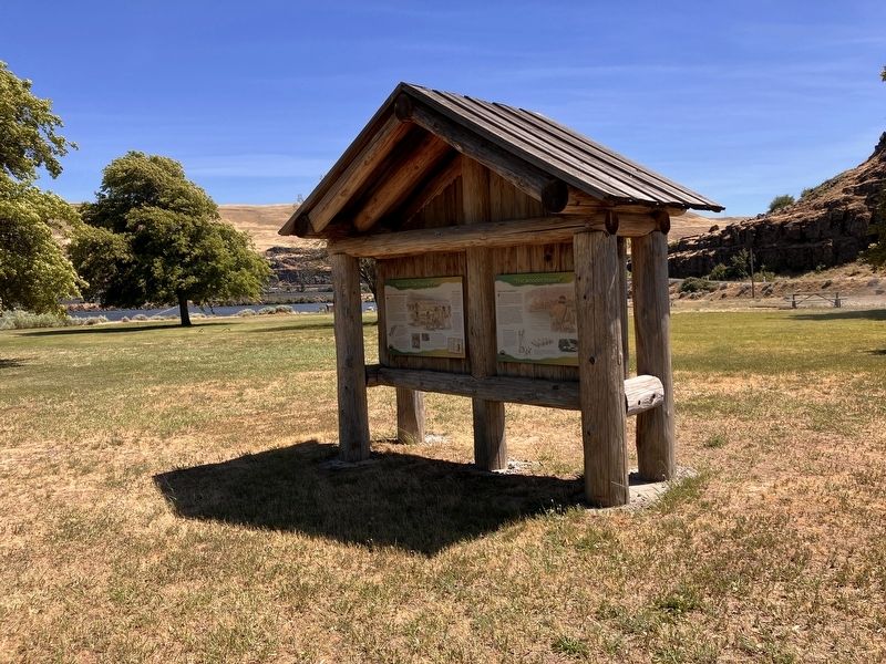
Photographed by Barry Swackhamer, June 12, 2026
2. Nix luv dix - The Trading Place Marker
"I Saw several large Scaffols on which the Indians dry fish; as this is out of Season the poles on which they dry those fish are tied up verry Securely in large bundles and put upon the Scaffolds, I counted 107 Stacks of dried pounded fish in different places on those rocks which must have contained 10,000 w. [pounds] of neet fish"
William Clark
April 19, 1806
" there was great joy with the natives last night in consequence of the arrival off the salmon; one of those fish was caught; this was the harbinger of good news to them. they informed us that these fish would arrive in great quantities in the course of about 5 days. this fish was dressed and being divided into small pieces was given to each child in the village."
Meriwether Lewis.
Erected by Washington Lewis & Clark Expedition Bicentennial Commission.
Topics and series. This historical marker is listed in these topic lists: Animals • Exploration • Indigenous Peoples and Communities • Notable Events. In addition, it is included in the Lewis & Clark Expedition series list. A significant historical date for this entry is April 10, 1806.
Location. 45° 38.623′ N, 121° 6.354′ W. Marker is near Dallesport, Washington, in Klickitat County. It is on Horsethief Lake State Park Road near Lewis and Clark Highway (Washington Route 14). This marker is in Horsethief Lake State Park. Touch for map. Marker is in this post office area: Dallesport WA 98617, United States of America. Touch for directions.

Regionally, this marker is in the Columbia River Gorge, in the Columbia Basin and in Yakima Valley. It is also in the American Mountain West and in the Lewis & Clark Corridor. Globally, it is in North America, in the Cascade Range, on the Ring of Fire, on the Pacific Rim, in the Western Hemisphere, in the Western World, and in the Anglosphere.
Other nearby markers. At least 8 other markers are within walking distance of this marker: Lewis and Clark National Historic Trail (here, next to this marker); Journey Through the Columbia River Gorge (here, next to this marker); "first wooden houses" (here, next to this marker); Horsethief Butte (approx. 0.2 miles away); Long Narrows Challenge (approx. ¼ mile away); "the Great Mart" (approx. ¼ mile away); Sheltered Homelands (approx. ¼ mile away); Through the Short Narrows (approx. ¼ mile away). Touch for a list and map of all markers in Dallesport.
Credits. This page was last revised on September 9, 2026. It was originally submitted on September 9, 2026, by Barry Swackhamer of Brentwood, California. This page has been viewed 14 times since then. Photos: 1, 2. submitted on September 9, 2026, by Barry Swackhamer of Brentwood, California.
