
Maryhill in Klickitat County, Washington — The American West (Northwest)
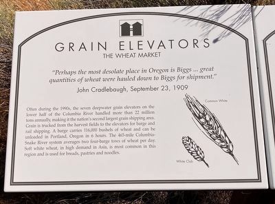
Grain Elevators
The Wheat Market
⎯⎯⎯
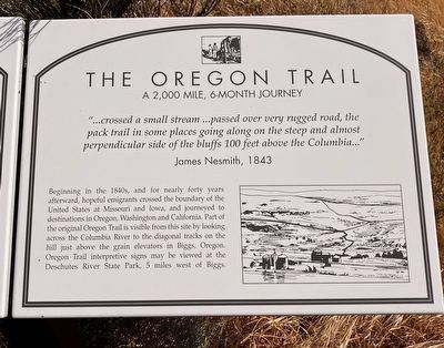
The Oregon Trail
A 2,000 Mile, 6-month Journey
Photographed by Barry Swackhamer, June 12, 2026
1. Grain Elevators Marker
Panel 1:
John Cradlebaugh, September 23, 1909
Often during the 1990s, the seven deepwater grain elevators (in the lower half of the Columbia River) handled more than 22 million tons annually, making it the nations's second largest grain shipping area. Grain is trucked from the harvest fields to the elevators for barge and rail shipping. A barge carries 116,000 bushels off wheat and can be unloaded in Portland, Oregon in 6 hours. The 456-mile Columbia-Snake River system averages two four-barge tows of wheat per day. Soft whiter wheat, in high demand in Asia, is most common in this region and is used for breads, pastries and noodles.
Panel 2:
James Nesmith, 1843
Beginning in the 1840s, and for nearly forty years afterward, hopeful emigrants crossed the boundary
this page online
Erected by Maryhill Museum of Art.
Topics. This historical marker is listed in these topic lists: Agriculture • Industry & Commerce • Roads & Vehicles • Settlements & Settlers.
Location. 45° 40.703′ N, 120° 51.714′ W. Marker is in Maryhill, Washington, in Klickitat County. It is on Maryhill Museum Drove near Lewis and Clark Highway (Washington Highway 14). Touch for map. Marker is in this post office area: Goldendale WA 98620, United States of America. Touch for directions.

Regionally, this marker is in Washington’s Columbia River Gorge, in the Columbia Basin and in Yakima Valley. It is also in the American Mountain West and in the Lewis & Clark Corridor. Globally,
Photographed by Barry Swackhamer, June 12, 2026
2. The Oregon Trail Marker
Other nearby markers. At least 8 other markers are within 4 miles of this marker, measured as the crow flies: Lewis & Clark Trail / Samuel Hill Bridge (a few steps from this marker); Loops Road (a few steps from this marker); Lewis & Clark Journals (within shouting distance of this marker); First Sight of the Columbia River (approx. 1.2 miles away in Oregon); Stonehenge (approx. 2.9 miles away); Sam Hill Country (approx. 3 miles away); Deschutes River Crossing (approx. 3.9 miles away in Oregon); Deschutes River Crossing Oregon Trail Kiosk (approx. 3.9 miles away in Oregon). Touch for a list and map of all markers in Maryhill.
Photographed by Barry Swackhamer, June 12, 2026
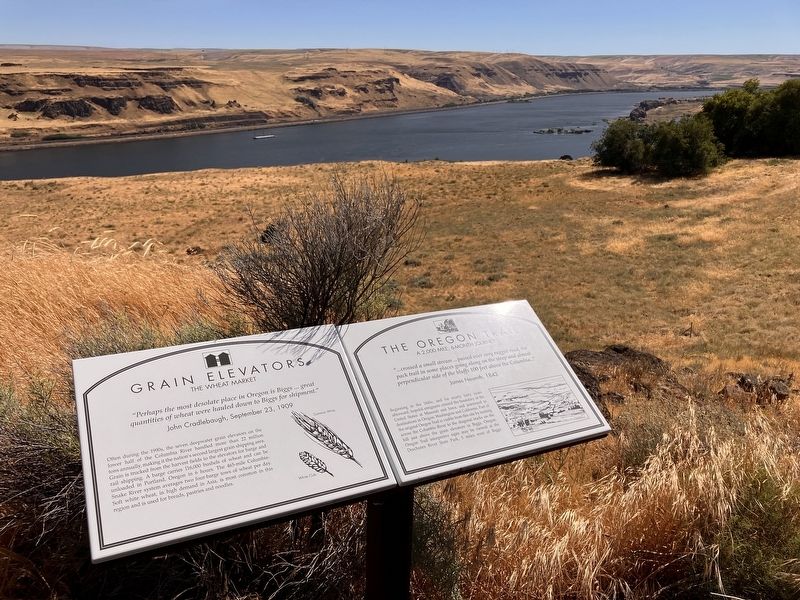
3. Grain Elevators / The Oregon Trail Marker
Credits. This page was last revised on September 10, 2026. It was originally submitted on September 10, 2026, by Barry Swackhamer of Brentwood, California. This page has been viewed 6 times since then. Photos: 1, 2, 3. submitted on September 10, 2026, by Barry Swackhamer of Brentwood, California.
