Ketchikan in Ketchikan Gateway Borough, Alaska — Northwest (North America)
The Creek is the heart of the town
Photographed by Bill Coughlin, September 2, 2026
1. The Creek is the heart of the town Marker
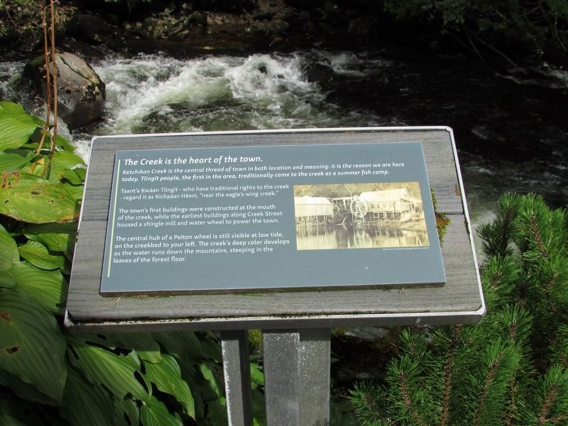
Ketchikan Creek is the central thread of town in both location and meaning: it is the reason we are here today. Tlingit people, the first in the area, traditionally came to the creek as a summer fish camp.
Taant’a Kwáan Tlingit – who have traditional rights to the creek – regard it as Kichxáan Hèeni – “near the eagle’s wing creek.”
The town’s first buildings were constructed at the mouth of the creek, while the earliest buildings along Creek Street housed a shingle mill and water wheel to power the town.
The central hub of a Pelton wheel is still visible at low tide, on the creekbed to your left. The creek’s deep color develops as the water runs down the mountains, steeping in the leaves of the forest floor.
Topics. This historical marker is listed in these topic lists: Indigenous Peoples and Communities • Settlements & Settlers • Waterways & Vessels.
Location. 55° 20.566′ N, 131° 38.612′ W. Marker is in Ketchikan, Alaska, in Ketchikan Gateway Borough. It can be reached from Bawden Street, on the right when traveling north. Marker is located behind the Tongass Historical
this page online

Regionally, this marker is in Southeast Alaska, in Tlingit and Haida & Tsimshian Region. It is also on the American Pacific Coast. Globally, it is in North America, in the Inside Passage, on the Pacific Rim, in the Western Hemisphere, in the Western World, and in the Anglosphere. Historically, it finds itself in what was once the Russian Empire.
Other nearby markers. At least 8 other markers are within walking distance of this marker: This is the beginning of a salmon’s final run (here, next to this marker); Ketchikan has a strong history of community service (a few steps from this marker); Raven Stealing the Sun Kootéeyaa (within shouting distance of this marker); Chief Johnson Totem Pole (within shouting distance of this marker); Yak'éi Haat Yeey.aadí. (within shouting distance of this marker); Veterans Memorial (within shouting distance of this marker); Creek Flood of Time (within shouting distance of this marker); 'Cat' Houses & Sporting Women (within shouting distance of this marker). Touch for a list and map

Photographed by Bill Coughlin, September 2, 2026
2. The Creek is the heart of the town Marker
More about this marker. A photograph on the right depicts Ketchikan Shingles Mill, circa 1900.
Photographed by Bill Coughlin, September 2, 2026
3. The Creek is the heart of the town Marker
Credits. This page was last revised on September 11, 2026. It was originally submitted on September 11, 2026, by Bill Coughlin of Woodland Park, New Jersey. This page has been viewed 8 times since then. Photos: 1, 2, 3. submitted on September 11, 2026, by Bill Coughlin of Woodland Park, New Jersey.
