Big Bog State Recreation Area near Waskish in Beltrami County, Minnesota — The American Midwest (Upper Plains)
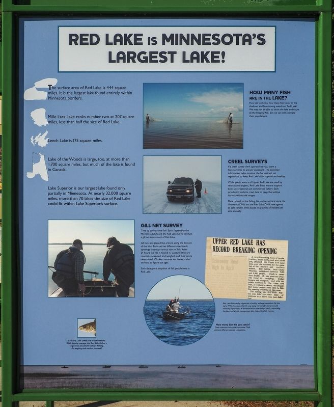
Red Lake is Minnesota's Largest Lake!
⎯⎯⎯
Flat Terrain Lets Water Pool
Photographed by McGhiever, August 30, 2021
1. Red Lake is Minnesota's Largest Lake! / Flat Terrain Lets Water Pool Marker
The surface area of Red Lake is 444 square miles. It is the largest lake found entirely within Minnesota borders.
Mille Lacs Lake ranks number two at 207 square miles, less than half the size of Red Lake.
Leech Lake is 175 square miles.
Lake of the Woods is large, too, at more than 1,700 square miles, but much of the lake is found in Canada.
Lake Superior is our largest lake found only partially in Minnesota. At nearly 32,000 square miles, more than 70 lakes the size of Red Lake could fit within Lake Superior's surface.
How Many Fish are in the Lake?
How do we know how many fish hover in the shadows and hide among weeds on Red Lake. We may not be able to drain the lake and count all the flopping fish, but we can still estimate their populations.
Creel Surveys
If a creel survey clerk approaches you, spare a few moments to answer questions. The collected information helps monitor the harvest and set regulations to keep Red Lake's fish populations healthy.
While public waters of Upper Red Lake are used by recreational anglers, Red Lake Band waters support both a recreational and commercial fishery.
this page online
Data related to the fishing harvest are critical since the Minnesota DNR and the Red Lake DNR have agreed to safe harvest limits based on pounds of walleye per acre annually.
Gill Net Survey
Time to count some fish! Each September the Minnesota DNR and the Red Lake DNR conduct a gill net assessment of Red Lake.
Gill nets are placed like a fence along the bottom of the lake. Each net has different-sized mesh openings that trap various sizes of fish. After 24 hours the net is hauled in. Captured fish are counted, measured, and weighed, and their sex is determined. Workers remove ear bones, called otoliths, to figure out ages.
Such data give a snapshot of fish populations in Red Lake.
The Red Lake DNR and the Minnesota DNR jointly manage the Red Lake fisher to provide excellent walleye fishing. Go angling and see for yourself!
Red Lake historically supported a healthy walleye population. By the early 1990s, however, the fish was being harvested before it could naturally repopulate. A moratorium on the walleye catch, restocking the lake, and a joint management plan helped the fish recover.
How many fish did you catch?
Data collection helps the Minnesota DNR estimate different species populations.
The
Photographed by McGhiever, August 30, 2021
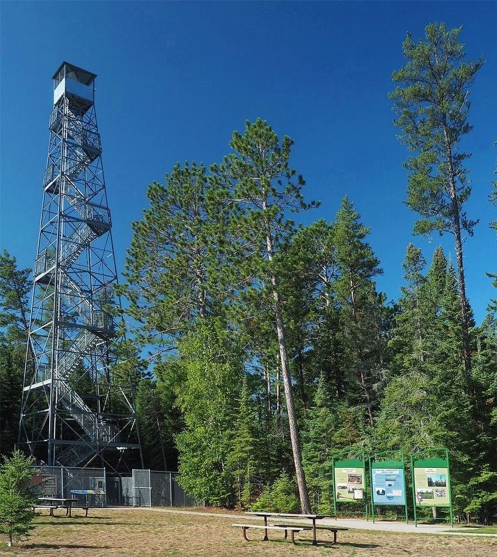
2. Marker (center) near the fire tower at Big Bog State Recreation Area
Why is Big Bog so soggy? As part of an ancient lake bed it is some of the flattest terrain anywhere. Peatlands form in places where water can't drain away. The ground becomes saturated and stays that way. Plants in this cold, wet, oxygen-poor area decay so slowly that they accumulate.
Sphagnum moss wasn't the original plant here after the great ice sheets retreated. Trees and forests grew first. As the climate cooled and became wetter, mosses moved in and peat formed.
Why is Red Lake Red?
The water in Red Lake and the bog is stained reddish brown.
The water picks up the color of plants as tea picks up the color of the leaves in a tea bag. Slowly decaying peatland plants are steeped in the slow-moving water of the bog.
Sphagnum moss, tamarack, black spruce, and cedar give waters here their characteristic color.
A bog is a chilly habitat for this Labrador tea and other specially adapted organisms.
Big peatlands are usually found at the headwaters of rivers. The Red Lake Peatlands form the headwaters of the Rapid River.
You are Standing in a Watershed
What is a watershed?
It is a physical space where a mosaic of rivers and lakes drain the landscape to its lowest point.
How Healthy are the Watersheds
How pristine is the water in Red Lake? Is the Big Bog unspoiled?
The water quality of lakes, rivers, and wetlands are a reflection of what goes on in watersheds. This area is the headwaters for the Red Lake and Rapid rivers.
The Red Lake Peatlands' watershed is relatively pristine. Wetlands dominate the landscape and act as sponges to filter and prevent runoff. Forested lands also act as buffers.
Red Lake is part of the Red River of the North watershed.
Much of the peatlands drain into the Rapid River, which is part of the Rainy River watershed.
The two routes, part of the massive Nelson-Saskatchewan watershed, meet at Lake Winnipeg where they continue north to Hudson Bay.
You are part of a watershed. Help protect lakes, rivers, and wetlands by preventing pollution. Every drop drains somewhere.
The rain that is dampening your fishing trip is nourishing the bog. Bog plants get many of their nutrients from precipitation, not soil.
Erected by the Minnesota Department of Natural Resources.
Topics. This historical marker is listed in these topic lists: Animals • Environment • Waterways & Vessels.
Location. 48° 10.22′ N, 94° 30.712′ W. Marker is near Waskish, Minnesota, in Beltrami County. It is in the Big Bog State Recreation Area. It is on Hillman Drive NE south of the Big Bog State Recreation Area entrance road, on the right when traveling south. The marker is at the south unit of Big Bog State Recreation Area (fee area), in a triptych of markers between the visitor center and the fire tower. Touch for map. Marker is at or near this postal address: 55716 State Highway 72, Waskish MN 56685, United States of America. Touch for directions.

Regionally, this marker is in Minnesota’s Northland. It is also in the American Midwest and in the Corn Belt. Globally, it is in North America, the Great North Woods, the Western Hemisphere, the Western World, and the Anglosphere. Historically, it finds itself in what was once Rupert’s Land, the territory of the Mississippian Culture, the Louisiana Purchase, and the Northwest Territory.
Other nearby markers. At least 8 other markers are within walking distance of this marker: Where There is Smoke / Forests of the Agassiz Lowlands (here, next to this marker); The Red Lake Walleye Story (about 800 feet away, measured in a direct line); Miskwagami-wizaga-iganing (about 800 feet away); The Marina (approx. 0.2 miles away); Journey along the waters… (approx. 0.3 miles away); Historic Waskish Hatchery 1941–1979 (approx. 0.3 miles away); Harry Davidson (approx. 0.3 miles away); The Old Waskish Town Site (approx. 0.4 miles away). Touch for a list and map of all markers in Waskish.
Credits. This page was last revised on September 12, 2026. It was originally submitted on September 12, 2026, by McGhiever of Minneapolis, Minnesota. This page has been viewed 4 times since then. Photos: 1. submitted on September 12, 2026, by McGhiever of Minneapolis, Minnesota. 2. submitted on October 4, 2022, by McGhiever of Minneapolis, Minnesota.
