Grantsville in Garrett County, Maryland — The American Northeast (Mid-Atlantic)
Casselman River Bridge State Park
Bicentennial 1813-2013
Photographed by F. Robby, July 31, 2016
1. Casselman River Bridge State Park Marker
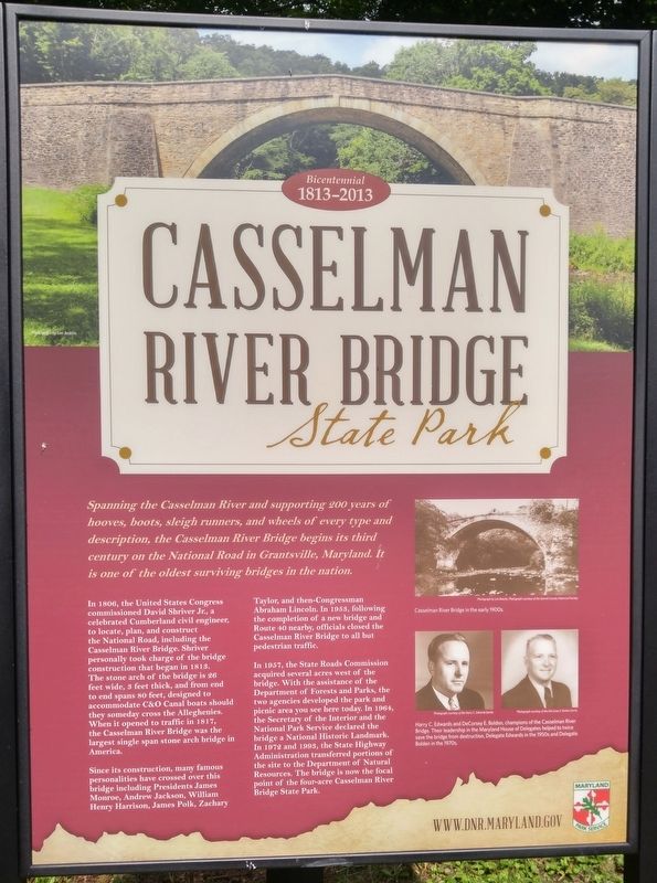
Spanning the Cassleman River and supporting 200 years of hooves, boots, sleigh runners, and wheels of every type and description, the Cassleman River Bridge begins its third century on the National Road in Grantsville, Maryland. It is one of the oldest surviving bridges in the nation.
In 1806, the United States Congress commissioned David Shriver, Jr., a celebrated Cumberland civil engineer, to locate, plan, and construct the National Road, including the Casselman River Bridge. Shriver personally took charge of the bridge construction that began in 1813. The stone arch is 26 feet wide, 3 feet thick, and from end to end spans 80 feets, designed to accommodate C&O Canal boats should they someday cross the Alleghenies. When it opened to traffic in 1817, the Casselman River Bridge was the largest single span stone arch bridge in America.
Since its construction, many famous personalities have crossed over this bridge including Presidents James Monroe, Andrew Jackson, William Henry Harrison, James Polk, Zachary Taylor, and then-Congressman Abraham Lincoln. In 1953, following the completion of a new bridge and Route 40
this page online
In 1957, the State Road Commission acquired several acres west of the bridge. With the assistance of the Department of Forests and Parks, the two agencies developed the park and picnic area you see here today. In 1964, the Secretary of the Interior and the National Park Service declared the bridge a National Historic Landmark. In 1972 and 1993, the State Highway Administration transferred portions of the site to the Department of Natural Resources. The bridge is now the focal point of the four-acre Casselman River Bridge State Park.
Erected by Maryland Park Service.
Topics. This historical marker is listed in these topic lists: Bridges & Viaducts • Parks & Recreational Areas • Roads & Vehicles. A significant historical year for this entry is 1806.
Location. 39° 41.812′ N, 79° 8.546′ W. Marker is in Grantsville, Maryland, in Garrett County. It is on Casselman Road west of Main Street (Alternate U.S. 40), on the left when traveling west. Touch for map. Marker is in this post office area: Grantsville MD 21536, United States of America.
Photographed by F. Robby, July 31, 2016
2. Casselman River Bridge State Park Marker
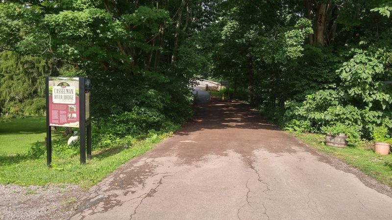
The Casselman River Bridge is in the center distance of this photo.

Regionally, this marker is in Western Maryland. It is also in the American Mid-Atlantic, in Appalachia, and specifically in Northern Appalachia. Globally, it is in North America, the Western Hemisphere, the Western World, and the Anglosphere. Historically, it finds itself in what was once one of the original Thirteen Colonies.
Other nearby markers. At least 8 other markers are within walking distance of this marker: The National Road (here, next to this marker); Mountain Maryland Gateway to the West (here, next to this marker); a different marker also named Casselman River Bridge State Park (here, next to this marker); The National Pike (a few steps from this marker); Castleman’s River Bridge / The Little Crossings (a few steps from this marker); “The Little Crossings” / Castleman’s River Bridge (within shouting distance of this marker); The Miller House (within shouting distance of this marker); The Original Tombstone of Solomon Glotfelty (within shouting distance of this marker). Touch for a list and map of all markers in Grantsville.
Credits. This page was last revised on September 13, 2026. It was originally submitted on September 13, 2026, by F. Robby of Baltimore, Maryland. This page has been viewed 5 times since then. Photos: 1, 2. submitted on October 10, 2016, by F. Robby of Baltimore, Maryland. • Devry Becker Jones was the editor who published this page.
