Grantsville in Garrett County, Maryland — The American Northeast (Mid-Atlantic)
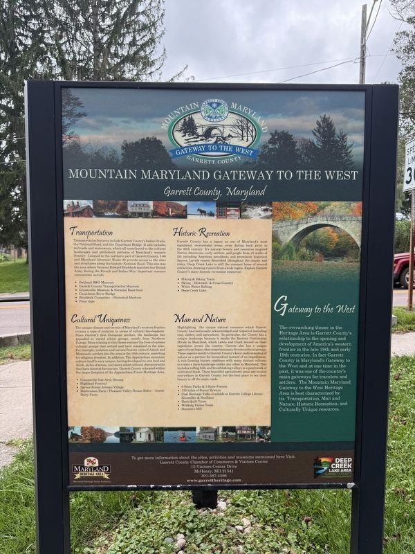
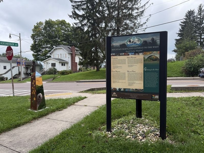
Mountain Maryland Gateway to the West
Garrett County, Maryland
Photographed by Devry Becker Jones (CC0), September 12, 2026
1. Mountain Maryland Gateway to the West Marker
Transportation
Transportation features include Garrett County's Indian Trails, the National Road, and the Casselman Bridge. It also includes railroads and waterways, which all contributed to the cultural landscapes and settlement patterns of Maryland's western frontier. Located in the northern part of Garrett County, I-68 and Maryland Alternate Route 40 provide access to the sites and structures along the historic National Road. This also was the area where General Edward Braddock marched the British Army during the French and Indian War. Important resource connections include:
• Oakland B&O Museum
• Garrett County Transportation Museum
• Grantsville Museum & National Road Inns, Casselman River Bridge,
• Braddock Campsites—Historical Markers
• Penn Alps
Historic Recreation
Garrett County has a legacy as one of Maryland's most significant recreational areas, even dating back prior to the 20th century. It's natural beauty and resources inspired Native Americans, early settlers, and people from all walks of life including American presidents and prominent historical figures. Lavish resorts flourished throughout
this page online
• Hiking & Biking Trails
• Skiing—Downhill & Cross Country,
• White Water Rafting
• Deep Creek Lake
Cultural Uniqueness
The unique climate and terrain of Maryland's western frontier creates a type of isolation in terms of cultural development. Since Garrett's first European settlers, the landscape has appealed to varied ethnic groups, mostly from Northern Europe. Sites relating to this theme recount the lives of various cultural groups that settled and have remained in the area. For example, isolation and natural beauty enticed Amish and Mennonite settlers into the area in the 19th century, searching for religious freedom. In addition, The Appalachian mountain culture itself is very unique, having developed its own food and drink, styles of music, and many other cultural characteristics that have interest for tourists. Garrett County is located within the larger footprint of the Appalachian Forest Heritage Area.
• Cranesville Sub-Artic Swamp
• HighlandFestivalPhotographed by Devry Becker Jones (CC0), September 12, 20262. Mountain Maryland Gateway to the West Marker
• Spruce Forest Artisan Village
• Duntrussen Farm/Pleasant Valley Dream Rides—Amish Dairy Farm
Man and Nature
Highlighting the unique natural resources which Garrett County has continually acknowledged and respected including coal, timber, and agriculture. In particular, the County has a unique landscape because it marks the Eastern Continental Divide in Maryland, which Lewis and Clark braved on their expedition across the country. Garrett also has a unique agricultural legacy that comprises many diverse cultural groups. These aspects testify to Garrett County's keen understanding of nature as a partner for humankind instead of an impediment. A rich farming history combines with many distinct cultures to create a farm-landscape unlike any other in Maryland. This includes rolling hills and breathtaking valleys in a patchwork of cultivated fields. These beautiful agricultural areas are located everywhere in Garrett County but the best place to see their beauty is off the main roads.
• 6 State Parks & 3 State Forests
• 150 miles of Scenic Byways
• Coal Heritage Talks available at Garrett College Library: Kitzmiller & Shallmar
• Barn Quilt Tours
• Working Farms Tours
• Stanton's Mill
Gateway to the West
The overarching theme in the Heritage Area is Garrett County's relationship to the opening and development of America's western frontier in the late 18th and early 19th centuries. In fact Garrett County is Maryland's Gateway to the West and at one time in the past, it was one of the country's main gateways for travelers and settlers. The Mountain Maryland Gateway to the West Heritage Area is best characterized by its Transportation, Historic Recreation, and Culturally Unique resources.
Garrett County Chamber of Commerce & Visitor Center
15 Visitors Center Drive
McHenry, MD 21541
301-387-4386
www.garrettheritage.com
Erected by Maryland Heritage Areas Authority; Deep Creek Lake Area, Garrett County Chamber of Commerce.
Topics and series. This historical marker is listed in these topic lists: Parks & Recreational Areas • Religion & Religious Structures • Roads & Vehicles • Settlements & Settlers. In addition, it is included in the The Historic National Road series list.
Location. 39° 41.838′ N, 79° 9.489′ W. Marker is in Grantsville, Maryland, in Garrett County. It is at the intersection of Main Street (Alternate U.S. 40) and Hershberger Lane, on the right when traveling west on Main Street. Touch for map. Marker is at or near this postal address: 173 Main St, Grantsville MD 21536, United States of America. Touch for directions.

Regionally, this marker is in Western Maryland. It is also in the American Mid-Atlantic, in Appalachia, and specifically in Northern Appalachia. Globally, it is in North America, the Western Hemisphere, the Western World, and the Anglosphere. Historically, it finds itself in what was once one of the original Thirteen Colonies.
Other nearby markers. At least 8 other markers are within walking distance of this marker: The Town of Grantsville (here, next to this marker); Grantsville (here, next to this marker); The National Road (about 300 feet away, measured in a direct line); a different marker also named Leo J. Beachy (about 600 feet away); Early Roads (approx. 0.2 miles away); Traveling the National Road (approx. 0.2 miles away); Casselman Hotel (approx. 0.3 miles away); a different marker also named Traveling the National Road (approx. 0.4 miles away). Touch for a list and map of all markers in Grantsville.
Other markers no longer nearby. Grantsville (was about 300 feet away but has been replaced with another marker now near it); Leo J. Beachy (was about 600 feet away but has been replaced with another marker now near it).
Credits. This page was last revised on September 13, 2026. It was originally submitted on September 13, 2026, by Devry Becker Jones of Washington, District of Columbia. This page has been viewed 8 times since then. Photos: 1, 2. submitted on September 13, 2026, by Devry Becker Jones of Washington, District of Columbia.
