Scottsbluff in Scotts Bluff County, Nebraska — The American Midwest (Upper Plains)
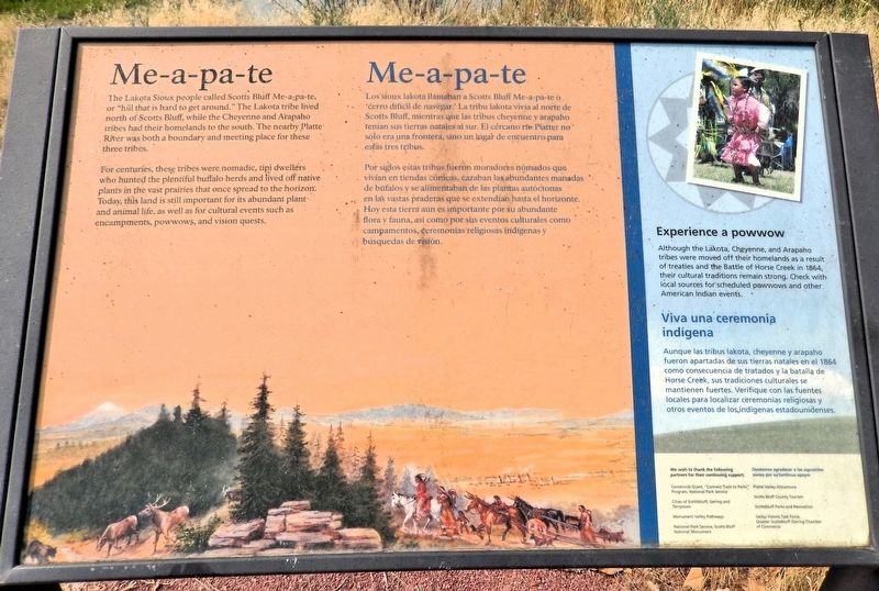
Me-a-pa-te
Photographed by Cosmos Mariner, August 1, 2021
1. Me-a-pa-te Marker

For centuries, these tribes were nomadic, tipi dwellers who hunted the plentiful buffalo herds and lived off native plants in the vast prairies that once spread to the horizon. Today, this land is still important for its abundant plant and animal life, as well as for cultural events such as encampments, powwows and vision quests.
Experience a powwow
Although the Lakota, Cheyenne, and Arapaho tribes were moved off their homelands as a result of treaties and the Battle of Horse Creek in 1864, their cultural traditions remain strong. Check with local sources for scheduled powwows and other American Indian events.
this page online
Por siglos estas tribus fueron moradores nómados que vivían en tienda cónicas, cazaban las abundantes manadas de búfalos y se alimentaban de las plantas autóctonas en las vastas praderas que se extendían hasta el horizonte. Hoy esta tierra aún es importante por su abundante flora y fauna, así como por sus eventos culturales como campamentos, ceremonias religiosas indígenas y búsquedas de visión.
Viva una ceremonia indígena
Aunque las tribus lakota, cheyenne y arapaho fueron apartadas de sus tierras natales eh el 1864 como consecuencia de tratados y la batalla de Horse Creek, sus tradiciones culturales se mantienen fuertes. Verifique con las fuentes locales para localizar ceremonias religiosas y otros eventos de los indígenas estadounidenses.
Erected by National Parks Service, Cities of Scottsbluff, Gering and Terrytown, Monument Valley Pathways, and Greater Scottsbluff/Gering Chamber of Commerce.
Topics. This historical marker is listed in these topic lists: Indigenous Peoples and Communities • Waterways & Vessels.
Location. 41° 51.096′ N,
Photographed by Cosmos Mariner, August 1, 2021
2. Me-a-pa-te Marker
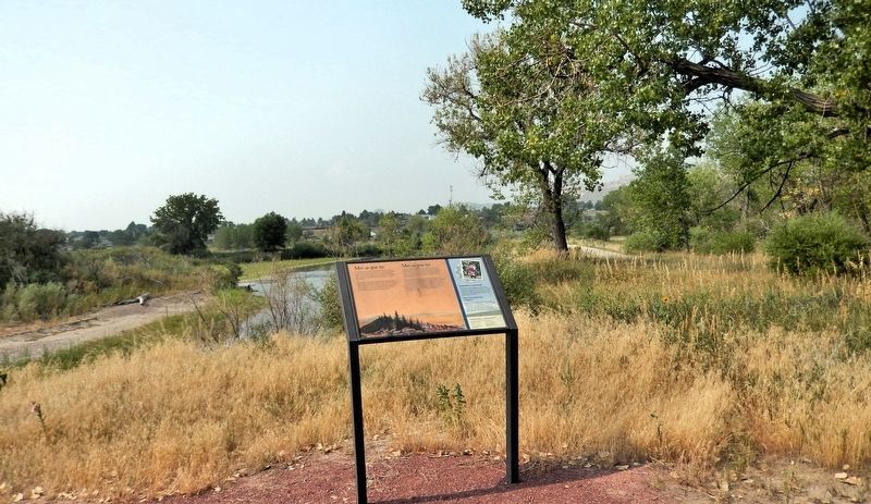
Looking southwest from the Monument Valley Pathway. The North Platte River is in the background.

Regionally, this marker is in the Nebraska Panhandle. It is also in the American Midwest, in the Corn Belt, and on the prairies. Globally, it is in North America, the Western Hemisphere, the Western World, and the Anglosphere. Historically, it finds itself in what was once the Louisiana Purchase.
Other nearby markers. At least 8 other markers are within walking distance of this marker: Marching to Zion/Marchando al monte Sion (about 400 feet away, measured in a direct line); Turn Back from Here?/¿Regresar de aquí? (about 600 feet away); Rapid Changes/Cambios rápidos (approx. ¼ mile away); The Great Platte River Road/El camino del gran Río Platte (approx. ¼ mile away); Settling the North Platte Valley/Colonizando el valle North Platte (approx. 0.3 miles away); The “Flat Water” Platte River/El Río Platte de agua plana (approx. 0.4 miles away); North Platte River Flooding (approx. 0.4 miles away); The Fur Trade/El comercio de piel (approx. 0.4 miles away). Touch for a list and map of all markers in Scottsbluff.
Credits. This page was last revised on September 16, 2026. It was originally submitted on September 14, 2026, by Cosmos Mariner of Cape Canaveral, Florida. This page has been viewed 9 times since then. Photos: 1, 2. submitted on September 15, 2026, by Cosmos Mariner of Cape Canaveral, Florida.
