Downtown Seattle in King County, Washington — The American West (Northwest)
Ever-Changing Landscape
Photographed by Douglass Halvorsen, February 20, 2026
1. Ever-Changing Landscape Marker
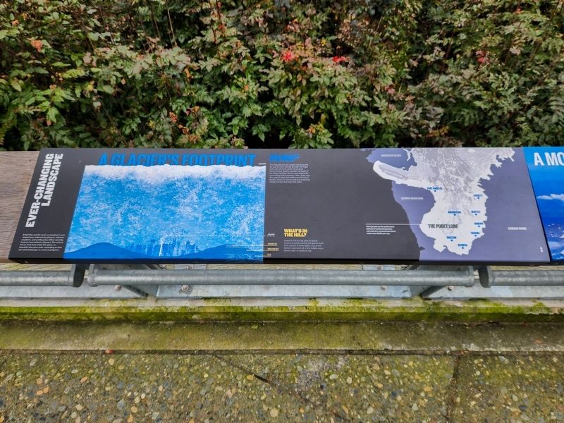
A Glacier’s Footprint
Why Seattle is So Steep
The Puget Sound was gouged out during the Ice Age by rivers running beneath the Puget Lobe, part of an ice sheet whose peak thickness over Seattle equaled the height of five Space Needles. The ice also shaped the surrounding land, furrowing it like a giant rake. The parallel ridges left behind are the hills of Seattle, which run north-south and tend to be steeper on their east and west sides.
What’s in the Hill?
Seattle’s hills are big piles of glacial sediment compressed by the glacier itself. They consist of three layers: clay at the bottom, sand and silt in the middle, and a thinner layer of rubble on top.
The Puget Lobe was the southernmost extension of continental glaciation and reached its maximum extent to the south around 16,000 years ago.
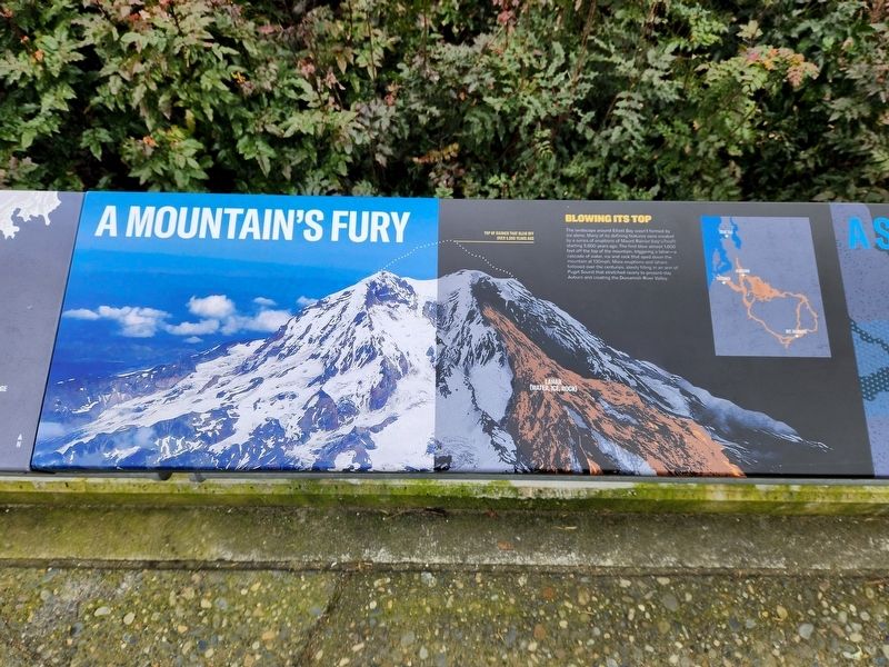
A Mountain’s Fury
Blowing its Top
The
this page online
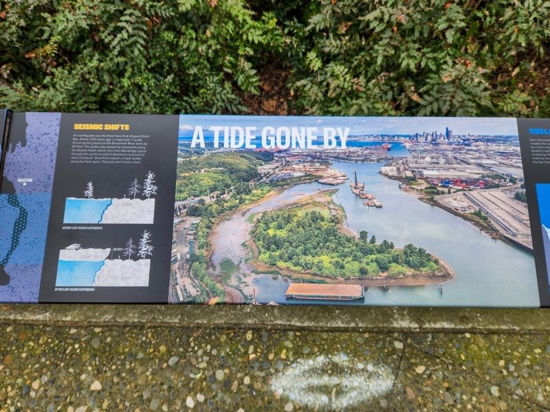
A Serious Shake-up
Seismic Shifts
An earthquake was the third force that shaped Elliott Bay. About 1,100 years ago, a magnitude 7 quake thrust up the ground at the Duwamish River delta by 20 feet. The quake was caused by movement along the Seattle Fault, which runs from Bainbridge Island through the southern end of downtown and east to about Issaquah. Scientists expect a major quake along the fault again. They just don't know when.
A Tide Gone By
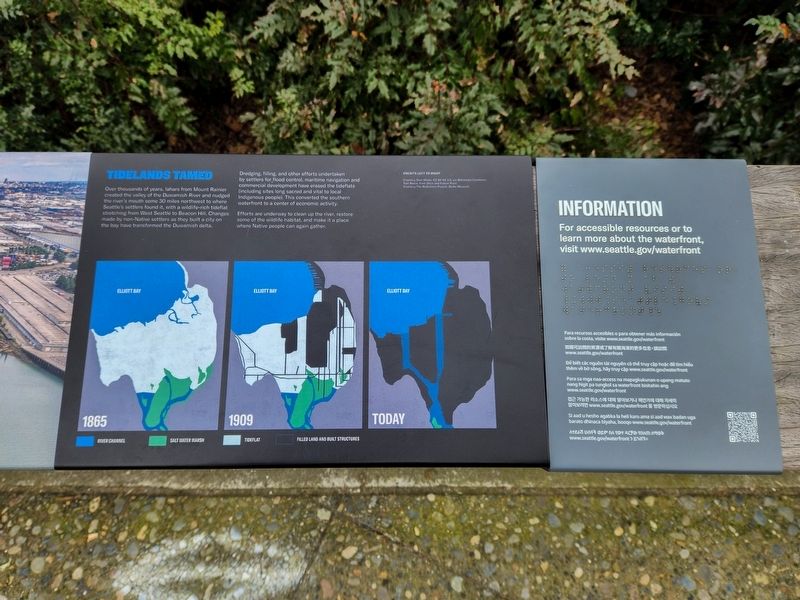
Tidelands Tamed
Over thousands of years, lahars from Mount Rainier created the valley of the Duwamish River and nudged the river’s mouth some 30 miles northwest
Photographed by Douglass Halvorsen, February 20, 2026
2. Ever-Changing Landscape Marker
Dredging, filling, and other efforts undertaken by settlers for flood control, maritime navigation and commercial development have erased the tideflats (including sites long sacred and vital to local Indigenous people). This converted the southern waterfront to a center of economic activity.
Efforts are underway to clean up the river, restore some of the wildlife habitat, and make it a place where Native people can again gather.
Topics. This historical marker is listed in these topic lists: Environment • Natural Features.
Location. 47° 36.069′ N, 122° 20.179′ W. Marker is in Seattle, Washington, in King County. It is in Downtown Seattle. It is on Alaskan Way South, on the right when traveling south. Touch for map. Marker is at or near this postal address: 199 Alaskan Way S, Seattle WA 98104, United States of America. Touch for directions.

Regionally, this
Photographed by Douglass Halvorsen, February 20, 2026
3. Ever-Changing Landscape Marker
Other nearby markers. At least 8 other markers are within walking distance of this marker: Chun Ching Hock (a few steps from this marker); Habitat Beach (a few steps from this marker); Who Belongs Here? / Violence & Vitriol (within shouting distance of this marker); Ballast Island (within shouting distance of this marker); Who landed here? (within shouting distance of this marker); Pioneer Square Hotel (about 300 feet away, measured in a direct line); What was Yesler’s Way? / How did a parking garage spark a preservation movement? (about 300 feet away); Maynard Building (about 400 feet away). Touch for a list and map of all markers in Seattle.
Other markers no longer nearby. Steamer Idaho Wreckage (was within shouting distance of this marker but has been permanently removed);
Photographed by Douglass Halvorsen, February 20, 2026
4. Ever-Changing Landscape Marker
Photographed by Douglass Halvorsen, February 20, 2026
5. Ever-Changing Landscape Marker
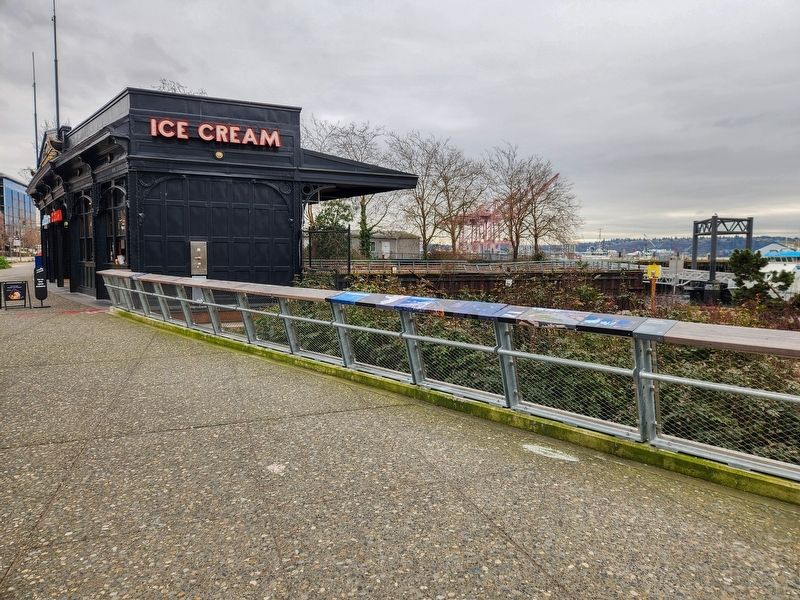
View of marker looking south towards the historic boat landing pergola.
Credits. This page was last revised on September 16, 2026. It was originally submitted on September 14, 2026, by Douglass Halvorsen of Klamath Falls, Oregon. This page has been viewed 10 times since then. Photos: 1, 2, 3, 4, 5. submitted on September 14, 2026, by Douglass Halvorsen of Klamath Falls, Oregon. • Andrew Ruppenstein was the editor who published this page.
