Downtown Seattle in King County, Washington — The American West (Northwest)
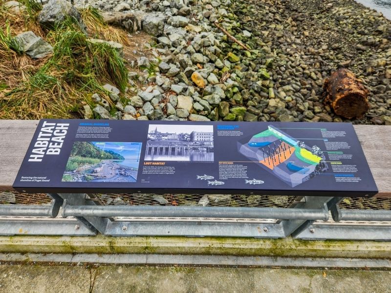
Habitat Beach
Restoring the natural shoreline of Puget Sound
Photographed by Douglass Halvorsen, February 20, 2026
1. Habitat Beach Marker
Original Shoreline
Historically, the eastern shoreline of Elliott Bay looked much like the other unaltered shorelines across Puget Sound—bluff-backed beach with intertidal marshes and mudflats. These mudflats and gently sloping beaches were home to an abundance of birds, fish, and marine invertebrates.
Nearshore habitat is the ribbon of habitat that extends from shallow waters up to the tops of the beaches and bluffs. It includes uplands, intertidal, and subtidal zones.
Lost Habitat
In the early 1900s, the shoreline of Elliott Bay was filled in with concrete, steel, and piers to make way for the increasing demands of commerce. These changes reduced nearshore habitat and threatened juvenile salmon and other wildlife in Puget Sound.
Restoring the Ecosystem
An important part of the seawall project involved replicating natural shoreline water, thereby improving the nearshore habitat and restoring the salmon migration corridor.
Deep Water Danger
Piers cast dark shadows on the water, reducing the sunlight that vegetation needs to grow and impacting the natural patterns of salmon migration along the edges of
this page online
Seawall
The face of the new seawall has textured surfaces and habitat shelves to promote the growth of vegetation and foster marine invertebrates, both important food sources for fish.
Light
To restore the natural light to shallower waters along the seawall, glass blocks and other light-generating surfaces were incorporated into the cantilevered sidewalk, allowing light to pass to the aquatic life below.
Migration Corridor
Habitat trenches were added to create a continuous shallow water corridor for juvenile salmon to travel along the waterfront.
Habitat Beach
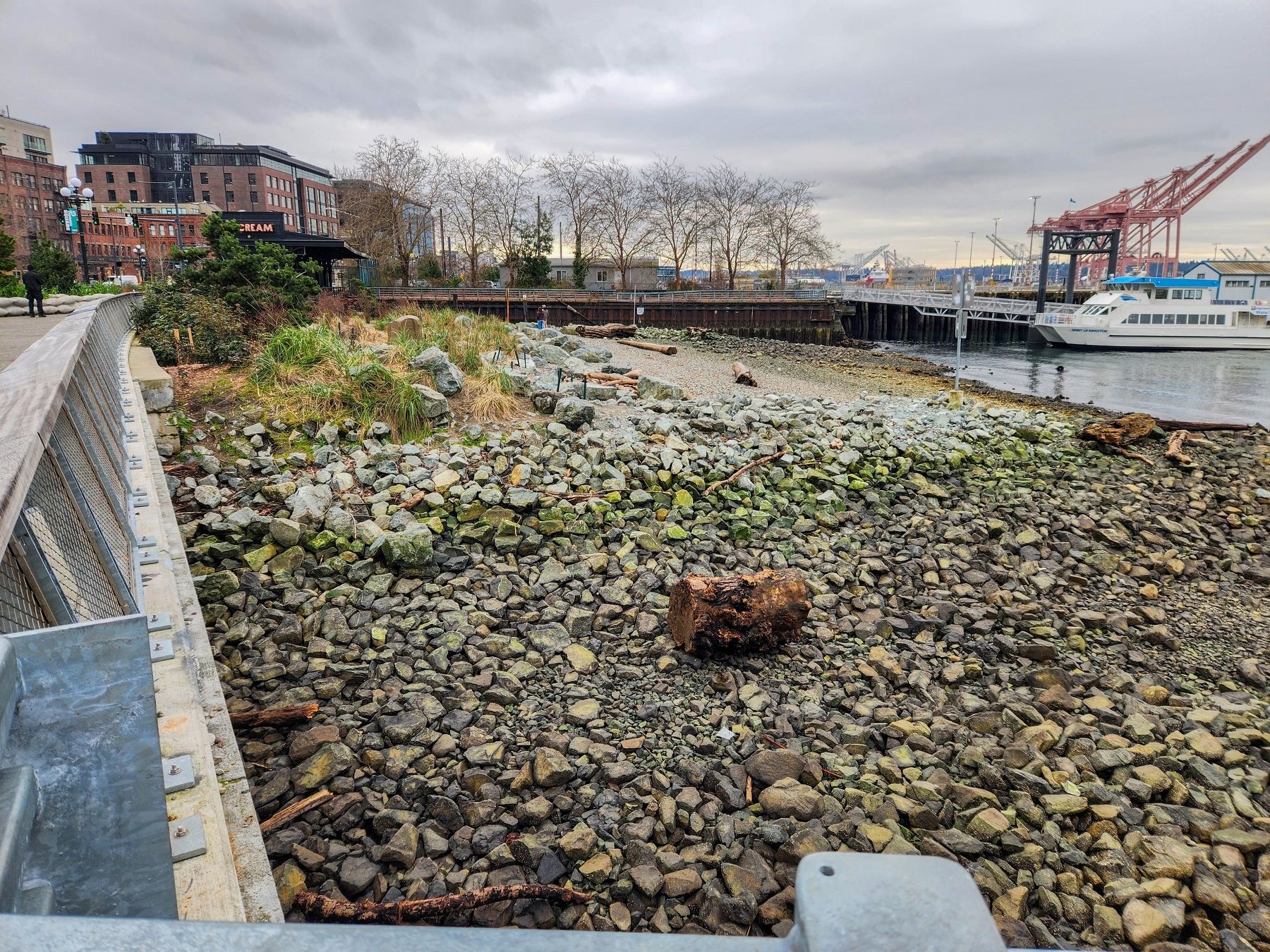
Habitat Beach is placed directly in the current salmon migration pathway leading them to this safer waterfront habitat. Vegetation provides diversity and connectivity between habitats.
Seafloor Improvements
At lower depths, enhancements and cobble reefs have been introduced for juvenile crabs, rockfish, and kelp.
Topics. This
Photographed by Douglass Halvorsen, February 20, 2026
2. Habitat Beach Marker
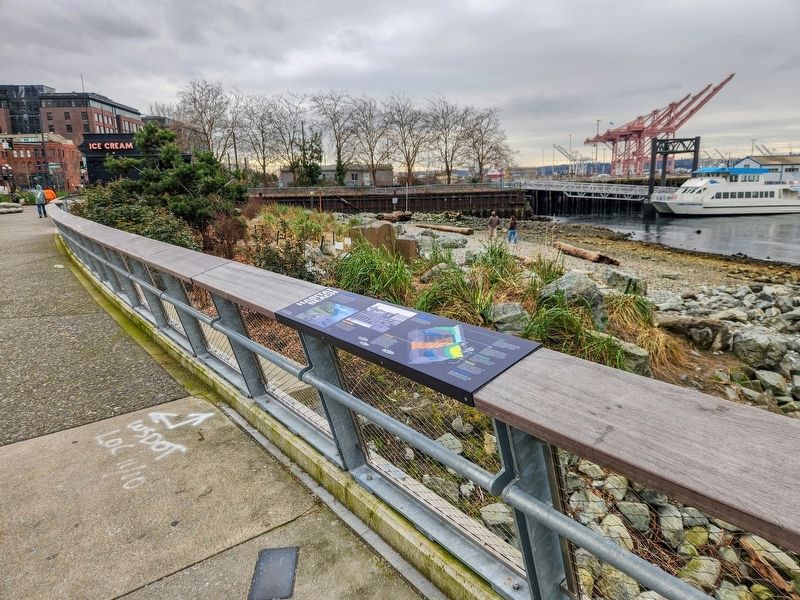
Location. 47° 36.077′ N, 122° 20.183′ W. Marker is in Seattle, Washington, in King County. It is in Downtown Seattle. It is on Alaskan Way south of Yesler Wy, on the right when traveling south. Touch for map. Marker is at or near this postal address: 199 Alaskan Wy, Seattle WA 98104, United States of America. Touch for directions.

Regionally, this marker is in Washington’s Puget Sound Region. It is also on the American Pacific Coast, in the Pacific Northwest, and in the Lewis & Clark Corridor. Globally, it is in North America, in the Cascade Range, in the Inside Passage, on the Ring of Fire, on the Pacific Rim, in the Western Hemisphere, in the Western World, and in the Anglosphere.
Other nearby markers. At least 8 other markers are within walking distance of this marker: Ever-Changing Landscape (a few steps from this marker); Chun Ching Hock (within shouting distance of this marker); Who Belongs Here? / Violence & Vitriol (within shouting distance of this marker); Ballast Island
Photographed by Douglass Halvorsen, February 20, 2026
3. Habitat Beach
Other markers no longer nearby. Indians Attack Seattle! Jan. 26, 1856 (was a few steps from this marker but has been permanently removed); Seattle’s First Pier (was within shouting distance of this marker but has been permanently removed); Steamer Idaho Wreckage (was within shouting distance of this marker but has been permanently removed).
Credits. This page was last revised on September 14, 2026. It was originally submitted on September 14, 2026, by Douglass Halvorsen of Klamath Falls, Oregon. This page has been viewed 10 times since then. Photos: 1, 2, 3. submitted on September 14, 2026, by Douglass Halvorsen of Klamath Falls, Oregon. • James Hulse was the editor who published this page.
