Near North Liberty in St. Joseph County, Indiana — The American Midwest (Great Lakes)
Farming Potato Creek
Photographed by Daniel Barriball, September 12, 2026
1. Farming Potato Creek Marker
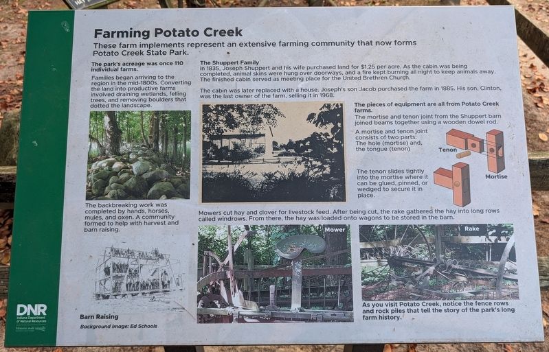
These farm implements represent an extensive farming community that now forms Potato Creek State Park.
The park's acreage was once 110 individual farms.
Families began arriving to the region in the mid-1800s. Converting the land into productive farms involved draining wetlands, felling trees, and removing boulders that dotted the landscape.
The backbreaking work was completed by hands, horses, mules, and oxen. A community formed to help with harvest and barn raising.
The Shuppert Family
In 1835, Joseph Shuppert and his wife purchased land for $1.25 per acre. As the cabin was being completed, animal skins were hung over doorways, and a fire kept burning all night to keep animals away. The finished cabin served as meeting place for the United Brethren Church.
The cabin was later replaced with a house. Joseph's son Jacob purchased the farm in 1885. His son, Clinton, was the last owner of the farm, selling it in 1968.
The pieces of equipment are all from Potato Creek farms.
The mortise and tenon joint from the Shuppert barn joined beams together using a wooden dowel rod.
A mortise and tenon joint consists of two parts:
this page online
The tenon slides tightly into the mortise where it can be glued, pinned, or wedged to secure it in place.
Mowers cut hay and clover for livestock feed. After being cut, the rake gathered the hay into long rows called windrows. From there, the hay was loaded onto wagons to be stored in the barn.
As you visit Potato Creek, notice the fence rows and rock piles that tell the story of the park's long farm history.
Erected 2026 by Indiana Department of Natural Resources, Indiana State Parks.
Topics. This historical marker is listed in these topic lists: Agriculture • Parks & Recreational Areas • Settlements & Settlers. A significant historical year for this entry is 1835.
Location. 41° 33.261′ N, 86° 21.411′ W. Marker is near North Liberty, Indiana, in St. Joseph County. It is on West Worster Parkway near Primrose Road, on the right when traveling east. This marker stands near the nature center in Potato Creek State Park. Touch for map. Marker is at or near this postal address: 25350 W Worster Pkwy, North Liberty IN 46554, United States of America. Touch for directions.

Regionally,
Photographed by Daniel Barriball, September 12, 2026
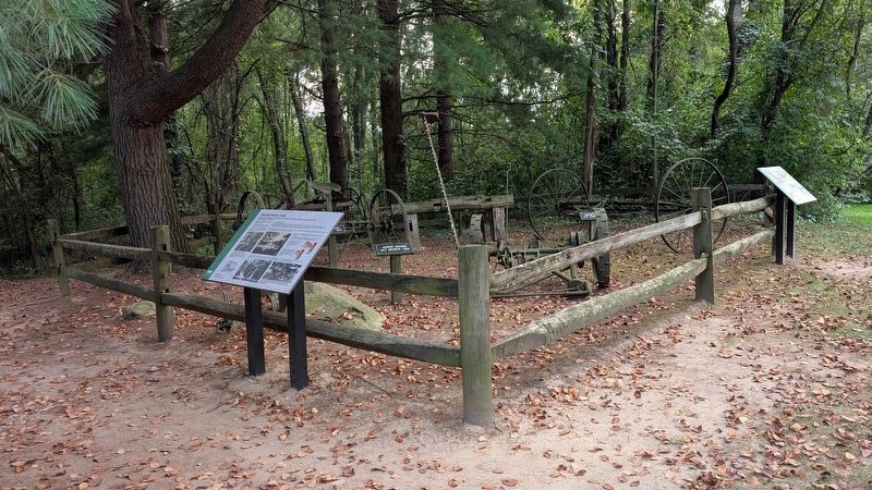
2. Farming Potato Creek Marker in context
The Naragon Barn marker is in the background on the right side of the photo.
Other nearby markers. At least 8 other markers are within 3 miles of this marker, measured as the crow flies: The Naragon Barn (here, next to this marker); The Springhouse (approx. 0.4 miles away); Porter (Rea) Cemetery (approx. half a mile away); Shuppert/Shupert Family (approx. ¾ mile away); People Make the Difference (approx. 1.3 miles away); A Champion of Farmland to Parkland (approx. 1.3 miles away); Indiana State Parks: the First 100 Years 1916-2016 (approx. 1.3 miles away); Huggart Settlement (approx. 2.7 miles away). Touch for a list and map of all markers in North Liberty.
Another marker is no longer nearby. Farm Equipment (was here, next to this marker but has been permanently removed).
Credits. This page was last revised on September 15, 2026. It was originally submitted on September 15, 2026, by Daniel Barriball of Chesterton, Indiana. This page has been viewed 13 times since then. Photos: 1, 2. submitted on September 15, 2026, by Daniel Barriball of Chesterton, Indiana. • Devry Becker Jones was the editor who published this page.
