Near North Liberty in St. Joseph County, Indiana — The American Midwest (Great Lakes)
Farm Equipment

Photographed by Daniel Barriball, March 26, 2025
1. Farm Equipment at Potato Creek State Park Marker
This farm equipment was used at the turn of the century in fields that are now part of Potato Creek State Park. Farmers used hay mowers to cut clover and grasses to make feed for horses and cattle. Once cut, the hay rake gathered hay into long rows called windrows. The hay was then loaded by hand onto wagons. Today, watchful park visitors may still see some signs of this land's past.
Topics. This historical marker is listed in these topic lists: Agriculture • Parks & Recreational Areas.
Location. Marker has been permanently removed. It was located near 41° 33.263′ N, 86° 21.413′ W. Marker was near North Liberty, Indiana, in St. Joseph County. It was on West Worster Parkway, on the right when traveling east. This marker is located outside of the Nature Center at Potato Creek State Park. Touch for map. Marker was at or near this postal address: 25350 W Worster Pkwy, North Liberty IN 46554, United States of America.
We have been informed that this marker is no longer there and will not be replaced. This page is an archival view of what was.
Regionally, this marker
this page online

Other nearby markers. At least 8 other markers are within 2 miles of this location, measured as the crow flies: The Naragon Barn (here, next to this marker); Farming Potato Creek (here, next to this marker); The Springhouse (approx. 0.4 miles away); Porter (Rea) Cemetery (approx. half a mile away); Shuppert/Shupert Family (approx. ¾ mile away); People Make the Difference (approx. 1.3 miles away); A Champion of Farmland to Parkland (approx. 1.3 miles away); Indiana State Parks: the First 100 Years 1916-2016 (approx. 1.3 miles away). Touch for a list and map of all markers in North Liberty.

Photographed by Daniel Barriball, March 26, 2025
2. Farm Equipment Marker in context

Photographed by Daniel Barriball, March 26, 2025
3. Close-up of the farm equipment
Photographed by Daniel Barriball, September 12, 2026
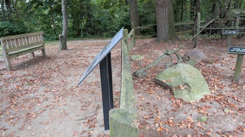
4. Farm Equipment Marker
The Farm Equipment marker used to be on the top fence rail. The Farming Potato Creek marker which replaced it is directly in front of this marker's former location.
Credits. This page was last revised on September 16, 2026. It was originally submitted on March 29, 2025, by Daniel Barriball of Chesterton, Indiana. This page has been viewed 162 times since then and 27 times this year. Last updated on September 15, 2026, by Daniel Barriball of Chesterton, Indiana. Photos: 1, 2, 3. submitted on March 29, 2025, by Daniel Barriball of Chesterton, Indiana. 4. submitted on September 15, 2026, by Daniel Barriball of Chesterton, Indiana. • Devry Becker Jones was the editor who published this page.
