Scottsbluff in Scotts Bluff County, Nebraska — The American Midwest (Upper Plains)
The “Flat Water” Platte River/El Río Platte de agua plana
Photographed by Cosmos Mariner, August 1, 2021
1. The “Flat Water” Platte River/El Río Platte de agua plana Marker

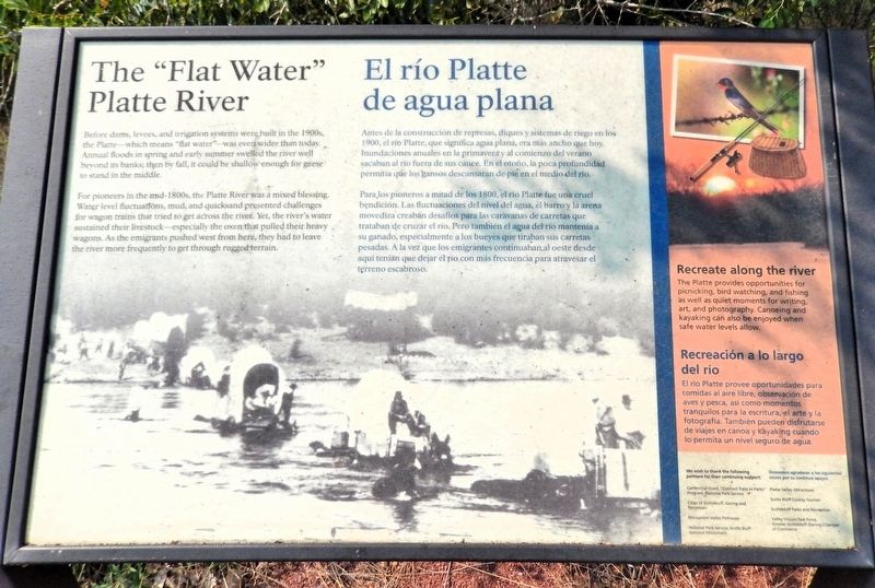
Before dams, levees, and irrigation systems were built in the 1900s, the Platte — which means “flat water” — was even wider than today. Annual floods in spring and early summer swelled the river well beyond its banks; then by fall, it could be shallow enough for geese to stand in the middle.
For pioneers in the mid-1800s, the Platte River was a mixed blessing. Water level fluctuations, mud, and quicksand presented challenges for wagon trains that tried to get across the river. Yet, the river's water sustained their livestock — especially the oxen that pulled their heavy wagons. As the emigrants pushed west from here, they had to leave the river more frequently to get through rugged terrain.
Recreate along the river
The Platte provides opportunities for picnicking, bird watching, and fishing as well as quiet moments for writing, art, and photography. Canoeing and kayaking can also be enjoyed when safe water levels allow.
Ante de la construcción de represas, diques y sistemas de riego en los 1900, el río Platte, que significa agua plana, era
this page online
Para los pioneros a mitad de los 1800, el río Platte fue una cruel bendición. Las fluctuaciones del nivel del agua, él barro y la arena movediza creaban desafíos para las caravanas de carretas que trataban de cruzar el río. Pero también el agua del río mantenía a su ganado, especialmente a los bueyes que tiraban sus carretas pesadas. A la vez que los emigrantes continuaban al oeste desde aquí tenían que dejar el río con más frecuencia para atravesar el terreno escabroso.
Recreación a lo largo del río
El río Platte provee oportunidades para comidas al aire libre, observación de aves y pesca, así como momentos tranquilos para la escritura, el arte y la fotografía. También pueden disfrutarse de viajes en canoa y kayaking cuando lo permita un nivel seguro de agua.
Erected by National Parks Service, Cities of Scottsbluff, Gering and Terrytown, Monument Valley Pathways, and Greater Scottsbluff/Gering Chamber of Commerce.
Topics.
Photographed by Cosmos Mariner, August 1, 2021
2. The “Flat Water” Platte River/El Río Platte de agua plana Marker
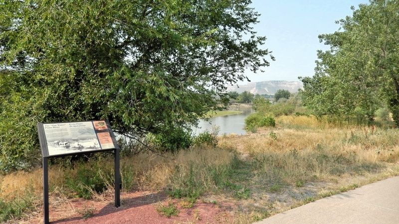
Looking southwest from the Monument Valley Pathway. The North Platte River is in the background.
Location. 41° 51.136′ N, 103° 39.876′ W. Marker is in Scottsbluff, Nebraska, in Scotts Bluff County. It can be reached from Avenue B just south of South Beltline Highway West. The marker is on the Monument Valley Pathway, just east of Riverside Park. Touch for map. Marker is at or near this postal address: 126 South Beltline Highway West, Scottsbluff NE 69361, United States of America. Touch for directions.

Regionally, this marker is in the Nebraska Panhandle. It is also in the American Midwest, in the Corn Belt, and on the prairies. Globally, it is in North America, the Western Hemisphere, the Western World, and the Anglosphere. Historically, it finds itself in what was once the Louisiana Purchase.
Other nearby markers. At least 8 other markers are within walking distance of this marker: North Platte River Flooding (about 400 feet away, measured in a direct line); The Fur Trade/El comercio de piel (about 400 feet away); The Great Platte River Road/El camino del gran Río Platte (about 700 feet away); Turn Back from Here?/¿Regresar de aquí? (approx. ¼ mile away); Me-a-pa-te (approx. 0.4 miles away); Marching to Zion/Marchando al monte Sion (approx. 0.4 miles away); Rapid Changes/Cambios rápidos (approx. 0.6 miles away); The Old Post Office (approx. 0.7 miles away). Touch for a list and map of all markers in Scottsbluff.
Also see . . . Platte River (Wikipedia).
Excerpt: The Platte is one of the most significant tributary systems in the watershed of the Missouri, draining a large portion of the central Great Plains in Nebraska and the eastern Rocky Mountains in Colorado and Wyoming. The river valley played an important role in the westward expansion of the United States, providing the route for several major emigrant trails, including the Oregon, California, Mormon, and Bozeman trails. The first Europeans to see the Platte were French explorers and fur trappers about 1714; they first called it the Nebraskier (Nebraska), a transliteration of the name given by the Otoe people, meaning “flat water”. This expression is very close to the French phrase “rivière platte” (“flat river”), which is likely the origin of the name “Platte River”.(Submitted on September 16, 2026, by Cosmos Mariner of Cape Canaveral, Florida.)
Credits. This page was last revised on September 16, 2026. It was originally submitted on September 15, 2026, by Cosmos Mariner of Cape Canaveral, Florida. This page has been viewed 10 times since then. Photos: 1, 2. submitted on September 16, 2026, by Cosmos Mariner of Cape Canaveral, Florida.
