Near Burbank in Walla Walla County, Washington — The American West (Northwest)
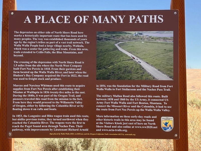
A Place of Many Paths
Photographed by Barry Swackhamer, June 13, 2026
1. A Place of Many Paths Marker
The crossing of the depression with North Shore Road is 1.5 miles from the site where the North West Company built Fort New Percés in 1818. From their gardens and farm located up the Walla Walla River, and later when the Hudson's Bay Company acquired the Fort in 1822, the road was used to freight stock and produce.
Marcus and Narcissa Whitman used this route to acquire supplies from Fort New Percés after establishing their Mission at Wailaptu in 1836 twenty-five miles to the east. During the 1840s, it was part of the Oregon Trail, and pioneers traveled this road from the mission to the fort. From here they would proceed to the Willamette Valley of Oregon, either by following the Columbia River or by floating
this page online
In 1853, the Longmire and Biles wagon train used this route, but unlike previous trains, they turned northwest when they reached the Columbia River. The wagons were the first to reach the Puget Sound area through Naches Pass. Their pathway, with improvements by Lieutenant Richard Arnold in 1854, was the foundation for the Military Road from Fort Walla Walla to Fort Steilacoom and the Naches Pass Trail.
The military Mullan Road also followed this route. Built between 1858 and 1860 by the US Army, it connected US Army Fort Walla Walla and Fort Benton, Montana. To connect the Missouri River and the Columbia, it had to use the route from Fort Nez Percés up the Walla Walla Valley.
More information on these early-day roads and other historic trails in this area may be found at the Visitors Kiosk just east of here on North Shore Road and also online at www.ww2020.net and www.octa-trails.org.
Erected by Walla Walla 2020 and Oregon-California Trails Association.
Topics. This historical marker is listed in these topic lists: Forts and Castles • Indigenous Peoples and Communities • Roads & Vehicles

Photographed by Barry Swackhamer, June 13, 2026
2. A Place of Many Paths Marker
Location. 46° 3.933′ N, 118° 54.338′ W. Marker is near Burbank, Washington, in Walla Walla County. It is on North Shore Road near U.S. 12, on the right when traveling north. The marker is located in Madame Dorian Memorial Park. Touch for map. Marker is in this post office area: Burbank WA 99323, United States of America. Touch for directions.

Regionally, this marker is in the Columbia Basin. It is also in the American Mountain West and in the Lewis & Clark Corridor. Globally, it is in North America, on the Pacific Rim, in the Western Hemisphere, in the Western World, and in the Anglosphere.
Other nearby markers. At least 8 other markers are within 12 miles of this marker, measured as the crow flies: Madame Marie L'Aguivoise Dorion (approx. ¼ mile away); Fort Nez Percés / Fort Walla Walla (approx. 1.3 miles away); Wallula Veterans Memorial (approx. 1.3 miles away); Here Stood Fort Nez Perce (approx. 1.3 miles away); The History of Wallula (approx. 1.6 miles away); At the Confluence (approx. 11.2 miles away); Lewis & Clark Camp (approx. 11.2 miles away); Mayor A. P. Gray (approx. 11.2 miles away).
Another marker is no longer nearby. Fort Walla Walla (was approx. 1.3 miles away but has been confirmed missing).
Credits. This page was last revised on September 19, 2026. It was originally submitted on September 19, 2026, by Barry Swackhamer of Brentwood, California. This page has been viewed 5 times since then. Photos: 1, 2. submitted on September 19, 2026, by Barry Swackhamer of Brentwood, California.
