Historic District in St. Augustine in St. Johns County, Florida — The American South (South Atlantic)
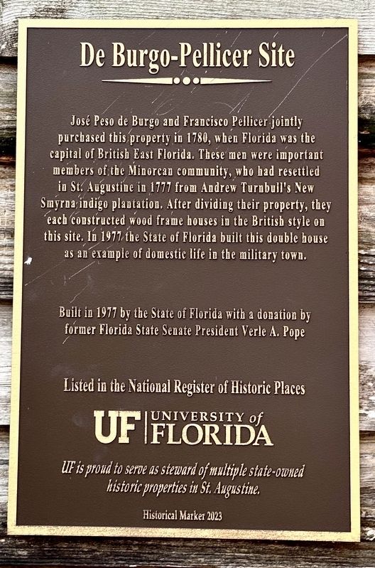
De Burgo-Pellicer Site
Photographed by Stephen Thomas White, July 30, 2026
1. De Burgo-Pellicer Site Marker
Built in 1977 by the State of Florida with a donation by former Florida State Senate President Verle A. Pope
Listed in the National Register of Historic Places
UF | University of Florida
UF is proud to serve as steward of multiple state-owned historic properties in St. Augustine.
Historical Marker 2023
Erected 2023 by University of Florida.
Topics. This historical marker is listed in these topic lists: Colonial Era • Exploration • Parks & Recreational Areas. A significant historical year for this entry is 1780.
Location. 29° 53.769′ N, 81° 18.789′ W. Marker is in St. Augustine, Florida, in St. Johns County. It is in the Historic District. It is on Saint George Street 0.2 miles north of Cordova Street, on the right when traveling north. Touch for map. Marker is at or near this postal address: 43 St George Street, Saint Augustine FL 32084, United States of America. Touch for directions.

Regionally, this marker is in First Coast and in Greater Jacksonville. It is also in the American South and on the Eastern Seaboard. Globally, it is in the North Atlantic Region, North America, a Gulf of Mexico state, the Western Hemisphere, the Western World, and the Anglosphere. Historically, it finds itself in what was once New Spain, the territory of the Mississippian Culture,
this page online
Other nearby markers. At least 8 other markers are within walking distance of this marker: De Mesa-Sánchez House (here, next to this marker); Rodriquez-Avero-Sanchez House (a few steps from this marker); Rodriguez-Avero-Sanchez House (a few steps from this marker); Avero House (a few steps from this marker); Casa Avero (a few steps from this marker); Arrivas House (a few steps from this marker); De Hita-González Houses (within shouting distance of this marker); The Minorcan Heritage (within shouting distance of this marker). Touch for a list and map of all markers in St. Augustine.
Also see . . . UFHSA Governor’s House Library. (Submitted on September 19, 2026, by Stephen Thomas White of Norfolk, Virginia.)
Photographed by Stephen Thomas White, July 30, 2026
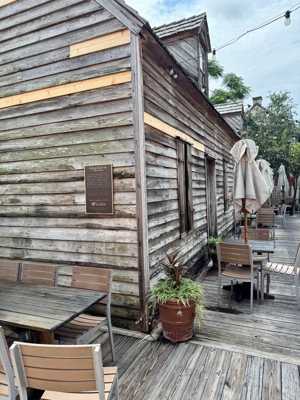
2. De Burgo-Pellicer Site Marker
Credits. This page was last revised on September 20, 2026. It was originally submitted on September 19, 2026, by Stephen Thomas White of Norfolk, Virginia. This page has been viewed 8 times since then. Photos: 1, 2. submitted on September 19, 2026, by Stephen Thomas White of Norfolk, Virginia. • Andrew Ruppenstein was the editor who published this page.
