Winchester in Frederick County, Virginia — The American South (Mid-Atlantic)
The Second Battle of Kernstown
Mulligan's Final Stand
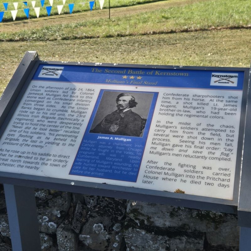
Photographed by Mike McKeown, September 19, 2026
1. The Second Battle of Kernstown Marker
On the afternoon of July 24, 1864, Union soldiers led by Colonel James A Mulligan fell back to this stone wall as Confederate infantry converged on his small division from three sides. As the Union flanks began to crumble, Mulligan rode up to his old unit, the 23rd Illinois Irish Brigade (technically a regiment), who were desperately trying to hold the center of the line, "Never did he look better" recalled one of his soldiers, "his penetrating eyes flashed as he beheld his brigade, the last in yielding to the pressure of the enemy."
As he rose up in his saddle to direct what he intended to be an orderly retreat north towards the town of Winchester, the nearby Confederate Confederate sharpshooters shot him from his horse. At the same time, a shot killed Lt. James Nugent, Mulligan's 19-year-old brother-in-law, who had been holding the regimental colors.
In the midst of the chaos, Mulligan's soldiers attempted to carry him from the field, but several were shot down in the process. Seeing his men fall Mulligan gave his final order: "Lay me down and save the flag." Mulligan's men reluctantly complied.
After the fighting
this page online
(caption)
James A. Mulligan
Mulligan was a charismatic Irish-Catholic attorney from Chicago. While he fought in the Valley, his pregnant wife was in nearby Cumberland, Maryland. Upon learning of Mulligan's wounding, his wife hurried toward Winchester to care for her husband, but he died before she arrived.
Erected by Kernstown Battlefield Association.
Topics. This historical marker is listed in this topic list: War, US Civil. A significant historical date for this entry is July 24, 1864.
Location. 39° 8.627′ N, 78° 11.639′ W. Marker is in Winchester, Virginia, in Frederick County. It is on Battle Park Drive west of Valley Avenue (U.S. 11), on the right when traveling west. Touch for map. Marker is at or near this postal address: 610 Battle Park Drive, Winchester VA 22601, United States of America. Touch for directions.

Regionally, this marker is in the Shenandoah Valley. It is also in the American South, specifically in the Upper South, and in the Mid-Atlantic. Globally, it is in North America, the Western Hemisphere, the Western World, and the Anglosphere. Historically, it finds itself in what was once the territory of the Mississippian Culture, one of the original Thirteen Colonies, one of the Confederate States of America, and the Antebellum South.
Other nearby markers. At least 8 other markers are within walking distance of this marker: Kernstown Battlefield (about 500 feet away, measured in a direct line); a different marker also named The Pritchard House (about 800 feet away); a different marker also named Second Battle of Kernstown (approx. 0.2 miles away); Pritchard Family Cemetery (approx. 0.2 miles away); a different marker also named The First Battle of Kernstown (approx. 0.2 miles away); Site of the Original Pritchard Barn (approx. 0.2 miles away); Enslaved Labor in the Shenandoah Valley (approx. 0.2 miles away); Agriculture in the Shenandoah Valley (approx. 0.2 miles away). Touch for a list and map of all markers in Winchester.
Other markers no longer nearby. The Pritchard House (was within shouting distance of this marker but has been replaced with another marker now near it); The First Battle of Kernstown (was within shouting distance of this marker but has been replaced with another marker now near it); a different marker also named The Second Battle of Kernstown (was about 700 feet away but has been replaced with another marker now near it); a different marker also named The First Battle of Kernstown (was about 700 feet away but has been replaced with another marker now near it); a different marker also named The Second Battle of Kernstown (was approx. 0.2 miles away but has been permanently removed).
Also see . . . Kernstown Battlefield Association. (Submitted on September 30, 2026.)
Credits. This page was last revised on September 30, 2026. It was originally submitted on September 19, 2026, by Mike McKeown of Baltimore, Maryland. This page has been viewed 12 times since then. Photo 1. submitted on September 19, 2026, by Mike McKeown of Baltimore, Maryland. • Bernard Fisher was the editor who published this page.
Editor’s want-list for this marker. Wide shot of marker and its surroundings. • Can you help?
