Pascp, Washington — The American West (Northwest)
Snake River Passage & Columbia Plains Crossing
Photographed by Barry Swackhamer, June 13, 2026
1. Snake River Passage & Columbia Plains Crossing Marker
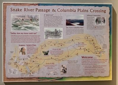
Click on this image to enlarge it and examine details of the Lewis and Clark Expedition map.
Welcome to the homelands of the Nimiipuu (meaning "the people") or Nez Perce tribe and other tribes of the Columbia Plateau. As you travel the Lewis and Clark Trail and across tribal homelands, please be good stewards and respectful visitors.
• Leave no trace - help protect the environment and the plants and animals living here.
• Respect private property - do not trespass and
• Protect archaeological and cultural resources - leave things were you find them. Report what you find.
"Swifter than any horse could run"
In fall 1805, the Lewis and Clark Expedition raced against time, hoping to reach the Pacific Ocean before winter set in. Traveling faster than at any other time during the journey, the party often covered 30 mies or more per day on the swift water of the Snake River. Clark wished that the party could have portaged around more of the treacherous rapids, but he knew "the Season was so far advanced and time precious with us."
Sacagawea - Symbol of Peace
Clark wrote that Sacagawea's presence in this region signaled "our friendly intentions, as no woman ever accompanies a war party of Indians in this quarter."
this page online
A "good road"
On the advice of the Walla Walla people, the Lewis and Clark Expedition followed " a good road...plenty of Deer and Antilopes" that led travelers overland between the confluences of the Columbia / Walla Walla rivers and the Snake / Clearwater rives. The Expedition travels approximately 100 miles on this route between April 30 and May 5, 1806.
The "Great Columbian Plain"
The Expedition had its first and completely unexpected encounter with the semi-arid plain of the Columbia, now known as the Columbia Plateau. Clark wrote, "not one stick of timber on the river."
Jefferson's Instructions
President Thomas Jefferson wrote detailed instructions to Meriwether Lewis, directing him to lead an expedition to the Pacific Ocean. He asked him to find "the most direct & practicable water communication across this continent for the purpose of commerce.
Great quantities of a kind of prickley pares, much worst than any I have before Seen of a tapering form and attach themselves by bunches."
William Clark
October 18, 1805
"saw a mountain bearing S.W. conocol form Covered with Snow."
Photographed by Barry Swackhamer, June 13, 2026
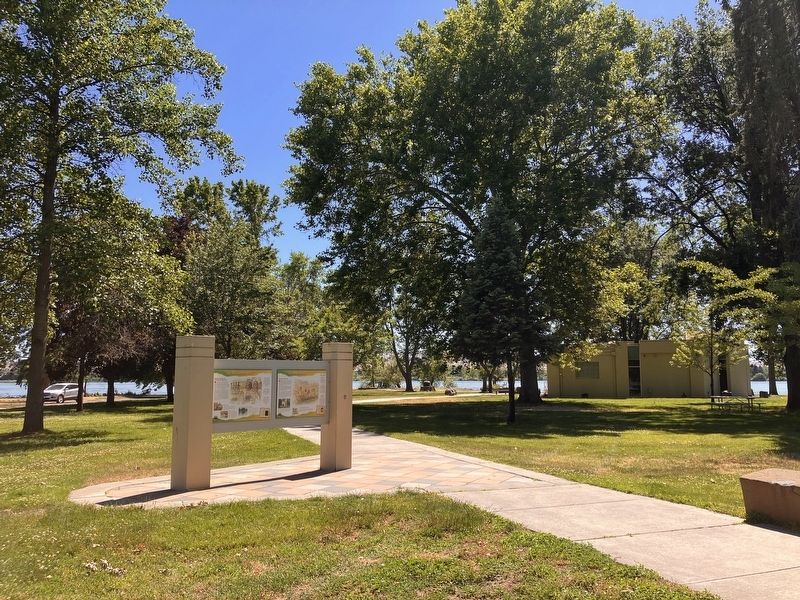
2. Snake River Passage & Columbia Plains Crossing Marker
William Clark
May 4, 1806
The Soil is extreamly feritile" Meriwether Lewis
Meeting with the "Bighorn Chief
On Paráha Creek, a tributary of the Tucannon River, Lewis and Clark encountered a prominent Nez Perce chief who wore the horn of a bighorn sheep under his arm. Historians believe this chief's son and grandson were also prominent leaders known as Looking Glass (elder and younger).
Erected by Washington Lewis & Clark Expedition Bicentennial Commission.
Topics. This historical marker is listed in these topic lists: Exploration • Indigenous Peoples and Communities • Waterways & Vessels. A significant historical month for this entry is October 1805.
Location. 46° 11.969′ N, 119° 2.332′ W. Marker is in Pascp in , Washington. It is on Sacajawea Park Road near South Road 40 East. This marker is located in Sacajawea Park,. Touch for map. Marker is at or near this postal address: oa Sacajawea Park Rd, Pasco WA 99301, United States of America. Touch for directions.

Regionally, this marker is in the American Lewis & Clark Corridor. Globally, it is in North America, on the Pacific Rim, in the Western Hemisphere, in the Western World, and in the Anglosphere.
Other nearby markers. At least 8 other markers are within walking distance of this marker: "Sah-cah-ga-weah" (here, next to this marker); "great Columbia river" (here, next to this marker); Lewis and Clark National Historic Trail (here, next to this marker); Mayor A. P. Gray (within shouting distance of this marker); Columbia River (within shouting distance of this marker); Snake River (within shouting distance of this marker); At the Confluence (within shouting distance of this marker); Lewis & Clark Camp (within shouting distance of this marker).
Credits. This page was last revised on September 19, 2026. It was originally submitted on September 19, 2026, by Barry Swackhamer of Brentwood, California. This page has been viewed 9 times since then. Photos: 1, 2. submitted on September 19, 2026, by Barry Swackhamer of Brentwood, California.
