Southbank in Melbourne, Victoria, Australia — Oceania
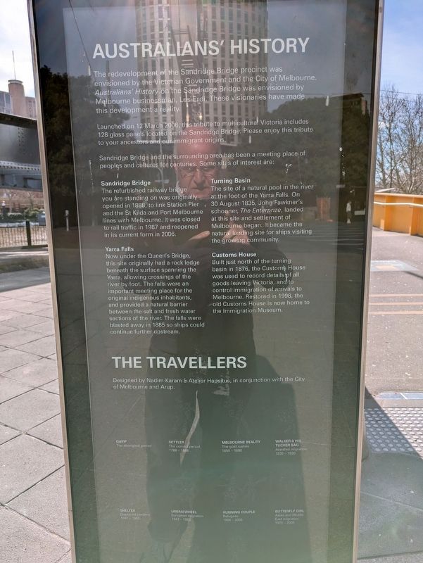
Australians' History
Photographed by Dean Barton-Ancliffe, August 24, 2026
1. Australians' History Marker
Launched on 12 March 2006, this tribute to multicultural Victoria includes 128 glass panels located on the Sandridge Bridge. Please enjoy this tribute to your ancestors and our immigrant origins.
Sandridge Bridge and the surrounding area has been a meeting place of peoples and cultures for centuries. Some sites of interest are:
Sandridge Bridge
The refurbished railway bridge you are standing on was originally opened in 1888, to link Station Pier and the St Kilda and Port Melbourne lines with Melbourne. It was closed to rail traffic in 1987 and reopened in its current form in 2006.
Yarra Falls
Now under the Queen's Bridge, this site originally had a rock ledge beneath the surface spanning the Yarra, allowing crossings of the river by foot. The falls were an important meeting place for the original indigenous inhabitants, and provided a natural
this page online
Turning Basin
The site of a natural pool in the river at the foot of the Yarra Falls. On 30 August 1835, John Fawkner's schooner, The Enterprize, landed at this site and settlement of Melbourne began. It became the natural landing site for ships visiting the growing community.
Customs House
Built just north of the turning basin in 1876, the Customs House was used to record details of all goods leaving Victoria, and to control immigration of arrivals to Melbourne. Restored in 1998, the old Customs House is now home to the Immigration Museum.
Erected 2006.
Topics. This historical marker is listed in these topic lists: Arts, Letters, Music • Bridges & Viaducts • Colonial Era • Settlements & Settlers • Waterways & Vessels. A significant historical year for this entry is 1888.
Location. 37° 49.252′ S, 144° 57.719′ E. Marker is in Southbank, Victoria, in Melbourne. It is on Queens Bridge Street 0.1 kilometers east of Yarra Promenade, on the right when traveling north.
Photographed by Dean Barton-Ancliffe, August 24, 2026
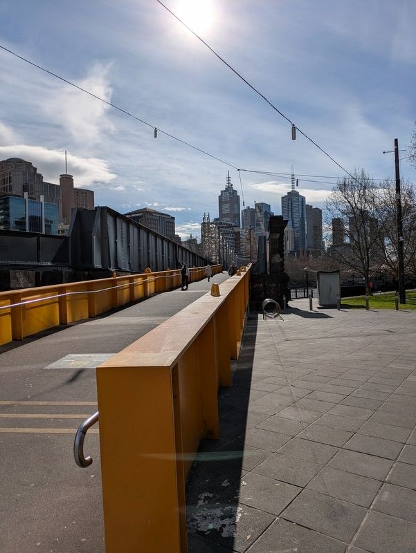
2. Sandridge Bridge and the Sculptures

Regionally, it is in Oceania, in Australasia, in the Pacific Ocean, in South Pacific, on the Pacific Rim, in the Western World, and in the Anglosphere. Historically, it finds itself in what was once a British colony.
Other nearby markers. At least 8 other markers are within walking distance of this marker: The Turning Basin (about 90 meters away, measured in a direct line); Customs House (about 210 meters away); Old Customs House Restoration (about 210 meters away); The Battle of Flinders Street (approx. 0.3 kilometers away); Melbourne Port Authority Building (approx. 0.3 kilometers away); Former National Mutual Life Association Building (approx. 0.4 kilometers away); Former Bank of Australasia (approx. 0.4 kilometers away); Banking Chamber Commercial Bank of Australia (approx. half a kilometer away).
Also see . . . The Travellers 2005. City of Melbourne
Location: Sandridge Bridge precinct The Travellers celebrates Indigenous presence and the meeting of cultures through migration.(Submitted on September 19, 2026, by Dean Barton-Ancliffe of Rowville, Victoria.)It comprises ten large-scale sculptures, each approximately 7.5 metres tall and collectively incorporating 3.7 kilometres of stainless steel. It is sited near a former Aboriginal meeting ground and near the landing point where many early migrants stepped ashore. Built in 1888, the bridge is the third to occupy this site, the original constructed in 1853. Each of the ten figures comprising the work represents a phase of arrival, as historian James Jupp has defined these. The figures, graphic and abstracted in form, are Gayip (Aboriginal period); First Settler (convict period); Melbourne Beauty (gold rushes); Walker and His Tucker Bag (assisted migration); Shelter (displaced persons); Urban Wheel (European migration); Running Couple (refugees); Butterfly Girl (Asian and Middle Eastern migration); Technoman (students and professionals); and Walking Sun (multiculturalism). Below the figures, a series of etched glass panels stretch across the bridge as a component in this history of migration to Australia. They record places of origin and other details relevant to the migration experience when this artwork was completed. This work was commissioned by the City of Melbourne and Victorian government, and launched in 2005.Photographed by Dean Barton-Ancliffe, August 24, 20263. Sandridge Bridge
Credits. This page was last revised on September 19, 2026. It was originally submitted on September 19, 2026, by Dean Barton-Ancliffe of Rowville, Victoria. This page has been viewed 7 times since then. Photos: 1, 2, 3. submitted on September 19, 2026, by Dean Barton-Ancliffe of Rowville, Victoria. • Andrew Ruppenstein was the editor who published this page.
