Crotona in the Bronx in Bronx County, New York — The American Northeast (Mid-Atlantic)
Prospect Playground

Photographed by Devry Becker Jones, September 17, 2026
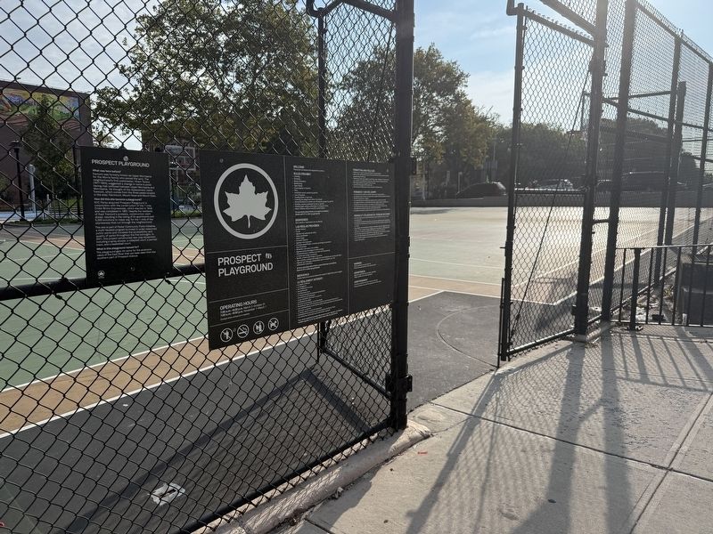
1. Prospect Playground Marker
What was here before?
Tremont was formerly known as Upper Morrisania for the Morris family who owned the land. The neighborhood's first postmaster, Hiram Tarbox (1817-1904), suggested a change in name to avoid having mail confused between Upper Morrisania and Morrisania. He thought of the replacement name Tremont, which comes from the three peaks located in the area: Fairmount, Mount Hope and Mount Eden.
How did this site become a playground?
NYC Parks acquired Prospect Playground in conjunction with the construction of the 7-mile Cross-Bronx Expressway, which started in 1948 and was completed in 1963. Despite the residents of East Tremont's protests, construction went ahead, resulting in the razing of 54 apartments and 5,000 evictions to make way for the 1 mile of the expressway that cut through the neighborhood.
This site is part of Parks' Community Parks Initiative a multi-faceted program to invest in under-resourced public parks and increase the accessibility and quality of parks throughout the five boroughs. In 2021, this project constructed new playground equipment, including a spray shower, a volleyball
this page online
What is this playground named for?
The playground gets its name for the extensive views of the East River that can be seen from the southern part of Prospect Avenue.
Erected by NYC Parks. (Marker Number 300.)
Topics and series. This historical marker is listed in these topic lists: Communications • Parks & Recreational Areas • Roads & Vehicles • Settlements & Settlers. In addition, it is included in the NYC Parks series list. A significant historical year for this entry is 1948.
Location. 40° 50.582′ N, 73° 53.456′ W. Marker is in Bronx, New York, in Bronx County. It is in Crotona. It is on East 176th Street west of Prospect Avenue, on the right when traveling west. Touch for map. Marker is at or near this postal address: 1919 Prospect Ave, Bronx NY 10457, United States of America. Touch for directions.

Regionally, this marker is in New York City. It is also in the American Northeast, in the Mid-Atlantic, and on the Eastern Seaboard. Globally, it is in the North Atlantic Region, North America, the Western Hemisphere, the Western World, and the Anglosphere.
Other nearby markers. At least 8 other markers are within walking distance of this marker: Jonas Salk (approx. 0.2 miles away); Walter Gladwin Park (approx. ¼ mile away); Happy Land Social Club Fire Memorial (approx. 0.3 miles away); Tommies: Tiny but Tough (approx. 0.7 miles away); Look for the Skeleton (approx. 0.7 miles away); Nyala: An African Antelope (approx. ¾ mile away); One Cat Linking Two Countries (approx. 0.8 miles away); Species Survival Plan / A Snow Leopard Family Tree (approx. 0.8 miles away). Touch for a list and map of all markers in Bronx.
Additional keywords. Freeway Revolts
Credits. This page was last revised on September 22, 2026. It was originally submitted on September 22, 2026, by Devry Becker Jones of Washington, District of Columbia. This page has been viewed 3 times since then. Photos: 1, 2. submitted on September 22, 2026, by Devry Becker Jones of Washington, District of Columbia.
