St. Robert in Pulaski County, Missouri — The American Midwest (Upper Plains)
Tri-State Bonding
Photographed by Jason Voigt, September 23, 2026
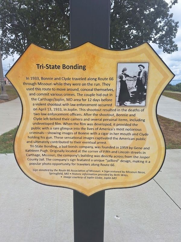
1. Tri-State Bonding Marker
In 1933, Bonnie and Clyde travelled along Route 66 through Missouri while they were on the run. They used this route to move around, conceal themselves, and commit various crimes. The couple hid out in the Carthage/Joplin, MO area for 12 days before a violent shootout with law enforcement occurred on April 13, 1933, in Joplin. This shootout resulted in the deaths of two law enforcement officers. After the shootout, Bonnie and Clyde left behind their camera and several personal items, including undeveloped film. When the film was developed, it provided the public with a rare glimpse into the lives of America's most notorious criminals - showing images of Bonnie with a cigar in her mouth and Clyde holding his gun. These sensational images captivated the American public and ultimately contributed to their eventual arrest.
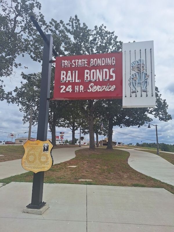
Tri-State Bonding, a bail bonds company, was founded in 1959 by Gene and Kathleen Pugh. Originally located at the corner of Fifth and Lincoln streets in Carthage, Missouri, the company's building was directly across from the Jasper County Jail. The company's sign featured a unique "jailbird" design,
this page online
Sign donated by the Route 66 Association of Missouri · Sign restored by Missouri Neon, Springfield, MO · Historic information provided by Beth Wiles · Image courtesy of Joplin Globe, Joplin MO
Erected 2025.
Topics and series. This historical marker is listed in these topic lists: Industry & Commerce • Law Enforcement • Women. In addition, it is included in the U.S. Route 66 series list. A significant historical year for this entry is 1933.
Location. 37° 49.276′ N, 92° 8.879′ W. Marker is in St. Robert, Missouri, in Pulaski County. It is at the intersection of J.H. Williamson Drive and Business Interstate 44, on the right when traveling north on J.H. Williamson Drive. Marker is located at Route 66 Neon Park. Touch for map. Marker is at or near this postal address: 133 Reed Pkwy, Saint Robert MO 65584, United States of America. Touch for directions.

Regionally, this marker is in South-Central Missouri. It is also in the American Ozarks, in the Lewis & Clark Corridor, and in the Corn Belt. Globally, it is in North America, the Western Hemisphere,
Photographed by Jason Voigt, September 23, 2026
2. Tri-State Bonding Marker
Other nearby markers. At least 8 other markers are within walking distance of this marker: D & G Package Store (a few steps from this marker); AlPac Motel (a few steps from this marker); Alura Motel (a few steps from this marker); Motel St. Louis (a few steps from this marker); Stanley Cour-Tel (a few steps from this marker); Skyline Garage Auto Service (within shouting distance of this marker); Modern Cabins (within shouting distance of this marker); George M. Reed (within shouting distance of this marker). Touch for a list and map of all markers in St. Robert.
Also see . . . Route 66 Neon Park (City of Saint Robert's website). (Submitted on September 23, 2026, by Jason Voigt of Glen Carbon, Illinois.)
Additional keywords. outlaws
Photographed by Jason Voigt, September 23, 2026
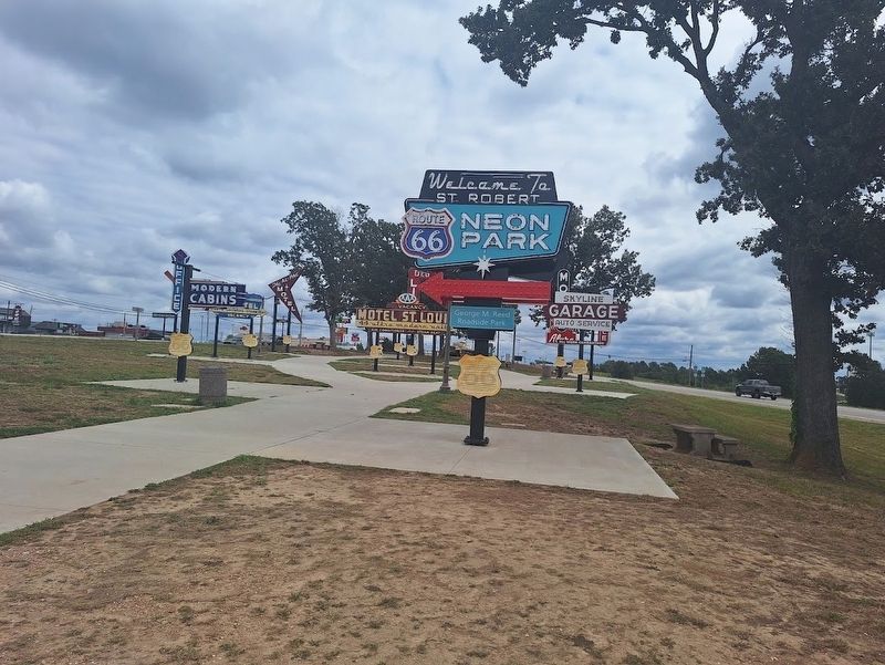
3. Tri-State Bonding Marker
Located at Route 66 Neon Park, which is also George M. Reed Roadside Park
Credits. This page was last revised on September 23, 2026. It was originally submitted on September 23, 2026, by Jason Voigt of Glen Carbon, Illinois. This page has been viewed 6 times since then. Photos: 1, 2, 3. submitted on September 23, 2026, by Jason Voigt of Glen Carbon, Illinois.
