Near LaCrosse in Whitman County, Washington — The American West (Northwest)
Floods Reveal the Past
Photographed by Barry Swackhamer, June 14, 2026
1. Floods Reveal the Past Marker
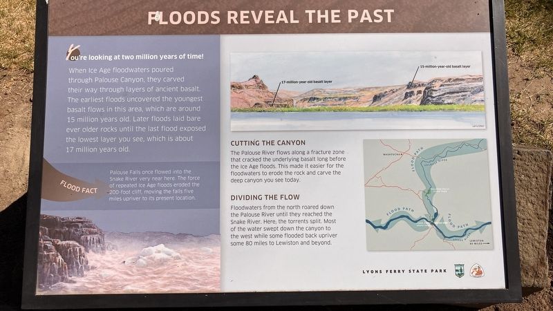
You're looking at two millions years of time!
When Ice Age floodwaters poured through Palouse Canyon, they carved their way through layes of ancient basalt. The earliest floods uncovered the youngest basalt flows in this area, which are around 15 million years old. Later floods laid bare even older rocks until the last flood exposed the lowest layer you see, which is about 17 million years old.
FLOOD FACT: Palouse Falls once flowed into the Snake River very near here. The force of repeated Ice Age floods eroded the 200-foot cliff, moving the falls five miles upriver to its present location.
Cutting the Canyon
The Palouse River flows along a fracture zone that cracked the underlying basalt long before the Ice Age floods. This made it easier for the floodwaters to erode the rock and carve the deep canyon you see today.
Dividing the Flow
Floodwaters from the north roared down the Palouse River until they reached the Snake River. Here the torrents split. Most of the water swept down the canyon to the west while some flooded back upriver some 80 miles to the Lewiston and beyond.
Erected by Lyons
this page online
Topics. This historical marker is listed in these topic lists: Natural Features • Notable Events.
Location. 46° 35.746′ N, 118° 13.157′ W. Marker is near LaCrosse, Washington, in Whitman County. It is on Washington Route 261 near Lyons Ferry Road, on the right when traveling north. This marker is in Lyons Ferry State Park. Touch for map. Marker is in this post office area: Lacrosse WA 99143, United States of America. Touch for directions.

Regionally, this marker is in the Palouse and in Greater Spokane. It is also in the American Mountain West and in the Lewis & Clark Corridor. Globally, it is in North America, on the Pacific Rim, in the Western Hemisphere, in the Western World, and in the Anglosphere.
Other nearby markers. At least 8 other markers are within 5 miles of this marker, measured as the crow flies: Cataclysmic Floods (here, next to this marker); M - R Military Road (here, next to this marker); M-R Military Wagon Road (within shouting distance of this marker); Drewyers River (within shouting distance of this marker); Small Town, Big Voice (approx. 4.7 miles away); Overwhelming Proof for an "Outrageous" Theory (approx. 4.7 miles away); Setting the Stage (approx. 4.7 miles away); Stealing a Stream (approx. 4.7 miles away).
Photographed by Barry Swackhamer, June 14, 2026
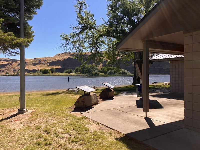
2. Floods Reveal the Past Marker
Photographed by Barry Swackhamer, June 14, 2026
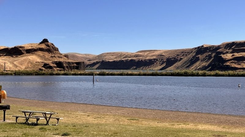
3. Snake River
On the left, at the base of the cliff, a "17-million-year-onld basalt layer." On the right, at the base of the cliff, a "15-million-year-old basalt layer."
Credits. This page was last revised on September 24, 2026. It was originally submitted on September 24, 2026, by Barry Swackhamer of Brentwood, California. This page has been viewed 7 times since then. Photos: 1, 2, 3. submitted on September 24, 2026, by Barry Swackhamer of Brentwood, California.
