Lower Southampton Township near Langhorne in Bucks County, Pennsylvania — The American Northeast (Mid-Atlantic)
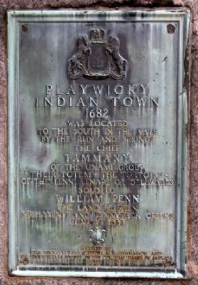
Playwicky Indian Town
1682
Photographed by William Fischer, Jr., October 15, 2009
1. Playwicky Indian Town Marker
to the south in the vale
by the run and springs.
The Chief
Tammany
of the Unami Group
• their totem • the tortoise •
of the Lenni Lenape or Delawares
sold to
William Penn
the land between
Neshaminy and Pennypack Creeks
June 23, 1683
Erected 1925 by The Pennsylvania Historical Commission and The Pennsylvania Society of the Colonial Dames of America.
Topics and series. This historical marker is listed in these topic lists: Colonial Era • Indigenous Peoples and Communities • Settlements & Settlers. In addition, it is included in the The Colonial Dames of America, National Society of series list. A significant historical month for this entry is June 1867.
Location. 40° 10.324′ N, 74° 58.206′ W. Marker is near Langhorne, Pennsylvania, in Bucks County. It is in Lower Southampton Township. It is on Bridgetown Pike (Pennsylvania Route 213), on the right when traveling east. Marker is on the grounds of Playwicki Farm. Touch for map. Marker is at or near this postal address: 2350 Bridgetown Pike, Feasterville Trevose PA 19053, United States of America. Touch for directions.

Regionally, this marker
this page online
Other nearby markers. At least 8 other markers are within 3 miles of this marker, measured as the crow flies: The Playwicki Farm Labyrinth (about 300 feet away, measured in a direct line); Middletown Township World War I Memorial (approx. 2.6 miles away); The Birthplace of Edward Hicks (approx. 2.7 miles away); Revolutionary War Burial Site (approx. 2.7 miles away); a different marker also named Revolutionary War Burial Site (approx. 2.7 miles away); a different marker also named Revolutionary War Burial Site (approx. 2.7 miles away); Archaeology and History (approx. 2.7 miles away); Mollie Woods Hare (approx. 2.7 miles away). Touch for a list and map of all markers in Langhorne.
Also see . . . Playwicki Farm. Website homepage (Submitted on May 23, 2023, by Larry Gertner of New York, New York.)
Photographed by William Fischer, Jr., October 15, 2009
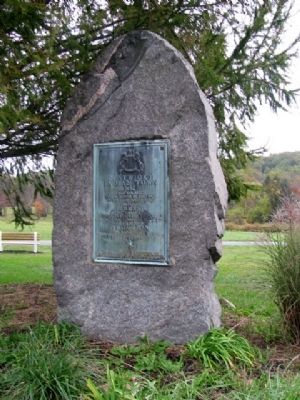
2. Playwicky Indian Town Marker
Photographed by William Fischer, Jr., October 15, 2009
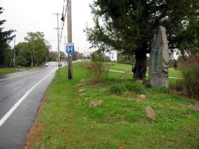
3. Playwicky Indian Town Marker
Looking east on Bridgetown Pike toward split with Maple Avenue in distance.
Credits. This page was last revised on June 11, 2025. It was originally submitted on May 26, 2010, by William Fischer, Jr. of Reynoldsburg, Ohio. This page has been viewed 2,631 times since then and 75 times this year. Photos: 1, 2, 3. submitted on May 26, 2010, by William Fischer, Jr. of Reynoldsburg, Ohio.
