Jamestown in Newport County, Rhode Island — The American Northeast (New England)
Jamestown and Newport Ferry Service: 1675-1969
Photographed by Devry Becker Jones (CC0), September 18, 2026
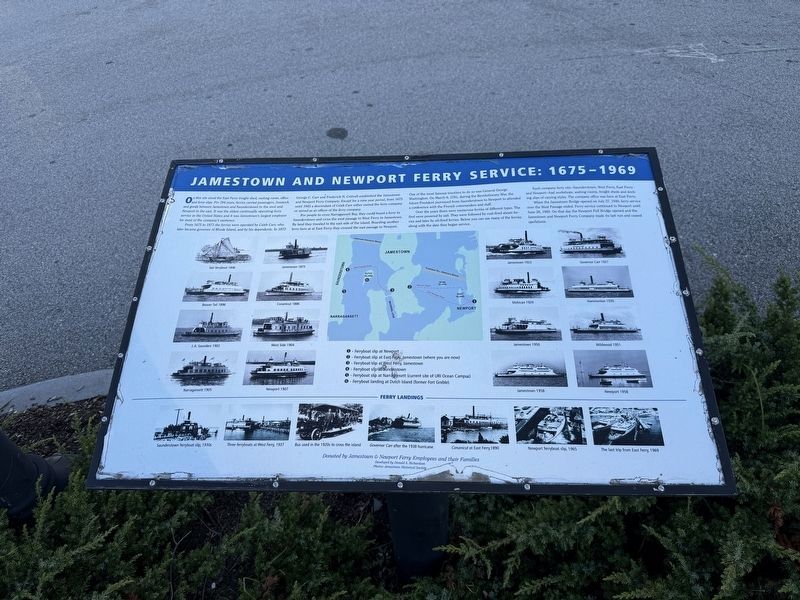
1. Jamestown and Newport Ferry Service: 1675-1969 Marker
On this site stood the East Ferry freight shed, waiting room, office and ferry slips. For 294 years, ferries carried passengers, livestock and goods between Jamestown and Saunderstown to the west and Newport to the east. It was the oldest continually operating ferry service in the United States and it was Jamestown's largest employer for most of the company's existence.
From 1675 to 1873 the ferries were operated by Caleb Carr, who later became governor of Rhode Island, and by his dependents. In 1873, George C. Carr and Frederick N. Cottrell established the Jamestown and Newport Ferry Company. Except for a nine year period, from 1675 until 1945 a descendant of Caleb Carr either owned the ferry company or served as an officer of the ferry company.
For people to cross the Naragansett Bay, they could board a ferry in Saunderstown and cross the west passage to West Ferry in Jamestown. By land they traveled to the east side of the island. Boarding another ferry here at at East Ferry they crossed the east passage to Newport. One of the most famous travelers to do so was General George Washington. On March 6, 1781, during
this page online
Over the years there were numerous ferries of different types. The first were powered by sail. They were followed by coal-fired steam ferries and later by oil-fired ferries. Below you can see many of the ferries along with the date they began service.
Each company ferry site—Saunderstown, West Ferry, East Ferry and Newport—had workshops, waiting rooms, freight sheds and docking slips of varying styles. The company office was here at East Ferry.
When the Jamestown Bridge opened on July 27, 1940, ferry service over the West Passage ended. Ferry service continued to Newport until June 28, 1969. On that day the Newport Pell Bridge opened and the Jamestown and Newport Ferry Company made its last run and ceased operations.
Erected by Jamestown & Newport Ferry Employees and their Families.
Topics. This historical marker is listed in these topic lists: Colonial Era • Industry & Commerce • War, US Revolutionary • Waterways & Vessels. A significant historical date for this entry is March 6, 1781.
Location. 41° 29.751′ N,
Photographed by Devry Becker Jones (CC0), September 18, 2026
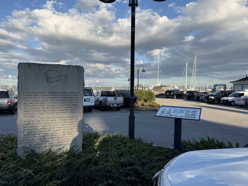
2. Jamestown and Newport Ferry Service: 1675-1969 Marker

Regionally, this marker is on Narragansett Bay. It is also in the American Northeast, in New England, and on the Eastern Seaboard. Globally, it is in the North Atlantic Region, North America, the Western Hemisphere, the Western World, and the Anglosphere. Historically, it finds itself in what was once one of the original Thirteen Colonies.
Other nearby markers. At least 8 other markers are within 2 miles of this marker, measured as the crow flies: Roger Williams and Canonicus (here, next to this marker); Veterans Memorial (within shouting distance of this marker); Memorial to the Veterans of Jamestown (approx. 0.4 miles away); Fort Wetherill (approx. 1.3 miles away); Harbor Mine (Torpedo) Complex (approx. 1.3 miles away); History of the Dumplings (approx. 1.3 miles away); Leaching Stone (approx. 1.4 miles away); History of the Jamestown Windmill (approx. 1.4 miles away). Touch for a list and map of all markers in Jamestown.
Credits. This page was last revised on September 25, 2026. It was originally submitted on September 25, 2026, by Devry Becker Jones of Washington, District of Columbia. This page has been viewed 4 times since then. Photos: 1, 2. submitted on September 25, 2026, by Devry Becker Jones of Washington, District of Columbia.
