East Hampton in Suffolk County, New York — The American Northeast (Mid-Atlantic)
Welling Springs of Amagansett
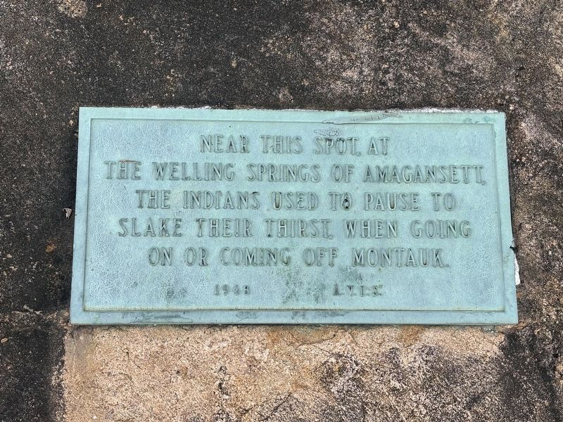
Photographed by Kevin Vincent, July 10, 2026
1. Welling Springs of Amagansett Marker
Erected 1948 by A.V.I.S. (these initials are at bottom of the marker and appear to signify the organization that erected the marker.
Topics. This historical marker is listed in these topic lists: Indigenous Peoples and Communities • Natural Features.
Location. 40° 58.018′ N, 72° 8.39′ W. Marker is in East Hampton, New York, in Suffolk County. It is on Indian Wells Highway, on the right when traveling south. The marker is just before the entrance to Indian Wells Beach. Touch for map. Marker is at or near this postal address: 100 Indian Wells Highway, East Hampton NY 11937, United States of America. Touch for directions.

Regionally, this marker is in the New York City Metropolitan Area and on Long Island. It is also in the American Northeast, in the Mid-Atlantic, and on the Eastern Seaboard. Globally, it is in the North Atlantic Region, North America, the Western Hemisphere, the Western World, and the Anglosphere.
this page online
Other nearby markers. At least 8 other markers are within 8 miles of this marker, measured as the crow flies: Coast Guard Beach (approx. 0.8 miles away); First Sheep Fold Site 1684 (approx. 2.2 miles away); May Groot Manson (approx. 2.6 miles away); Town Church (approx. 2.7 miles away); Clinton Academy (approx. 2.7 miles away); Indian Landmark Buc-Usk-Kil (approx. 5.9 miles away); Town of East Hampton (approx. 6.6 miles away); Cedar Point Lighthouse (approx. 7.3 miles away). Touch for a list and map of all markers in East Hampton.
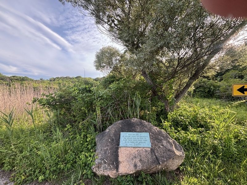
Photographed by Kevin Vincent, July 10, 2026
2. Welling Springs of Amagansett Marker
Credits. This page was last revised on October 5, 2026. It was originally submitted on September 25, 2026, by Kevin Vincent of Arlington, Virginia. This page has been viewed 6 times since then. Photos: 1, 2. submitted on September 25, 2026, by Kevin Vincent of Arlington, Virginia. • Andrew Ruppenstein was the editor who published this page.
