Near Lucerne in Fraser-Fort George, British Columbia — Canada’s West Coast (North America)
Historic Yellowhead Pass
Photographed by Cosmos Mariner, July 6, 2022
1. Historic Yellowhead Pass Marker
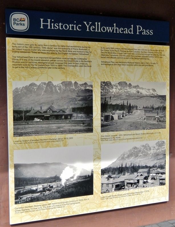
This historic pass gets its name from a famous fur trader that worked here during the early part of the 19th century. “Tête Jaune” was the nickname of Pierre Bostonais, a fair haired Iroquois trader who was employed by the North West and Hudson's Bay fur trading companies. Today we know this area by the English translation “Yellowhead.”
The Yellowhead Pass is an important transportation route across the Continental Divide. It is one of the lowest elevation passes across the Great Divide in the Northern Rockies and for centuries Aboriginal people traversed this pass on foot. It was an important route for the fur traders from 1825 to 1850. The Overlanders used this route to get to the rich Cariboo Goldfields later in the century.
In the early 20th century, the Yellowhead Pass was selected as the corridor for both the Grand Trunk Pacific Railway and the Canadian Northern Railway. During the Second World War a rough “tote road” was constructed through the pass by interned Japanese Canadians. Over the years this road was upgraded and by 1970 it was paved and officially opened as part of the Yellowhead Highway.
Yellowhead Pass
this page online
Erected by British Columbia Parks.
Topics. This historical marker is listed in these topic lists: Indigenous Peoples and Communities • Industry & Commerce • Railroads & Streetcars • Roads & Vehicles. A significant historical year for this entry is 1971.
Location. 52° 52.926′ N, 118° 27.064′ W. Marker is near Lucerne, British Columbia, in Fraser-Fort George. It is on Yellowhead Highway (Provincial Highway 16) 24.8 kilometers west of Icefields Parkway (Provincial Highway 93), on the right when traveling west. The marker is at the Yellowhead Pass National Historic Site in Mount Robson Provincial Park, just west of the British Columbia-Alberta boundary line. Touch for map. Marker is in this post office area: Lucerne BC V0E 2Z0, Canada. Touch for directions.

Regionally, this marker is in the BC Interior and in Cariboo Chilcotin Coast. Globally, it is in North America, on the Ring of Fire, on the Pacific Rim, in the Western Hemisphere, in the Western World, and in the Anglosphere.
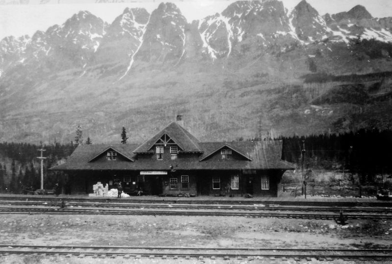
Valley Museum and Archives/Runnalls photo #1999.07.07
2. Marker detail: Lucerne Station (Canadian Northern Railway) about 1919-1920
Other nearby markers. At least 8 other markers are within walking distance of this marker: Connecting Canada/D'un océan à l'autre (here, next to this marker); Modern Travel/Les voyages des temps modernes (here, next to this marker); Yellowhead Pass (a few steps from this marker); The Yellowhead Pass / Le col Tête-Jaune (a few steps from this marker); Travelling a Traditional Route/Parcourir une route traditionnelle (a few steps from this marker); Crossing the Great Divide/Traverser la ligne de partage des eaux (a few steps from this marker); Rails Through the Rockies/Des rails à travers les Rocheuses (a few steps from this marker); Welcome to Yellowhead Pass National Historic Site (a few steps from this marker). Touch for a list and map of all markers in Lucerne.
Also see . . . Yellowhead Pass National Historic Site of Canada (Canadian Register of Historic Places).
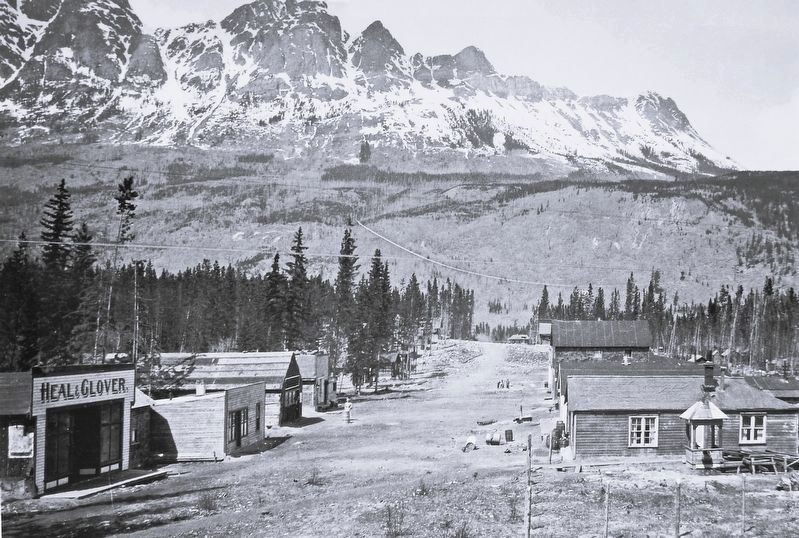
Excerpt: The Yellowhead Pass National Historic Site of Canada is a historic travel corridor through the Rocky Mountains from Alberta to British Columbia. The pass is located in Jasper National(Submitted on September 28, 2026, by Cosmos Mariner of Cape Canaveral, Florida.)Park of Canada at its eastern end and in Mount Robson Provincial Park at its western end. It is one of the lowest elevation passes across the Great Divide in the Northern Rockies. The official recognition refers to the cultural landscape of the pass and historic resources associated with the former railway roadbeds of the Grand Trunk Pacific Railway Company and Canadian Northern Railway Company.Valley Museum and Archives/Runnalls photo #2003.22.433. Marker detail: First Street, Lucerne, 1919. Yellowhead & Seven Sisters Mountains in the background
The Yellowhead Pass was designated a National Historic Site of Canada in 1971 because:
— it was used for brief periods from the mid-1820s to the 1850s by the Hudson’s Bay Company; and
— it became part of the Grand Trunk Pacific and the Canadian Northern Railway companies’ routes and a major highway crossing through the Rocky Mountains.This pass was used for centuries by First Nations peoples, and from about 1825 to the 1850s by the Hudson’s Bay Company principally to transport leather from the Saskatchewan District to its posts in New Caledonia. After 1906, it was used as a route for the Grand Trunk Pacific and the Canadian Northern railways and in 1942, Japanese-Canadians who had been interned during World War II began automotive roadway work
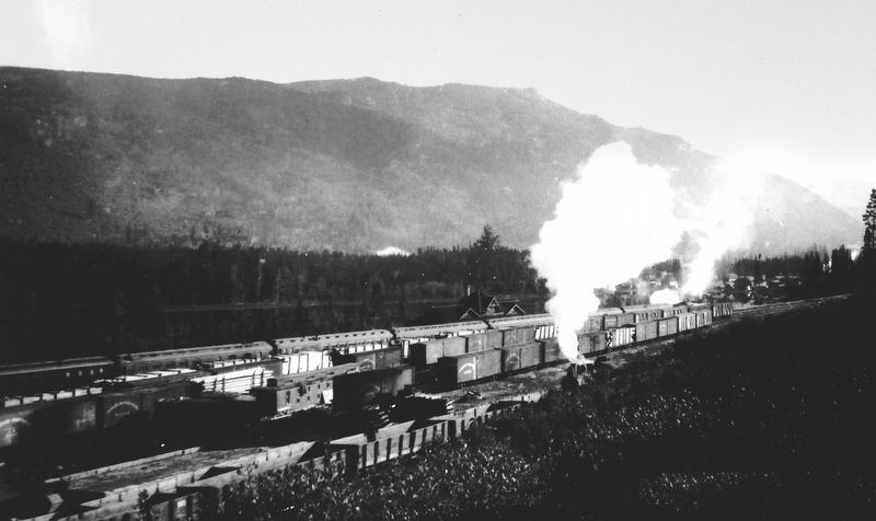
on it. The pass derives its name from Pierre Bostonais, called “Tête Jaune”, an Iroquois freeman active in the region in the early 19th century.Valley Museum and Archives/Runnalls photo #1999.07.104. Marker detail: Canadian Northern Railway yards with trains moving past Lucerne in 1919This is where Highway 16 now runs. The town of Lucerne is in the background.
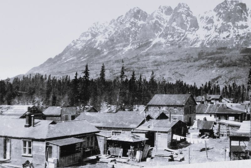
Valley Museum and Archives/Runnalls photo #1999.07.04
5. Marker detail: Lucerne with Seven Sisters and Yellowhead Mountains in 1919
Photographed by Cosmos Mariner, July 6, 2022
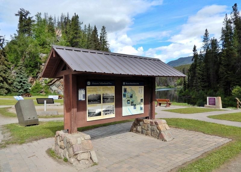
6. Historic Yellowhead Pass Marker
This marker is the leftmost of two panels on the east side of the Yellowhead Pass National Historic Site interpretive kiosk.
Credits. This page was last revised on September 28, 2026. It was originally submitted on September 25, 2026, by Cosmos Mariner of Cape Canaveral, Florida. This page has been viewed 4 times since then. Photos: 1, 2, 3, 4, 5, 6. submitted on September 28, 2026, by Cosmos Mariner of Cape Canaveral, Florida.
