Greenvale in Hume, Victoria, Australia — Oceania
Woodlands Historic Park
Photographed by Dean Barton-Ancliffe, August 27, 2026
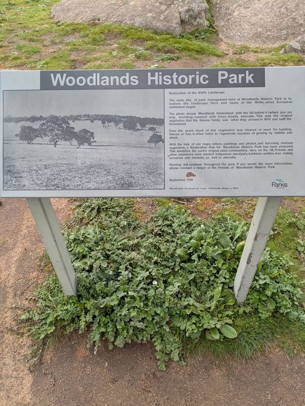
1. Woodlands Historic Park Marker
Restoration of the 1840's Landscape
The main aim of park management here at Woodlands Historic Park is to restore the landscape, flora and fauna of the 1840s, when European settlement began.
The photo shows Woodlands Homestead with the hill behind it (where you are now standing) covered with trees, mostly sheoaks. This was the original vegetation that the Greene family saw when they arrived in 1843 and built the Homestead.
Over the years much of this vegetation was cleared or used for building, fences or fuel. It often failed to regenerate because of grazing by rabbits and stock.
With the help of old maps, letters, paintings and photos, and surviving remnant vegetation, a Restoration Plan for Woodlands Historic Park has been prepared. This identifies the park's original plant communities. Here on the hill, Friends and other volunteers have planted indigenous eucalypts, banksias, wattles, tree violets, bursarias and clematis, as well as sheoaks.
Planting will continue throughout the park. If you would like more information, please contact a ranger or the Friends of Woodlands Historic Park.
Erected 1998
this page online
Topics. This historical marker is listed in these topic lists: Environment • Horticulture & Forestry • Parks & Recreational Areas • Settlements & Settlers. A significant historical year for this entry is 1840.
Location. 37° 38.238′ S, 144° 50.736′ E. Marker is in Greenvale, Victoria, in Hume. It is on Homestead Track 0.3 kilometers east of Woodlands Drive, on the left when traveling east. Touch for map. Marker is at or near this postal address: Homestead Track, Greenvale VIC 3059, Australia. Touch for directions.

Regionally, it is in Oceania, in Australasia, in the Pacific Ocean, in South Pacific, on the Pacific Rim, in the Western World, and in the Anglosphere. Historically, it finds itself in what was once a British colony.
Other nearby markers. At least 8 other markers are within 5 kilometers of this marker, measured as the crow flies: Hume and Hovell - 100 Year Memorial Marker (approx. one kilometer away); The Power of Steam (approx. 3.6 kilometers away); Former Bulla Shire Hall (approx. 3.6 kilometers away); Daffodils (approx. 3.6 kilometers away); Mrs Maud Alston (approx. 3.6 kilometers
Photographed by Dean Barton-Ancliffe, August 27, 2026
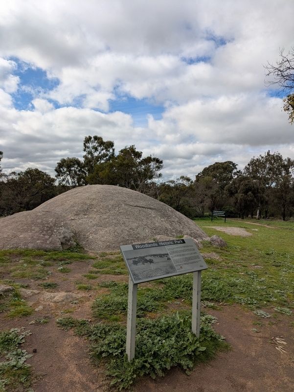
2. Woodlands Historic Park Marker alongside a basalt outcrop
Also see . . . Woodlands Historic Park. Parks Victoria
Woodlands Historic Park is home to one of Australia's first kit-houses: a prefabricated timber house brought from Britain in the 1840s. You can visit the homestead to learn more about its construction and significance.(Submitted on September 26, 2026, by Dean Barton-Ancliffe of Rowville, Victoria.)
The rest of Woodlands Historic Park preserves a landscape very similar to what early European settlers would have encountered. The fenced Eastern Barred Bandicoot Sanctuary in particular is reserved as a sanctuary for wildlife. Watch for birds and other native animals as you explore this section of the park – just remember to close the gates, as this is a site for a recovery program for the threatened Eastern Barred Bandicoot.
The park is a great place to see Victoria's cultural history. Scarred trees can still be found throughout the park. These are culturally important artefacts and a reminder Wurundjeri Aboriginal people lived in the area before European settlement. You can find out more about identifying Aboriginal cultural heritage at Parks Victoria's Protecting Aboriginal Cultural Heritage web page. The park also has two historic ruins; Cumberland Ruins, found within the Bandicoot Sanctuary, is a mid-1800s double-storey bluestone homestead which was damaged by fire in the 1950s. You can also find Dundonald Homestead, another mid-1800s homestead ruins site near the summit of Gellibrand Hill.
Credits. This page was last revised on September 30, 2026. It was originally submitted on September 26, 2026, by Dean Barton-Ancliffe of Rowville, Victoria. This page has been viewed 7 times since then. Photos: 1, 2. submitted on September 26, 2026, by Dean Barton-Ancliffe of Rowville, Victoria. • Andrew Ruppenstein was the editor who published this page.
