Windmill Hill in Jamestown in Newport County, Rhode Island — The American Northeast (New England)
Leaching Stone
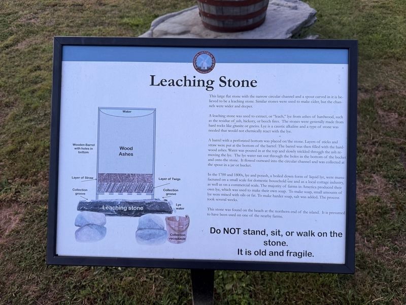
This large flat stone with the narrow circular channel and a spout carved in it is believed to be a leaching stone. Similar stones were used to make cider, but the channels were wider and deeper.
A leaching stone was used to extract, or "leach," lye from ashes of hardwood, such as the residue of ash, hickory, or beech fires. The stones were generally made from hard rocks like granite or gneiss. Lye is a caustic alkaline and a type of stone was needed that would not chemically react with the lye.
A barrel with a perforated bottom was placed on the stone. Layers of sticks and straw were put at the bottom of the barrel. The barrel was then filled with the hardwood ashes. Water was poured in at the top and slowly trickled through the ash removing the lye. The lye water ran out through the holes in the bottom of the bucket and onto the stone. It flowed outward into the circular channel and was collected at the spout in a jar or bucket.
In the 1700 and 1800s, lye and potash, a boiled down form of liquid lye, were manufactured on a small scale for domestic household use and as a local cottage industry, as well as on
this page online
This stone was found on the beach at the northern end of the island. It is presumed to have been used on one of the nearby farms.
Erected by Jamestown Historical Society.
Topics. This historical marker is listed in these topic lists: Agriculture • Colonial Era • Industry & Commerce. A significant historical year for this entry is 1700.
Location. 41° 30.916′ N, 71° 22.436′ W. Marker is in Jamestown, Rhode Island, in Newport County. It is in Windmill Hill. It is on North Road. Touch for map. Marker is at or near this postal address: 378 North Rd, Jamestown RI 02835, United States of America. Touch for directions.

Regionally, this marker is on Narragansett Bay. It is also in the American Northeast, in New England, and on the Eastern Seaboard. Globally, it is in the North Atlantic Region, North America, the Western Hemisphere, the Western World, and the Anglosphere.
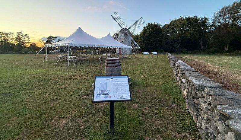
Other nearby markers. At least 8 other markers are within 3 miles of this marker, measured as the crow flies: History of the Jamestown Windmill (a few steps from this marker); Operation of the Jamestown Windmill (a few steps from this marker); Jamestown Windmill (within shouting distance of this marker); Memorial to the Veterans of Jamestown (approx. 1.3 miles away); Veterans Memorial (approx. 1.4 miles away); Roger Williams and Canonicus (approx. 1.4 miles away); Jamestown and Newport Ferry Service: 1675-1969 (approx. 1.4 miles away); Fort Getty (approx. 2.2 miles away). Touch for a list and map of all markers in Jamestown.
Credits. This page was last revised on September 26, 2026. It was originally submitted on September 26, 2026, by Devry Becker Jones of Washington, District of Columbia. This page has been viewed 7 times since then. Photos: 1, 2. submitted on September 26, 2026, by Devry Becker Jones of Washington, District of Columbia.
