Near Niobrara in Knox County, Nebraska — The American Midwest (Upper Plains)
They Opened The West
Photographed by William Fischer, Jr., September 17, 2026
1. They Opened The West Marker
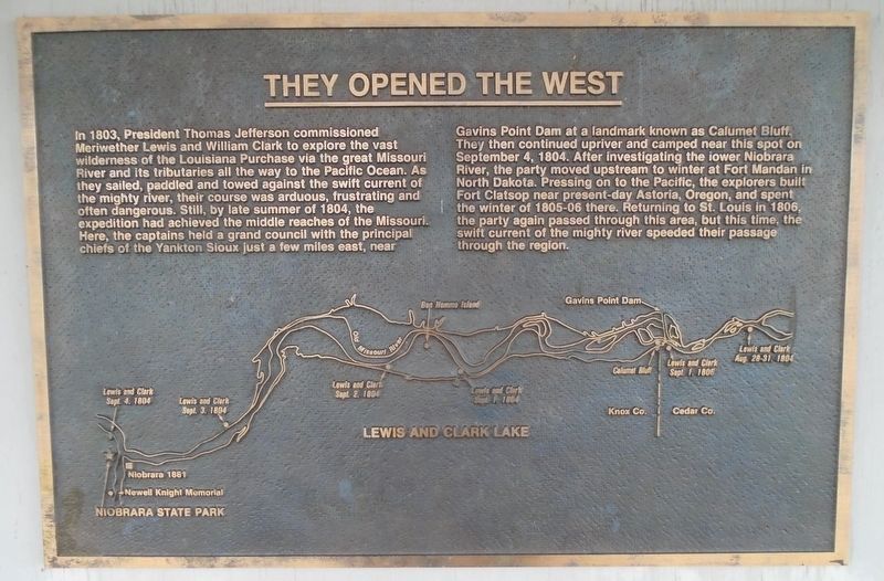
In 1803, President Thomas Jefferson commissioned Meriwether Lewis and William Clark to explore the vast wilderness of the Louisiana Purchase via the great Missouri River and its tributaries all the way to the Pacific Ocean. As they sailed, paddled and towed against the swift current of the mighty river, their course was arduous, frustrating and often dangerous. Still, by late summer of 1804, the expedition had achieved the middle reaches of the Missouri. Here, the captains held a grand council with the principal chiefs of the Yankton Sioux just a few miles east, near Gavins Point Dam at a landmark known as Calumet Bluff. They then continued upriver and camped near this spot on September 4, 1804. After investigating the lower Niobrara River, the party moved upstream to winter at Fort Mandan in North Dakota. Pressing on to the Pacific, the explorers built Fort Clatsop near present-day Astoria, Oregon, and spent the winter of 1805-06 there. Returning to St. Louis in 1806, the party again passed through this area, but this time, the swift current of the mighty river speeded their passage through the region.
[Map
this page online
Erected by Nebraska State Parks.
Topics and series. This historical marker is listed in these topic lists: Exploration • Indigenous Peoples and Communities • Patriots & Patriotism • Waterways & Vessels. In addition, it is included in the Lewis & Clark Expedition series list. A significant historical date for this entry is September 4, 1804.
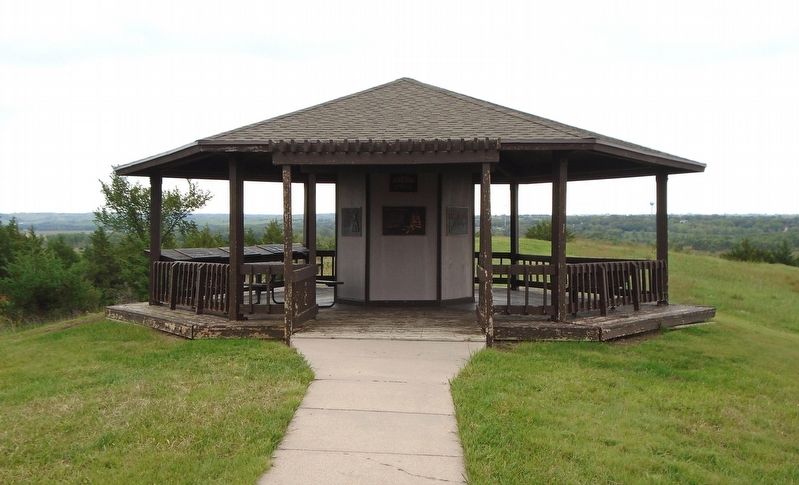
Location. 42° 45.953′ N, 98° 3.082′ W. Marker is near Niobrara, Nebraska, in Knox County. Marker is under the J. Alan Cramer Interpretive Shelter in Niobrara State Park. Touch for map. Marker is at or near this postal address: 89261 522 Avenue, Niobrara NE 68760, United States of America. Touch for directions.

Regionally, this marker is in Eastern Nebraska. It is also in the American Midwest, in the Corn Belt, and on the prairies. Globally, it is in North America, the Western Hemisphere, the Western World, and the Anglosphere. Historically, it finds itself in what was once the Louisiana Purchase.
Other nearby markers. At least 8 other markers are within walking distance of this marker: J. Alan Cramer Interpretive Shelter (here,
Photographed by William Fischer, Jr., September 17, 2026
2. J. Alan Cramer Interpretive Shelter Markers
More about this marker. Nebraska State Parks entrance fee required.
Credits. This page was last revised on September 27, 2026. It was originally submitted on September 27, 2026, by William Fischer, Jr. of Reynoldsburg, Ohio. This page has been viewed 4 times since then. Photos: 1, 2. submitted on September 27, 2026, by William Fischer, Jr. of Reynoldsburg, Ohio.
