Beaumaris in Bayside, Victoria, Australia — Oceania
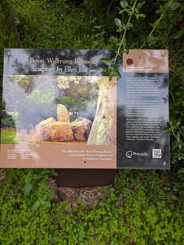
Boon Wurrung Blossom
Sculpture by Ellen Jose 2008
| — | Bayside Indigenous Trail | — |
Photographed by Dean Barton-Ancliffe, August 29, 2026
1. Boon Wurrung Blossom Marker
In a culture based on an oral tradition, the transfer of knowledge from one generation to the next was instrumental in the survival of the clans that made up the Boon wurrung; it continues to be a special place for both Indigenous and non-Indigenous Australians today.
'Boon Wurrung Blossom' acknowledges the original inhabitants of this land, especially the women and the children. It reminds us of the important role reconciliation plays in connecting all those Australians from different cultures from around the world that have made Boon Wurrung's land their home, together with the first inhabitants of this and - The Boon Wurrung.
The edible fruit of the 'Boon Wurrung Blossom' is reconciliation between Indigenous and non-Indigenous Australians.
Erected by Bayside City Council.
this page online
Topics. This historical marker is listed in these topic lists: Indigenous Peoples and Communities • Parks & Recreational Areas. A significant historical year for this entry is 2008.
Location. 37° 59.46′ S, 145° 1.731′ E. Marker is in Beaumaris, Victoria, in Bayside. It can be reached from Beach Road (Victoria Route 33) 0.3 kilometers north of Reserve Road. Touch for map. Marker is at or near this postal address: 390 Beach Road, Beaumaris VIC 3193, Australia. Touch for directions.

Regionally, it is in Oceania, in Australasia, in the Pacific Ocean, in South Pacific, on the Pacific Rim, in the Western World, and in the Anglosphere. Historically, it finds itself in what was once a British colony.
Other nearby markers. At least 8 other markers are within 18 kilometers of this marker, measured as the crow flies: Ricketts Point (here, next to this marker); Tom Roberts (here, next to this marker); The Grange (approx. 10.3 kilometers away); Flying Saucer Sighting (approx. 10.4 kilometers away); Caulfield Commons (approx. 12.3 kilometers away); Indigenous History and Mapping the Past (approx. 15.5 kilometers
Photographed by Dean Barton-Ancliffe, August 29, 2026
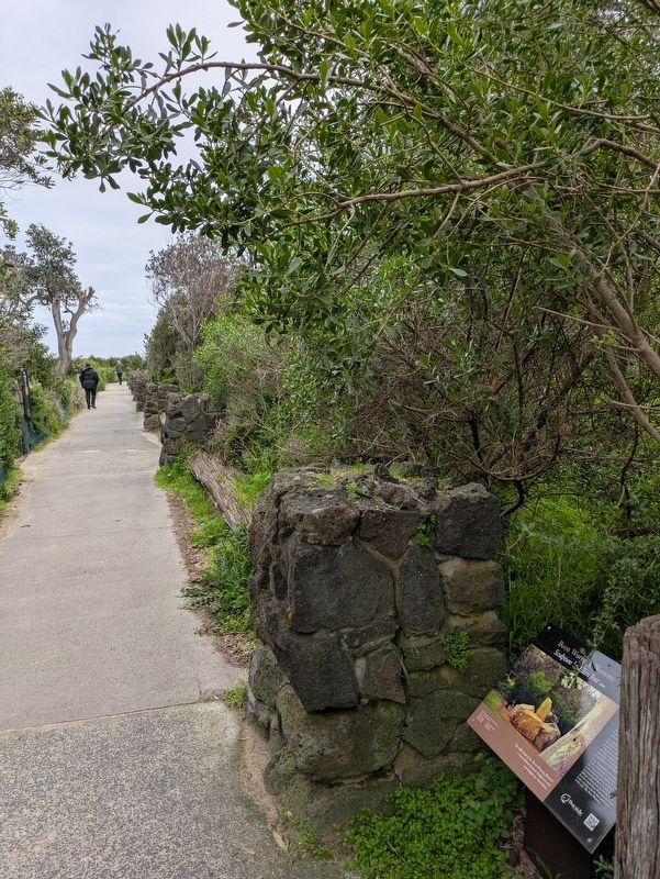
2. Boon Wurrung Blossom Marker along the trail
Also see . . . Bayside Coastal Trail Network. Coastal Trails Indigenous<blockquote>Bayside City Council has developed four affiliated trails stretching across the 17 kilometers of the coastline adjacent to Beach Road between Brighton and Beaumaris.
The Bayside Coastal Indigenous Trail
The Bayside Coastal Indigenous Trail Signs and sculptures provide insight into the works and the social customs of Indigenous people. Each of the Indigenous Trail Signs and sculptures are based on stories authored by Boon wurrung Elder, Carolyn Briggs.
The Indigenous Trail Signs and sculptures demonstrate a direct relationship with the Indigenous people and the coastal environment and have been located in positions that enhance and complement this rich cultural heritage. (Submitted on September 27, 2026, by Dean Barton-Ancliffe of Rowville, Victoria.)
Credits. This page was last revised on September 28, 2026. It was originally submitted on September 27, 2026, by Dean Barton-Ancliffe of Rowville, Victoria. This page has been viewed 4 times since then. Photos: 1, 2. submitted on September 27, 2026, by Dean Barton-Ancliffe of Rowville, Victoria. • Andrew Ruppenstein was the editor who published this page.
