Santa Clara in Santa Clara County, California — The American West (Pacific Coastal)
Mission Santa Clara de Asís
Photographed by Alice Mansell, September 22, 2026
1. Mission Santa Clara de Asís Marker
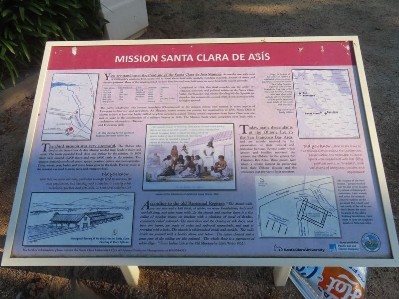
You are standing at the third site of the Santa Clara de Asís Mission. As was the case with most of California’s missions, Franciscans had to learn about local soils, available building materials, sources of water, and weather patterns. Many of the missions failed on their first sites and were built anew on more hospitable nearby grounds.
Dates of Use Date Abandoned Cause Materials Cemetery 1777–1779 1779 flooding wood yes 1779–1784 1784 abandoned wood yes 1784–1818 1818–1825 earthquake adobe no 1818–1825 1827 demolition adobe no 1825–1924 1924 fire adobe yes (1825 to 1950) 1925–present — — masonry no
Completed in 1784, this third complex was the center of religious, economic and political activity in the Santa Clara Valley. Earthquakes and winter flooding led the Spanish to abandon this mission site around 1818. It was moved nearby to higher ground.
The native inhabitants who became neophytes (Christianized) in the mission system were trained in many aspects of European architecture and agriculture.
this page online
The third mission was very successful. The Ohlone who lived at the Santa Clara de Asís Mission tended large herds of sheep and cattle. The herds provided food, cloth and leather for the mission. In 1809 there were around 10,000 sheep and over 6,000 cattle at the mission. The mission orchards produced pears, apples, peaches, quince and pomegranates. Corn, wheat, peas, barley and many beans grew in the fields. Pottery made at the mission was used to store, cook and transport food.
Did you know…
that this mission not only produced enough food to sustain its own population, but usually had a surplus to supply other missions, pueblos and presidios in Northern California?
“Their games consist of throwing little pieces of wood which have to fall in an even or an
Photographed by Alice Mansell, September 22, 2026
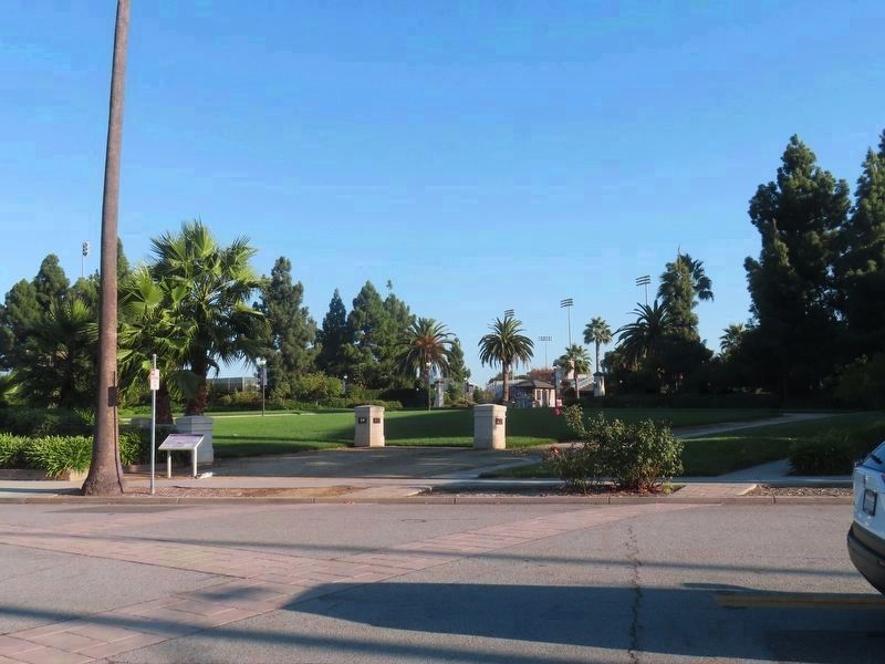
2. Marker at left
Stamped concrete lines in lawn, shrubbery, and street pavement indicate the excavated site #3 Mission walls
Today, many descendants of the Ohlone live in the San Francisco Bay Area, and are actively involved in the preservation of their cultural and historical heritage. Several active tribal groups and families represent the present day Ohlone in the greater San Francisco Bay Area. These groups have taken a strong interest in preserving both their Ohlone identity and the resources that represent their ancestors.
Did you know…
that at the time of the Spanish explorations the indigenous people within the Ohlonean cultural sphere were organized into over fifty political units, or “tribelets”, with variations of language, custom and appearance?
According to the old Baptismal Register: “The church walls are one vara and a half thick, of adobe, on stone foundations, forty and onehalf long, and nine varas wide…In the church and sacristy there is a flat ceiling of wooden beams on brackets with a planking of wood
Photographed by Alice Mansell, September 22, 2026
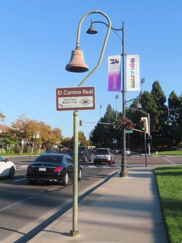
3. El Camino Real Bell yards away from Mission Santa Clara de Asís Marker
Bell’s marker was installed by the Santa Clara Women’s Club which owns an adobe building nearby formerly part of the neophyte housing structures at Mission Santa Clara site # 3.
For further information, please contact the Santa Clara University Office of Cultural Resources Management at 408-554-4513.
Erected by Santa Clara University. (Marker Number 3.)
Topics. This historical marker is listed in these topic lists: Agriculture • Architecture • Indigenous Peoples and Communities • Religion & Religious Structures.
Location. 37° 21.115′ N, 121° 56.295′ W. Marker is in Santa Clara, California, in Santa Clara County. It is on Franklin Street east of Sherman Street, on the right when traveling east. At the end of a cul-de-sac and yards away from State Route 82, El Camino Real. On the campus of Santa Clara University. Touch for map. Marker is at or near this postal address: 580 Franklin St, Santa Clara CA 95050, United States of America. Touch for directions.

Regionally, this marker is in the San Francisco Bay Area, in Silicon Valley, and on the Coast Ranges. It is also on the American Pacific Coast. Globally, it is in North America, on the Ring of Fire, on the Pacific Rim, in the Western Hemisphere, in the Western World, and in the Anglosphere. Historically, it finds itself in what was once New Spain and also Mexico’s Alta California.
Other nearby markers. At least 8 other markers are within walking distance of this marker: Santa Clara Mission (within shouting distance of this marker); Life at the Third Santa Clara de Asís Mission (within shouting distance of this marker); Santa Clara Depot (about 700 feet away, measured in a direct line); Santa Clara Tower (about 700 feet away); The Santa Clara Interlocking Control Tower (about 700 feet away); Santa Clara Women’s Club Adobe (about 700 feet away); a different marker also named Santa Clara Depot (about 700 feet away); Mission Santa Clara (approx. 0.2 miles away). Touch for a list and map of all markers in Santa Clara.
More about this marker. Marker sits by the north foundation walls of the third site of Mission Santa Clara, walls which were excavated and today marked with lines of stamped concrete extending onto Franklin street and a large grass lawn area with a second historical plaque along the south walls and more markers near the center with a large wooden cross.
Regarding Mission Santa Clara de Asís. Mission Santa Clara’s site # 1 is covered by I-101, San Jose International Airport, and other roads and buildings, but its land is exposed at the intersection of Channing and Seaboard in the City of San Jose currently has no marker on its City parklet at that site. Site # 2, at the intersection of De La Cruz Boulevard and Martin Avenue in the City of Santa Clara, had its carved stone cross marker forced off public display by a 2014 lawsuit. That stone cross marker was donated to Santa Clara University by the City of Santa Clara. Site # 4 is on the south side of the present day site #5. All five Santa Clara Mission sites were built along Mission Creek which used to run above ground and follow along a road now called De La Cruz Boulevard to where it flowed into Guadalupe River at a location very close to site #1. “De La Cruz” translates from Spanish as “Of the Cross” or “Way of the Cross.” Franciscan missions such as Santa Clara always started with a large cross outside near a bell hung from a tree or a wooden frame.
Related markers. Click here for a list of markers that are related to this marker. Mission Santa Clara sites, past and present
Additional keywords. Franciscan California Missions
Credits. This page was last revised on October 14, 2026. It was originally submitted on September 28, 2026, by Alice Mansell of Los Altos, California. This page has been viewed 29 times since then. Photos: 1, 2, 3. submitted on September 28, 2026, by Alice Mansell of Los Altos, California. • Devry Becker Jones was the editor who published this page.
