Tiverton in Newport County, Rhode Island — The American Northeast (New England)
Historic Bridgeport
Early Tiverton Industries
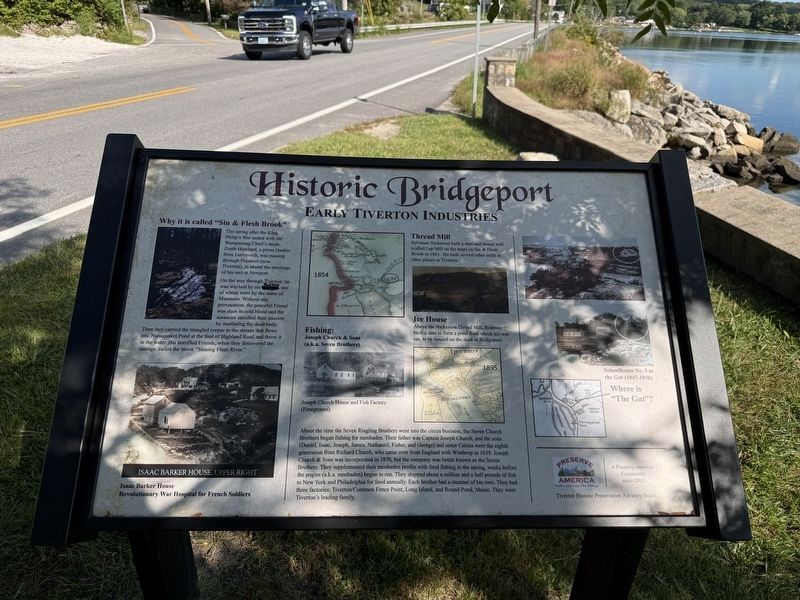
Why is it called "Sin & Flesh Brook"
The spring after the King Philip's War ended, way back in 1677, a Indian Chief's clerk, Zoeth Howland, a pious Quaker from Dartmouth, was passing through Pocasset (now Tiverton), to attend the meeting of his sect at Newport.
On the way through Tiverton, he was waylaid by six Indians, one of whom went by the name of Mamsooc. Without any provocation, the peaceful friend was slain in cold blood and the assassin satisfied their passion by mutilating the dead body. Then they carried the mangled corpse to the stream that flows into Nannaquaket Pond at the foot of Highland Road and threw it in the water. His horrified Friends, when they discovered the outrage, called the brook “Sinning Flesh River.”
Isaac Barker House
Revolutionary War hospital for French soldiers
Thread Mill
Sylvanus Nickerson built a dam and thread mill (called Cap Mill) on the brook on Sin & Flesh Brook in 1861. He had several other mills in other places in Tiverton.
Ice House
Above the Nickerson Thread Mill, Rodman built a dam to form a pond from which ice was cut, to be housed on the dock at Bridgeport.
Fishing:
Joseph Church & Sons
(a.k.a. Seven Brothers)
About
this page online
[Caption:]
Schoolhouse No. 3 at the Gut (1847-1936)
Erected by Tiverton Historic Preservation Advisory Board.
Topics. This historical marker is listed in these topic lists: Animals • Indigenous Peoples and Communities • Industry & Commerce • Waterways & Vessels. A significant historical year for this entry is 1677.
Location. 41° 37.094′ N,
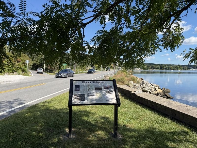

Regionally, this marker is on Narragansett Bay. It is also in the American Northeast, in New England, and on the Eastern Seaboard. Globally, it is in the North Atlantic Region, North America, the Western Hemisphere, the Western World, and the Anglosphere. Historically, it finds itself in what was once one of the original Thirteen Colonies.
Other nearby markers. At least 8 other markers are within walking distance of this marker: Historic Nanaquaket (a few steps from this marker); Holt’s Trail (approx. half a mile away); Town of Tiverton, Rhode Island World War II Honor Roll (approx. half a mile away); Fort Barton (approx. half a mile away); General Lafayette (approx. half a mile away); Fort Barton Redoubt (approx. half a mile away); a different marker also named Fort Barton (approx. half a mile away); Roll of Honor (approx. 0.7 miles away). Touch for a list and map of all markers in Tiverton.
Credits. This page was last revised on September 28, 2026. It was originally submitted on September 28, 2026, by Devry Becker Jones of Washington, District of Columbia. This page has been viewed 4 times since then. Photos: 1, 2. submitted on September 28, 2026, by Devry Becker Jones of Washington, District of Columbia.
