Valentine in Cherry County, Nebraska — The American Midwest (Upper Plains)
DeWitty
An African American Settlement in the Sandhills
Photographed by William Fischer, Jr., September 17, 2026
1. DeWitty Marker
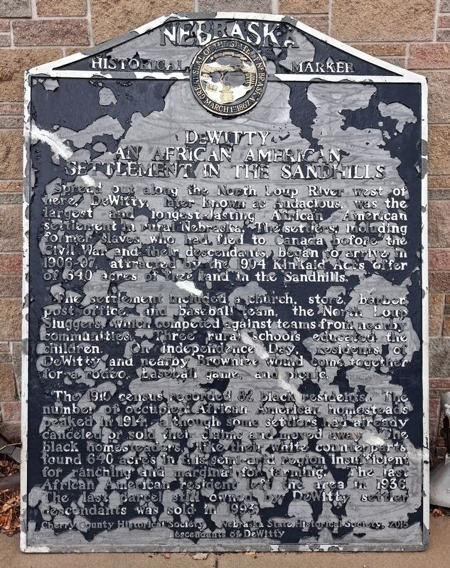
Spread out along the North Loup River west of here, DeWitty, later known as Audacious, was the largest and longest-lasting African American settlement in rural Nebraska. The settlers, including former slaves who had fled to Canada before the Civil War and their descendants, began to arrive in 1906-07, attracted by the 1904 Kinkaid Act’s offer of 640 acres of free land in the Sandhills.
The settlement included a church, store, barber, post office, and baseball team, the North Loup Sluggers, which competed against teams from nearby communities. Three rural schools educated the children. On Independence Day, residents of DeWitty and nearby Brownlee would come together for a rodeo, baseball game, and picnic.
The 1910 census recorded 82 black residents. The number of occupied African American homesteads peaked in 1914, although some settlers had already canceled or sold their claims and moved away. The black homesteaders, like their white counterparts, found 640 acres in this semi-arid region insufficient for ranching and marginal for farming. The last African American resident left the area in 1936. The last parcel still
this page online
Erected 2015 by Nebraska State Historical Society, Cherry County Historical Society, and Descendants of DeWitty.
Topics. This historical marker is listed in these topic lists: African Americans • Agriculture • Immigration • Settlements & Settlers. A significant historical year for this entry is 1904.
Location. 42° 52.096′ N, 100° 33.052′ W. Marker is in Valentine, Nebraska, in Cherry County. Marker is near the Cherry County Historical Museum entrance, off the parking lot. Touch for map. Marker is at or near this postal address: 249 South Main Street (US Hwy 83), Valentine NE 69201, United States of America. Touch for directions.

Regionally, this marker is in the Sand Hills and in the Niobrara Valley. It is also in the American Midwest, in the Corn Belt, on the prairies, and on the Northern Plains. Globally, it is in North America, the Western Hemisphere, the Western World, and the Anglosphere. Historically, it finds itself in what was once the Louisiana Purchase.
Other nearby markers. At least 8 other markers are within walking distance of this marker:
Photographed by William Fischer, Jr., September 17, 2026
2. DeWitty Marker
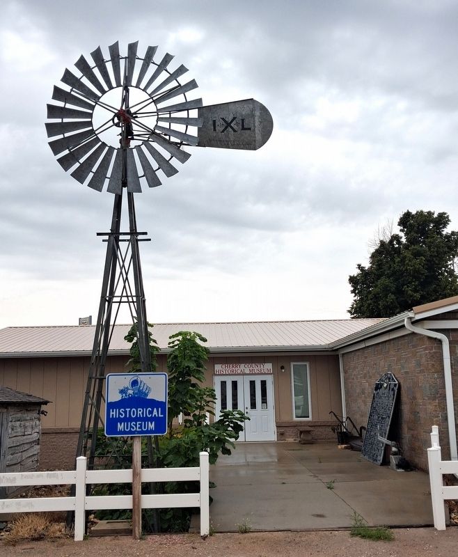
Leaning against wall to right of entrance
More about this marker. Per the Nebraska State Historical Society website, the marker was originally located along US Highway 83, 1000 ft south of Brownlee Road, Cherry County, at: 42.284600, -100.536268
Perhaps it will be returned there someday.
Credits. This page was last revised on September 29, 2026. It was originally submitted on September 29, 2026, by William Fischer, Jr. of Reynoldsburg, Ohio. This page has been viewed 3 times since then. Photos: 1, 2. submitted on September 29, 2026, by William Fischer, Jr. of Reynoldsburg, Ohio.
