Keystone in Pennington County, South Dakota — The American Midwest (Upper Plains)
40th Anniversary of "The Flood"
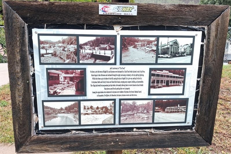
Photographed by William Fischer, Jr., September 21, 2026
1. 40th Anniversary of "The Flood" Marker
On June 9, 1972 the towns of Rapid City and Keystone were decimated by a flash flood which claimed a total of 238 lives. Rain began in late afternoon and continued through the night, increasing in intensity, with sky-splitting lightning. Within four hours, up to 16 inches of rain fell, causing the dam in Rapid City to give way, sucking the lake dry. In Keystone, Battle and Grizzly Creeks overflowed their banks, sweeping away campers, buildings, and automobiles. The village had voted for incorporation just days before, fortunately allowing them to receive disaster aid and rebuild.
Many heroes saved lives by putting their own in jeopardy. Among the organizations who volunteered in Keystone were residents of Keystone, Boy Scouts, National Guard, 1st Responders, Firefighters, the Men[n]onites, the Jaycees, business owners and other towns.
[Photos of the flood's aftermath]
Erected by Keystone Area Historical Society.
Topics. This historical marker is listed in these topic lists: Disasters • Environment • Waterways & Vessels. A significant historical date for this entry is June 9, 1972.
Location. 43° 53.723′ N, 103° 25.216′ W.
this page online

Regionally, this marker is in West River, in the Badlands, and in Greater Rapid City. It is also in the American Black Hills, in the Lewis & Clark Corridor, on the prairies, and on the Northern Plains. Globally, it is in North America, the Western Hemisphere, the Western World, and the Anglosphere. Historically, it finds itself in what was once Rupert’s Land and also the Louisiana Purchase.
Other nearby markers. At least 8 other markers are within walking distance of this marker: Keystone School (here, next to this marker); First School (within shouting distance of this marker); Historic Keystone in the early 1940s (about 300 feet away, measured in a direct line); Bill Durst (about 300 feet away); U.S. 4th Cavalry Bivouac (about 300 feet away); First Congregational Church (about 300 feet away); Site of the McDonald Hotel (about 400 feet away);
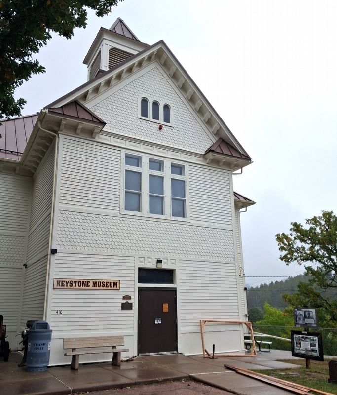
Photographed by William Fischer, Jr., September 17, 2026
2. 40th Anniversary of "The Flood" Marker
At far lower right of photo
Also see . . . The Black Hills-Rapid City flood of June 9-10, 1972 (USGS, 1975). (Submitted on September 30, 2026, by William Fischer, Jr. of Reynoldsburg, Ohio.)
Credits. This page was last revised on September 30, 2026. It was originally submitted on September 30, 2026, by William Fischer, Jr. of Reynoldsburg, Ohio. This page has been viewed 6 times since then. Photos: 1, 2. submitted on September 30, 2026, by William Fischer, Jr. of Reynoldsburg, Ohio.
