Keystone in Pennington County, South Dakota — The American Midwest (Upper Plains)
Keystone Battle Creek Cultural Center
Founded 1984
Photographed by William Fischer, Jr., September 17, 2026
1. Keystone Battle Creek Cultural Center Marker
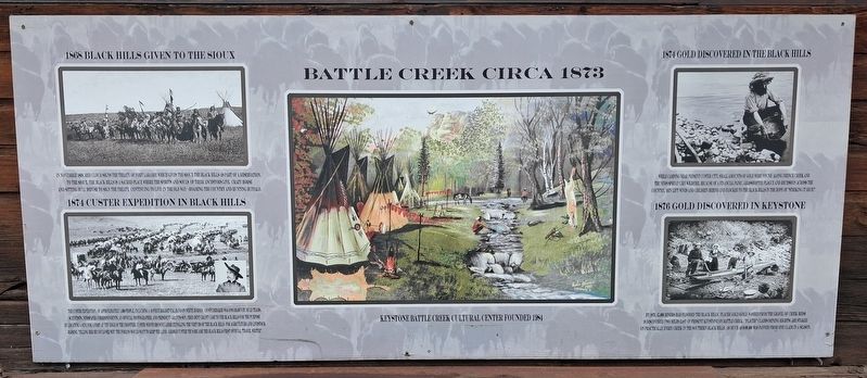
[Left photo captions, top and bottom, read]
1868 Black Hills given to the Sioux
In November 1868, Red Cloud signs the Treaty of Fort Laramie which gives the Sioux the Black Hills as part of a reservation. To the Sioux, the Black Hills is a sacred place where the spirits and souls of their ancestors live. Crazy Horse and Sitting Bull refuse to sign the treaty, continuing to live in the old way - roaming the country and hunting buffalo.
1874 Custer Expedition in Black Hills
The Custer Expedition, of approximately 1,000 people, including a 16-piece regimental band on white horses, 110 Studebaker wagons drawn by mule teams, scientists, newspaper correspondents, an official photographer, and President Grant's son, Fred Dent Grant came to the Black Hills for the purpose of locating a site for a fort at the edge of the frontier. Custer wrote his wife Libbie extolling the virtues of the Black Hills for agriculture and livestock raising, telling her he could see why the Indians would want to keep the land. George Custer thus became the Black Hills first official 'travel writer'.
[Center illustration caption reads]
Battle Creek Circa 1873
[Right
this page online
1874 Gold Discovered in the Black Hills
While camping near present Custer City, small amounts of gold were found along French Creek and the news spread like wildfire. Because of a financial panic, grasshopper plague and recession across the country, men left wives and children behind and flocked to the Black Hills in the hope of 'striking it rich.'
1876 Gold Discovered in Keystone
By 1876, 15,000 miners had flooded the Black Hills. Placer gold (gold washed from the gravel of creek beds) is discovered two miles east of present Keystone on Battle Creek. "Placer" Claims (mining rights) are staked on practically every creek in the southern Black Hills, as much as $100,000 was panned from one claim in a season.
Topics. This historical marker is listed in these topic lists: Exploration • Immigration • Indigenous Peoples and Communities • Industry & Commerce. A significant historical month for this entry is November 1868.
Location. 43° 53.772′ N, 103° 25.147′ W. Marker is in Keystone, South Dakota, in Pennington County. It is on Mitchell Street west of Madill Street (State Highway 40), on the left
Photographed by William Fischer, Jr., September 21, 2026
2. Keystone Battle Creek Cultural Center Marker
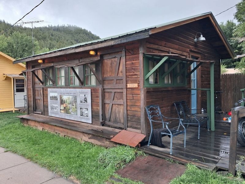
Marker is on the Sheridan Cabin

Regionally, this marker is in West River, in the Badlands, and in Greater Rapid City. It is also in the American Black Hills, in the Lewis & Clark Corridor, on the prairies, and on the Northern Plains. Globally, it is in North America, the Western Hemisphere, the Western World, and the Anglosphere. Historically, it finds itself in what was once Rupert’s Land and also the Louisiana Purchase.
Other nearby markers. At least 8 other markers are within walking distance of this marker: Keystone Trading Company/Halley's Store (a few steps from this marker); Medical Office of Eugene B. Hultz, M.D. (a few steps from this marker); Halley's Store Icehouse (within shouting distance of this marker); US Forest Service Icehouse (within shouting distance of this marker); U.S. 4th Cavalry Bivouac (within shouting distance of this marker); Site of Ernest "Peg Leg" Haase Blacksmith Shop (within shouting distance of this marker); Historic Keystone in the early 1940s (within shouting distance of this marker); Site of the McDonald Hotel (within shouting distance of this marker). Touch for a list and map of all markers in Keystone.
Credits. This page was last revised on October 1, 2026. It was originally submitted on October 1, 2026, by William Fischer, Jr. of Reynoldsburg, Ohio. This page has been viewed 5 times since then. Photos: 1, 2. submitted on October 1, 2026, by William Fischer, Jr. of Reynoldsburg, Ohio.
