Near Jasper in Jasper National Park, Alberta — Canada’s Prairie Region (North America)
New Trade Route Over the Rockies
⎯⎯⎯
Une nouvelle route de commerce à travers les Rocheuses
Photographed by Cosmos Mariner, July 6, 2022
1. New Trade Route Over the Rockies / Une nouvelle route de commerce à travers les Rocheuses Marker

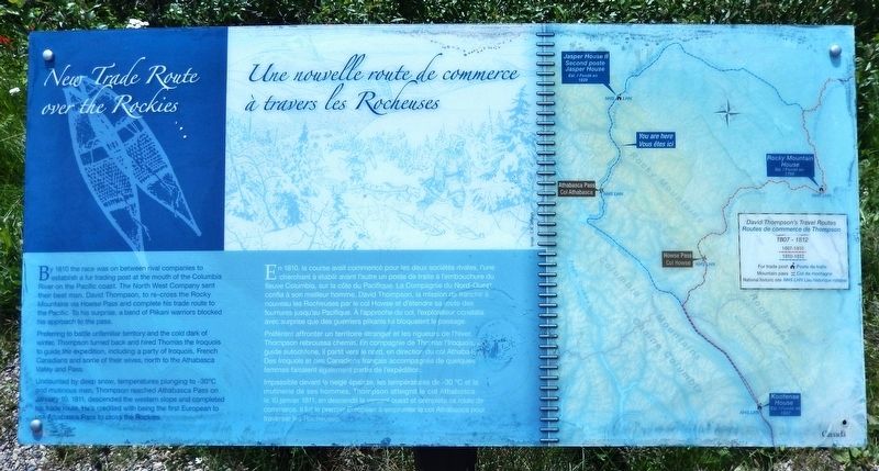
Preferring to battle unfamiliar territory and the cold dark of winter, Thompson turned back and hired Thomas the Iroquois to guide the expedition, including a party of Iroquois, French Canadians and some of their wives, north to the Athabasca Valley and Pass.
Undaunted by deep snow, temperatures plunging to -30°C and mutinous men, Thompson reached Athabasca Pass on January 10, 1811, descended the western slope and completed his trade route. He's credited with being the first European to use Athabasca Pass to cross the Rockies.
this page online
Préférant affronter un territoire étranger et les rigueurs de l'hiver, Thompson rebroussa chemin. En compagnie de Thomas l’Iroquois, un guide autochtone, il partit vers le nord, en direction du col Athabasca. Des Iroquois et des Canadiens français accompagnes de quelques femmes faisaient également partie de l’expédition.
Impassible devant la neige épaisse, les températures de -30 °C et la mutinerie de ses hommes, Thompson atteignit le col Athabasca le 10 janvier 1811, en descendit le versant ouest et compléta sa route de commerce. Il fut le premier Européen à emprunter le col Athabasca pour traverser les Rocheuses.
Erected by Parks Canada / Parcs Canada.
Topics. This historical marker is listed in these topic lists: Exploration • Indigenous Peoples and Communities • Industry & Commerce • Roads & Vehicles. A significant historical date for this entry is January 10, 1811.
Location. 52° 43.03′ N,
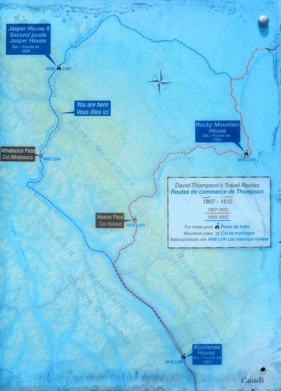
2. Marker detail: David Thompson’s Travel Routes
Routes de commerce de Thompson
Routes de commerce de Thompson

Regionally, this marker is in the Canadian Rockies. It is also in the Prairies. Globally, it is in North America, the Rocky Mountains, the Western Hemisphere, the Western World, and the Anglosphere. Historically, it finds itself in what was once a British colony and also Rupert’s Land.
Other nearby markers. At least 6 other markers are within 24 kilometers of this marker, measured as the crow flies: Athabasca Pass National Historic Site / Lieu historique national du Col-Athabasca (here, next to this marker); David Thompson (here, next to this marker); a different marker also named David Thompson (a few steps from this marker); Henry House (approx. 22.2 kilometers away); First People / Les premiers habitants (approx. 22.7 kilometers
Photographed by Cosmos Mariner, July 6, 2022
3. New Trade Route Over the Rockies / Une nouvelle route de commerce à travers les Rocheuses Marker
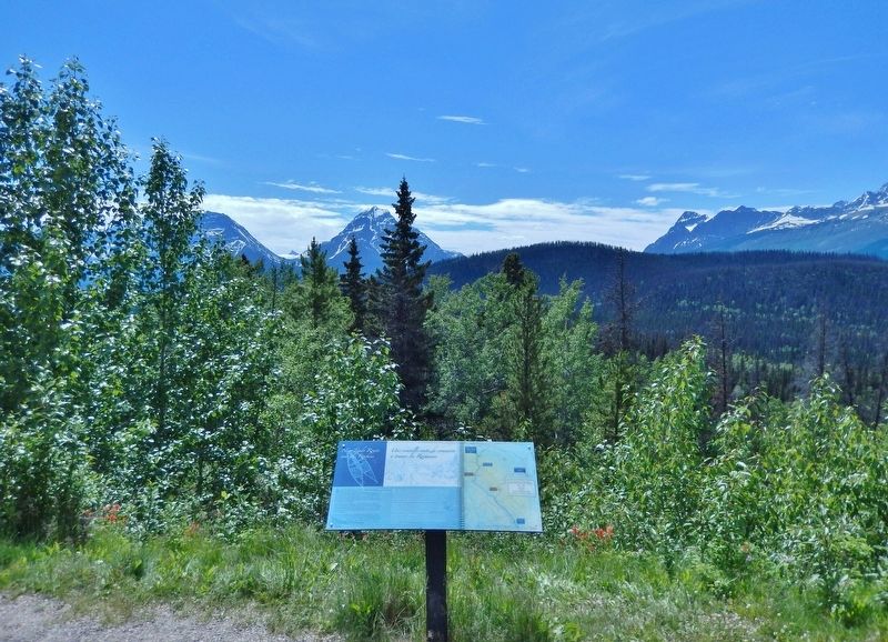
Looking southwest from the Athabasca Pass Lookout wayside.
Also see . . . Athabasca Pass National Historic Site of Canada (Parks Canada).
Excerpt: Athabaska Pass was designated a national historic site of Canada in 1971 because: the Athabaska Pass was, for almost half a century, part of the main fur trade route between Canada and the Oregon country. Between 1811 and the mid-1850s, the Athabaska Pass played an important role in the transportation routes of the fur trade of western North America. Its importance derived from its strategic location on the Continental Divide when traders, both British and American, were seeking to extend their commercial activity west of the Rocky Mountains. David Thompson, the noted surveyor and explorer, decided to search out a new route in order to get around the blockade mounted by the Piegan Indians. In January 1811, David Thompson, using traditional Aboriginal knowledge and guided by Thomas the Iroquois, crossed the Rockies through this pass and led his party down the Wood River to the place on the Columbia River later called Boat Encampment. Journeying over the pass in 1824, Hudson’s Bay Company Governor George Simpson named the small lake at the top of the pass “the Committee’s Punch Bowl” — a reference to the London Committee of the company. The Athabaska Pass route ensured continuity of service to the fur trade posts already established by Thompson in the upper and middle Columbia River Valley.(Submitted on October 4, 2026, by Cosmos Mariner of Cape Canaveral, Florida.)
Credits. This page was last revised on October 4, 2026. It was originally submitted on October 2, 2026, by Cosmos Mariner of Cape Canaveral, Florida. This page has been viewed 7 times since then. Photos: 1, 2, 3. submitted on October 4, 2026, by Cosmos Mariner of Cape Canaveral, Florida.
