Mount Hope in Providence in Providence County, Rhode Island — The American Northeast (New England)
The North Burial Ground
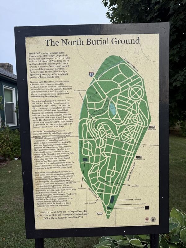
Established in 1700, the North Burial Ground is one of the largest properties in Providence, spanning over 110 acres. Filled with the rich history of Providence and its residents, from the colonial period to the present, it contains about 35,000 marked graves and the remains of more than 80,000 people. The site offers a unique opportunity to engage with a significant portion of Rhode Island's past.
Bounded by N. Main Street, Branch Avenue, Cemetery Street, Interstate 95 and the Moshassuck River, the Burial Ground serves as a natural retreat from the busy city. Its current landscape includes a pond that supports a vibrant ecosystem, as well as a glacier esker created during the last Ice Age.
During the rural cemetery movement of the 19th century, the Burial Ground underwent significant changes. The city constructed an office, greenhouse, receiving tomb, cast-iron fence, roads, and walkways. Randall Park became a half-mile long buffer between N. Main Street and the cemetery, and fountains and pavilions arose in and around three small ponds. The city also used marble left over from the new state house to build the
this page online
The Burial Ground uniquely includes memorials to worthy individuals, groups, and events of importance to Providence's history. The French Monument recognizes the contributions of General Rochambeau's soldiers, stationed in Providence during the American Revolution, who marched on Yorktown with Washington. The Armenian Martyrs Memorial honors lives lost in the Armenian Genocide. The Elks Rest statue, erected by the Benevolent and Protective Order of Elks, was once a prominent landmark featured on postcards. The famed Spanish-American War Hiker Statue has been replicated in dozens of communities across the country. Since 2016, a National Park Service plaque marks the historic Blackstone Canal.
Many important and individual people have been buried here over the centuries, including Stephen Hopkins, a signer of the Declaration of Independence; Horace Mann, the father of American public education; Charles Dow, co-founder of Dow Jones & Company; Edward and Christina Bannister, prominent African-American artist and hair salon proprietress,
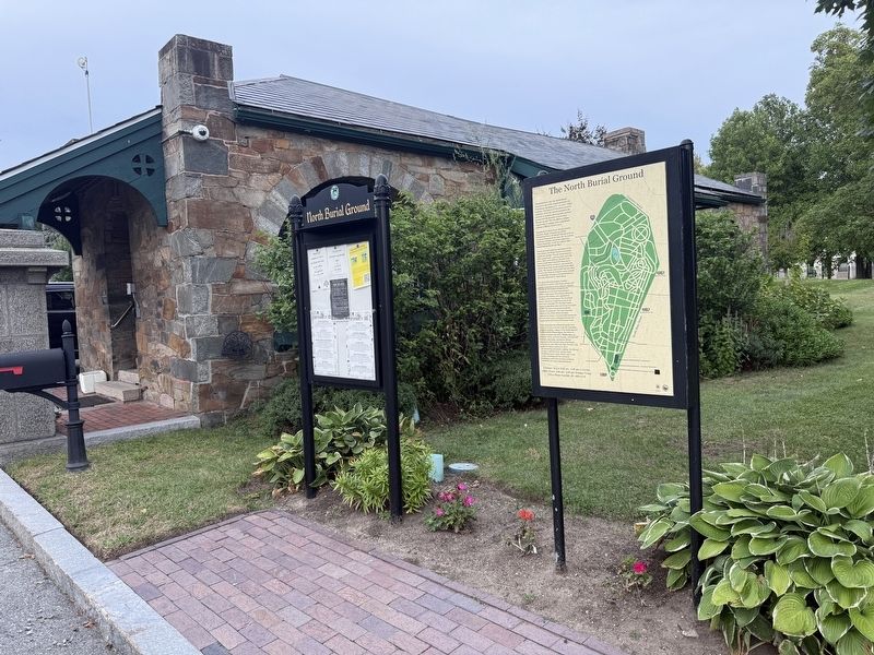
Office Hours: 8:00 am - 4:00 pm Monday-Friday
Office Phone Number: 401-680-5318
Erected 2017 by Rhode Island College; City of Providence, Rhode Island.
Topics and series. This historical marker is listed in these topic lists: Cemeteries & Burial Sites • Colonial Era • Industry & Commerce • War, US Revolutionary. In addition, it is included in the Signers of the Declaration of Independence series list. A significant historical year for this entry is 1700.
Location. 41° 50.59′ N, 71° 24.488′ W. Marker is in Providence, Rhode Island, in Providence County. It is in Mount Hope. It can be reached from the intersection of Branch Avenue and North Main Street (U.S. 1), on the right when traveling north. Touch for map. Marker is at or near this postal address: 5 Branch Ave, Providence RI 02904, United States of America. Touch for directions.

Regionally, this marker is on Narragansett Bay. It is also in the American Northeast, in New England, and on the Eastern Seaboard. Globally, it is in the North Atlantic Region, North America, the Western Hemisphere, the Western World, and the Anglosphere. Historically, it finds itself in what was once one of the original Thirteen Colonies.
Other nearby markers. At least 8 other markers are within walking distance of this marker: Stephen Hopkins (approx. 0.2 miles away); The Illustrious Stephen Hopkins (approx. 0.2 miles away); Revolutionary War Patriots (approx. 0.2 miles away); Sarah Scott Hopkins (approx. 0.2 miles away); Olney Street Riot 1831 (approx. half a mile away); Esek Hopkins (approx. 0.6 miles away); Elizabeth Angell Gould (approx. 0.6 miles away); Slavery and Land Acknowledgement (approx. 0.7 miles away). Touch for a list and map of all markers in Providence.
Credits. This page was last revised on October 2, 2026. It was originally submitted on October 2, 2026, by Devry Becker Jones of Washington, District of Columbia. This page has been viewed 18 times since then. Photos: 1, 2. submitted on October 2, 2026, by Devry Becker Jones of Washington, District of Columbia.
