Chattahoochee in Gadsden County, Florida — The American South (South Atlantic)
The British Evacuation
Photographed by James L.Whitman, September 26, 2026
1. The British Evacuation Marker
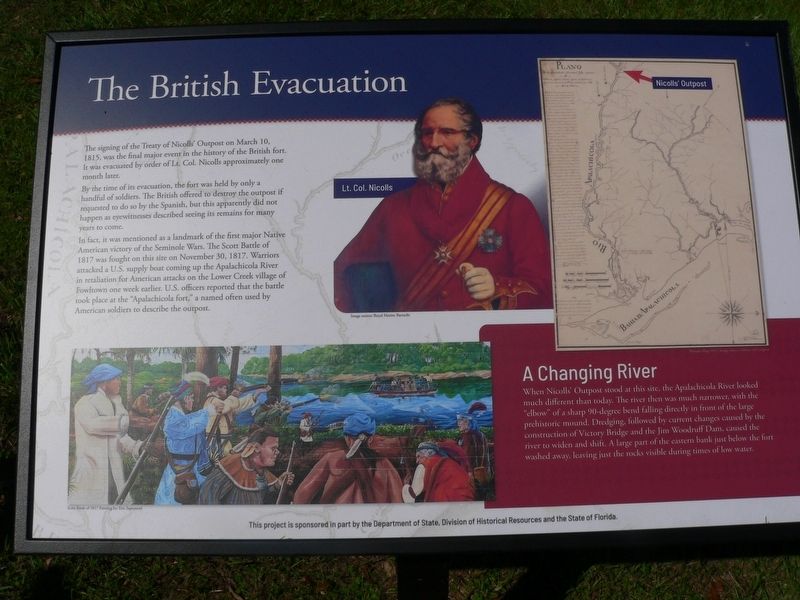
The signing of the Treaty of Nicolls' Outpost on March 10, 1815, was the final major event in the history of the British fort. It was evacuated by order of Lt. Col. Nicolls approximately one month later.
By the time of its evacuation, the fort was held by only a handful of soldiers. The British offered to destroy the outpost if requested to do so by the Spanish, but this apparently did not happen as eyewitnesses described seeing its remains for many years to come.
In fact, it was mentioned as a landmark of the first major Native American victory of the Seminole Wars. The Scott Battle of 1817 was fought on this site on November 30, 1817. Warriors attacked a U.S. supply boat coming up the Apalachicola River in retaliation for American attacks on the Lower Creek village of Fowltown one week earlier. U.S. officers reported that the battle took place at the "Apalachicola fort," a named often used by American soldiers to describe the outpost.
A Changing River
When Nicolls' Outpost stood at this site, the Apalachicola River looked much different than today. The river then was much narrower, with the "elbow" of a sharp
this page online
(caption)
Lt. Col. Nicolls Image source: Royal Marine Barracks
Scott Battle of 1817 Painting by Eric Saproneed
This project is sponsored in part by the Department of State, Division of Historical Resources and the State of Florida
Erected 2026 by Department of State, Division of Historical Resources and the State of Florida.
Topics. This historical marker is listed in these topic lists: Forts and Castles • Indigenous Peoples and Communities • War of 1812 • Wars, US Indian. A significant historical date for this entry is March 10, 1815.
Location. 30° 42.037′ N, 84° 51.389′ W. Marker is in Chattahoochee, Florida, in Gadsden County. It is at the intersection of South River Landing Road and North River Landing Road, on the left when traveling south on South River Landing Road. Touch for map.
Photographed by James L.Whitman, September 26, 2026
2. The British Evacuation Marker

Regionally, this marker is in Greater Tallahassee and on the Florida Panhandle. It is also in the American South and specifically in the Deep South. Globally, it is in the North Atlantic Region, North America, a Gulf of Mexico state, the Western Hemisphere, the Western World, and the Anglosphere. Historically, it finds itself in what was once New Spain, the territory of the Mississippian Culture, one of the Confederate States of America, and the Antebellum South.
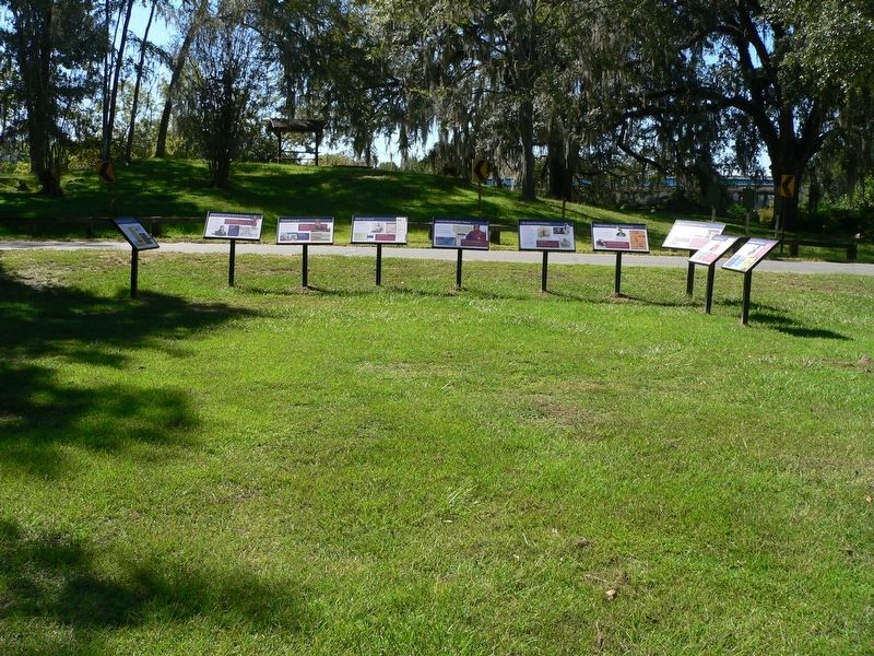
Other nearby markers. At least 8 other markers are within walking distance of this marker: Confrontation with the United States (here, next to this marker); The Treaty of Nicolls' Outpost (here, next to this marker); The Front Line of Freedom (here, next to this marker); Archaeology of Nicolls' Outpost (here, next to this marker); Nicolls' Outpost (within shouting distance of this marker); Chattahoochee Landing Mound Group (within shouting distance of this marker); The Scott Massacre (within shouting distance of this marker); The Scott Battle of 1817 (within shouting distance of this marker). Touch for a list and map of all markers in Chattahoochee.
Credits. This page was last revised on October 15, 2026. It was originally submitted on October 2, 2026, by James L.Whitman of Eufaula, Alabama. This page has been viewed 12 times since then. Photos: 1, 2. submitted on October 2, 2026, by James L.Whitman of Eufaula, Alabama. • Bernard Fisher was the editor who published this page.
