North Scituate in Providence County, Rhode Island — The American Northeast (New England)
The Village of North Scituate
⎯⎯⎯
Scituate, Rhode Island
Scituate Heritage Trail
| — | Historic Scituate, Rhode Island | — |
Photographed by Devry Becker Jones (CC0), September 19, 2026
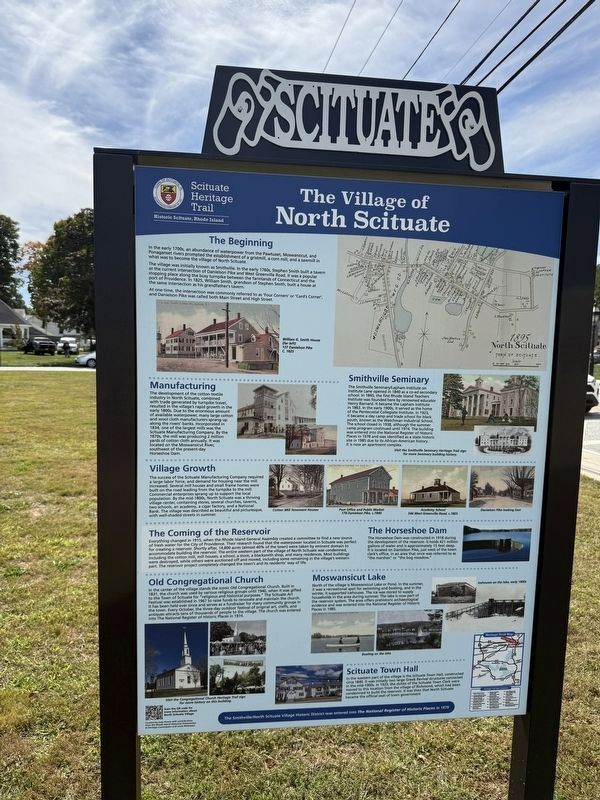
1. The Village of North Scituate side of the marker
In the early 1700s, an abundance of waterpower from the Pawtuxet, Moswaniscut, and Ponaganset rivers prompted the establishment of a gristmill, a corn mill, and a sawmill in what was to become the village of North Scituate.
The village was initially known as Smithville. In the early 1760s, Stephen Smith built a tavern at the current intersection of Danielson Pike and West Greenville Road. It was a popular stopping place along the busy turnpike between the farmlands of Connecticut and the port of Providence. In 1825, William Smith, grandson of Stephen Smith, built a house at the same intersection as his grandfather's tavern.
At one time, the intersection was commonly referred to as 'Four Corners' or 'Card's Corner', and Danielson Pike was called both Main Street and High Street.
Manufacturing
The development of the cotton textile industry in North Scituate, combined with trade generated by turnpike travel, resulted in the village's rapid growth in the early 1800s. Due to the enormous amount of available waterpower, many large cotton and wool cloth manufactures sprang
this page online
Smithville Seminary
The Smithville Seminary/Lapham Institute on Institute Lane opened in 1840 as a co-ed secondary school. In 1845, the first Rhode Island Teachers Institute was founded here by renowned educator Henry Barnard. It became the Lapham Institute in 1863. In the early 1900s, it served as the home of the Pentecostal Collegiate Institute. In 1923, it became a day camp and trade school for black youth, known as the Watchman Industrial School. The school closed in 1938, although the summer camp program continued until 1974. The building was entered into the National Register of Historic Places in 1978 and was identified as a state historic site in 1985 due to its African-American history. It is now an apartment complex.
Village Growth
The success of the Scituate
Photographed by Devry Becker Jones (CC0), September 19, 2026
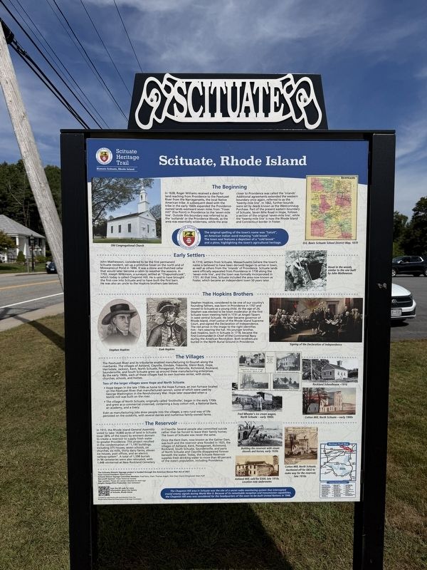
2. Scituate, Rhode Island side of the marker
The Coming of the Reservoir
Everything changed in 1915, when the Rhode Island General Assembly created a committee to find a new source of fresh water for the City of Providence. Their research found that the waterpower located in Scituate was perfect for creating a reservoir. Shortly after, 14,800 acres (almost 40% of the town) were taken by eminent domain to accommodate building the reservoir. The entire western part of the village of North Scituate was condemned, including the cotton mill, mill houses, a school, a store, a blacksmith shop, and many residences. Most buildings were destroyed, while others
Photographed by Devry Becker Jones (CC0), September 19, 2026
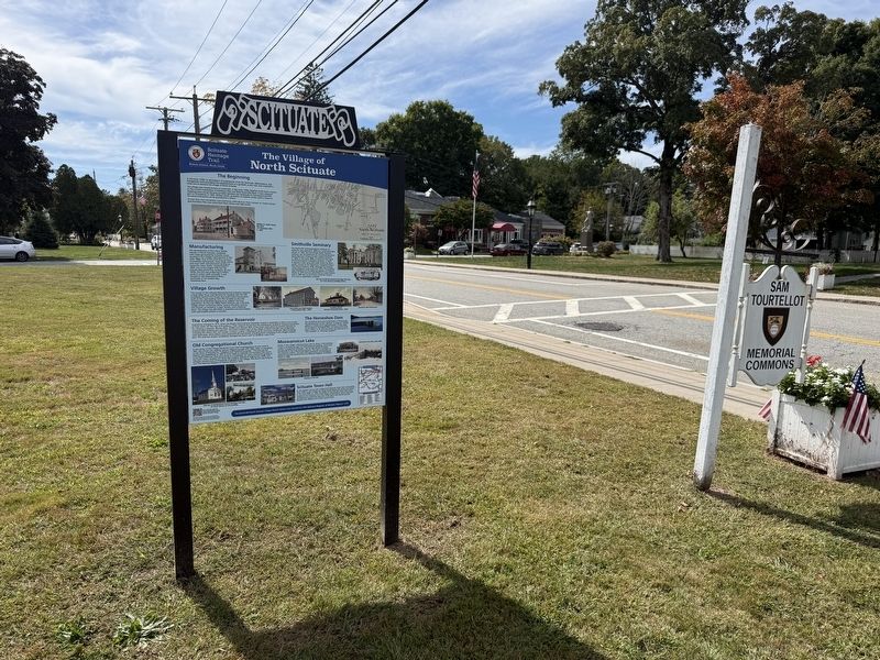
3. The Village of North Scituate / Scituate, Rhode Island Marker
The Horseshoe Dam
The Horseshoe Dam was constructed in 1918 during the development of the reservoir. It holds 421 million gallons of water and is approximately 15 feet deep. It is located on Danielson Pike, just west of the town clerk's office, in an area that once was referred to as "the marshes" or "the bog meadow."
Old Congregational Church
In the center of the village stands the iconic Old Congregational Church. Built in 1831, the church was used by various religious groups until 1940, when it was gifted to the Town of Scituate for "religious and historical purposes." The Scituate Art Festival was established in 1967 to raise funds to renovate and maintain the church. It has been held ever since and serves as a fundraiser for many community groups in the town. Every October, the three-day outdoor festival of original art, crafts, and antiques attracts tens of thousands of people to the village. The church was entered into The National Register of Historic
Photographed by Devry Becker Jones (CC0), September 19, 2026
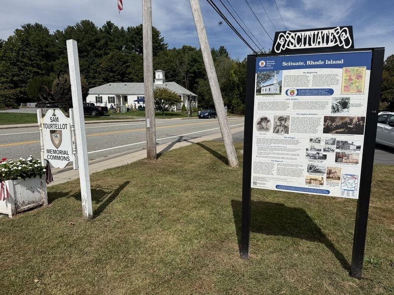
4. The Village of North Scituate / Scituate, Rhode Island Marker
Moswansicut Lake
North of the village is Moswansicut Lake or Pond. In the summer, it was a recreational spot for swimming and boating, and in the winter, it supported icehouses. The ice was stored to supply householdsd in the area during the summer. The lake is now part of the reservoir system. The area offers prehistoric archaeological evidence and was entered into the National Register of Historic Places in 1985.
Scituate Town Hall
In the western part of the village is the Scituate Town Hall, constructed circa 1840. It was initially two large Greek Revival structures connected in the mid-1900s. In 1923, the duties of the Scituate Town Clerk were moved to this location from the village of Richmond, which had been condemned to build the reservoir. It was then that North Scituate became the official seat of town government
In 1638, Roger Williams received a deed for land reaching from Providence to the Pawtuxet River from the Narragansetts, the local Native American tribe. A subsequent deed with the tribe in the early 1660s expanded the Providence-owned lands westward seven miles from "Fox Hill" (Fox Point) in Providence to the 'seven-mile line'. Outside this boundary was referred to as the 'outlands' or the Providence Woods, as the area was essentially wilderness, while the area closer to Providence was called the closer to Providence was called the 'inlands'. Additional agreements extended the western boundary once again, referred to as the 'twenty-mile line'. In 1662, further bounds were set by deeds known as the Westconnaug Purchase. Part of the present eastern boundary of Scituate, Seven Mile Road in Hope, follows a section of the original 'seven-mile line', while the 'twenty-mile line' is now the Rhode Island and Connecticut border in Foster.
Incorporated February 20, 1731
Early Settlers
John Mathewson, considered to be the first permanent Scituate resident, set up a primitive hovel on the north end of Moswansicut Pond in 1694. It was a stone and thatched cellar that would later become a cabin to weather the seasons. In 1703, Joseph Wilkins, a surveyor, settled at "Chapumishcook", which today is called Chopmist Hill. He is said to have brought the first cow into Scituate and to have built the first barn. He was also an uncle to the Hopkins brothers (see below).
In 1710, settlers from Scituate, Massachusetts (where the town's name is believed to have been derived) began to arrive in town, as well as others from the 'inlands' of Providence. Scituate lands were officially separated from Providence in 1730 along the 'seven-mile line', and the town was formally incorporated in 1731. At that time, Scituate included the area now known as Foster, which became an independent town 50 years later.
The Hopkins Brothers
Stephen Hopkins, considered to be one of our country's founding fathers, was born in Providence in 1707 and moved to Scituate as a young child. At the age of 24, Stephen was elected to be town moderator at the first Scituate town meeting held in 1731 at Angell Tavern in west central Scituate. He later became governor of Rhode Island, chief justice of the Rhode Island Supreme Court, and signed the Declaration of Independence. The red arrow in the image to the right identifies him - he's wearing the hat. His younger brother, Esek Hopkins, born in Scituate in 1718, became the first Commander-in-Chief of the Continental Navy during the American Revolution. Both brothers are buried in the North Burial Ground in Providence.
The Villages
The Pawtuxet River and its tributaries enabled manufacturing to flourish along the riverbanks. The villages of Ashland, Clayville, Elmdale, Fiskeville, Glenn Rock, Hope, Harrisdale, Jackson, Kent, North Scituate, Ponaganset, Potterville, Richmond, Rockland, Suandersville, and South Scituate grew up around these manufacturing enterprises. By the early 1900s, each of these villages had its own business center, with stores, churches, schools, and homes.
Two of the larger villages were Hope and North Scituate.
• Hope began in the late 1700s as home to the Hope Furnace, an iron furnace located on the Pawtuxet River that manufactured cannon, some of which were used by George Washington in the Revolutionary War. Hope later expanded when textile mill was built on the river.Even as manufacturing jobs drew people into the villages, a very rural way of life persisted on the outskirts, with several dairies and numerous family-owned farms.
• The village of North Scituate, originally called 'Smithville', began in the early 1700s and grew as a commercial crossroad, containing a busy cotton mill, a National Bank, an academy, and a livery.
The Reservoir
In 1915, the Rhode Island General Assembly voted to take 14,800 acres of land in Scituate (over 38% of the town) by eminent domain to create a reservoir to supply fresh water to greater Providence. This project resulted in the condemnation of "1,195 buildings, including 375 houses, seven schools, six churches, six mills, thirty dairy farms, eleven ice houses, post offices, and an electric railway system". A total of 1,598 burials in 96 cemeteries were relocated with 1,448 reinterred at New Rockland Cemetery in Clayville. Several people also committed suicide rather than be forced to leave their family homes. The town of Scituate was never the same.
Once the Kent Dam, now known as the Gainer Dam, was built and the reservoir area flooded in 1925, the villages of Ashland, Kent, Ponaganset, Richmond, Rockland, South Scituate, Saundersville, and parts of North Scituate and Clayville disappeared forever beneath the water. Today, the Scituate Reservoir supplies fresh drinking water to more than 60 percent of the state's population, including Providence.
Erected 2021 by The Town of Scituate, Rhode Island.
Topics and series. This historical marker is listed in these topic lists: Colonial Era • Industry & Commerce • Settlements & Settlers • Waterways & Vessels. In addition, it is included in the Signers of the Declaration of Independence series list. A significant historical year for this entry is 1825.
Location. 41° 50.064′ N, 71° 35.185′ W. Marker is in Scituate, Rhode Island, in Providence County. It is in North Scituate. It is on West Greenville Road (Rhode Island Route 116) north of Institute Lane, on the right when traveling north. Touch for map. Marker is at or near this postal address: 606 W Greenville Rd, North Scituate RI 02857, United States of America. Touch for directions.

Regionally, this marker is in the Quiet Corner and in Greater Providence. It is also in the American Northeast, in New England, and on the Eastern Seaboard. Globally, it is in the North Atlantic Region, North America, the Western Hemisphere, the Western World, and the Anglosphere. Historically, it finds itself in what was once one of the original Thirteen Colonies.
Other nearby markers. At least 8 other markers are within walking distance of this marker: Old Congregational Church (a few steps from this marker); Korea Memorial (within shouting distance of this marker); Vietnam Veterans Memorial (within shouting distance of this marker); Scituate Honor Roll (within shouting distance of this marker); a different marker also named Scituate Honor Roll (within shouting distance of this marker); Revolutionary War Memorial (within shouting distance of this marker); Owen Soldiers' Monument (within shouting distance of this marker); Scituate Schools (within shouting distance of this marker). Touch for a list and map of all markers in Scituate.
Credits. This page was last revised on October 2, 2026. It was originally submitted on October 2, 2026, by Devry Becker Jones of Washington, District of Columbia. This page has been viewed 18 times since then. Photos: 1, 2, 3, 4. submitted on October 2, 2026, by Devry Becker Jones of Washington, District of Columbia.
