
Near Keystone in Pennington County, South Dakota — The American Midwest (Upper Plains)
Black Elk Wilderness
A Spiritual Place
| — | Black Hills National Forest | — |
Photographed by Cosmos Mariner, August 18, 2023
1. Black Elk Wilderness Marker

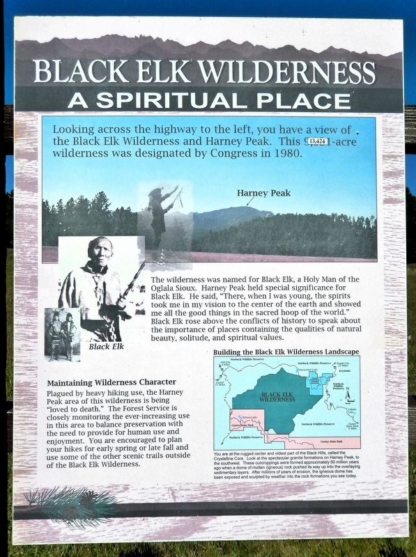
Looking across the highway to the left, you have a view of the Black Elk Wilderness and Harney Peak. This 13,424-acre wilderness was designated by Congress in 1980.
The wilderness was named for Black Elk, a Holy Man of the Oglala Sioux. Harney Peak held special significance for Black Elk. He said, “There, when I was young, the spirits took me in my vision to the center of the earth and showed am me all the good things in the sacred hoop of the world.” Black Elk rose above the conflicts of history to speak about the importance of places containing the qualities of natural beauty, solitude, and spiritual values.
Maintaining Wilderness Character
Plagued by heavy hiking use, the Harney Peak area of this wilderness is being “loved to death.” The Forest Service is closely monitoring the ever-increasing use in this area to balance preservation with the need to provide for human use and enjoyment. You are encouraged to plan your hikes for early spring or late fall and use some of the other scenic trails outside of the Black Elk Wilderness.
[image captions]
• Harney Peak
• Black Elk
Erected by Forest Service, U.S. Department
this page online
Topics. This historical marker is listed in these topic lists: Indigenous Peoples and Communities • Parks & Recreational Areas. A significant historical year for this entry is 1980.
Location. 43° 55.83′ N, 103° 27.023′ W. Marker is near Keystone, South Dakota, in Pennington County. It is on U.S. 16 just west of Calumet Road, on the right when traveling west. The marker is in a pull-out and parking area on the north side of US Highway 16. Touch for map. Marker is in this post office area: Keystone SD 57751, United States of America. Touch for directions.

Regionally, this marker is in West River, in the Badlands, and in Greater Rapid City. It is also in the American Black Hills, in the Lewis & Clark Corridor, on the prairies, and on the Northern Plains. Globally, it is in North America, the Western Hemisphere, the Western World, and the Anglosphere. Historically, it finds itself in what was once Rupert’s Land and also the Louisiana Purchase.
Other nearby markers. At least 8 other markers are within 3 miles of this marker, measured as the crow flies: Wilderness (here, next to this marker); Holy Terror Mine
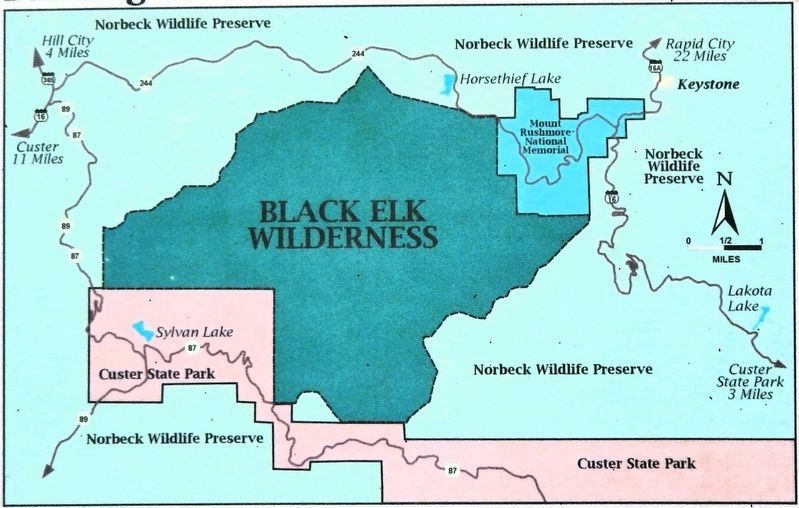
2. Marker detail: Building the Black Elk Wilderness Landscape
You are at the rugged center and oldest part of the Black Hills, called the Crystalline Core. Look at the spectacular granite formations on Harney Peak, to the southwest. These outcroppings were formed approximately 60 million years ago when a dome of molten (igneous) rock pushed its way up into the overlaying sedimentary layers. After millions of years of erosion, the igneous dome has been exposed and sculpted by weather into the rock formations you see today.
Also see . . .
1. Black Elk Wilderness (Wikipedia).
Excerpt: The Black Elk Wilderness is a nature preserve located in the U.S. state of South Dakota. The wilderness was designated by an act of Congress in 1980. Managed by the U.S. Forest Service, Black Elk Wilderness is part of Black Hills National Forest. This region is considered sacred to Native Americans, especially the Sioux and is named after Black Elk, an Oglala Sioux holy man.(Submitted on October 3, 2026, by Cosmos Mariner of Cape Canaveral, Florida.)
2. Black Elk Peak (Wikipedia).
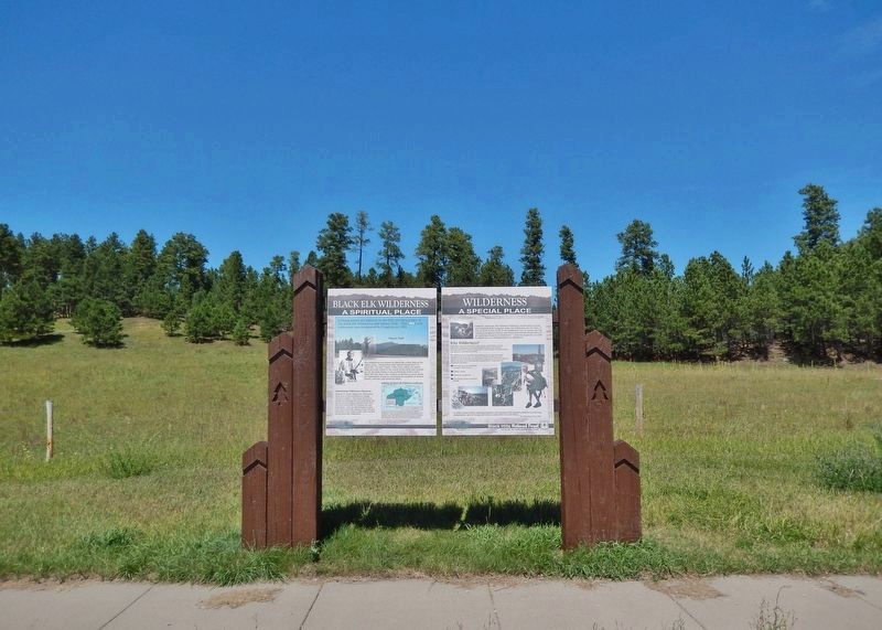
Excerpt: Black Elk Peak, formerly known as Harney Peak, is the highest natural point in the Black Hills mountain range and the U.S. state of South(Submitted on October 2, 2026, by Cosmos Mariner of Cape Canaveral, Florida.)Dakota. It lies in the Black Elk Wilderness area, in southern Pennington County, in the Black Hills. The U.S. Board on Geographic Names, which has jurisdiction in federal lands, officially changed the mountain's name from Harney Peak to Black Elk Peak on August 11, 2016, honoring Black Elk, the noted Lakota Sioux medicine man and Catholic Servant of God for whom the Wilderness Area is named.Photographed by Cosmos Mariner, August 18, 20233. Black Elk Wilderness MarkerLooking north from the US Highway 16 wayside. This marker is the leftmost of two panels in the interpretive kiosk at this location.
Black Elk Peak and the Black Hills were located within the Great Sioux Reservation established by the United States government in the Treaty of Fort Laramie in 1868. The first American settlers believed to have reached the summit were a party led by General George Armstrong Custer in 1874, during the Black Hills expedition. The federal government took back the Black Hills and another strip of land in a new treaty in 1877. More than a decade later, it broke up the Great Sioux Reservation in 1889 into five smaller reservations, the same year that North Dakota and South Dakota were admitted as states to the Union. The government made some nine million acres of former Lakota land available for purchase for ranching and homesteading. The area attracted many European immigrants as well as settlers from the East.
Black Elk Peak is the site where Black Elk (Lakota Sioux) received his “Great Vision” when nine years old. He later became a medicine man known for his wisdom. Late in life, he returned to the peak accompanied by writer John Neihardt. Black Elk was sharing much of his life and philosophy with Neihardt through long talks translated by his son. Neihardt tried to express the medicine man's wisdom in his book Black Elk Speaks (1932).
Credits. This page was last revised on October 3, 2026. It was originally submitted on October 2, 2026, by Cosmos Mariner of Cape Canaveral, Florida. This page has been viewed 17 times since then. Photos: 1, 2, 3. submitted on October 2, 2026, by Cosmos Mariner of Cape Canaveral, Florida.
