Richmond in Washington County, Rhode Island — The American Northeast (New England)
Early European Settlement
| — | Richmond Heritage Trail | — |
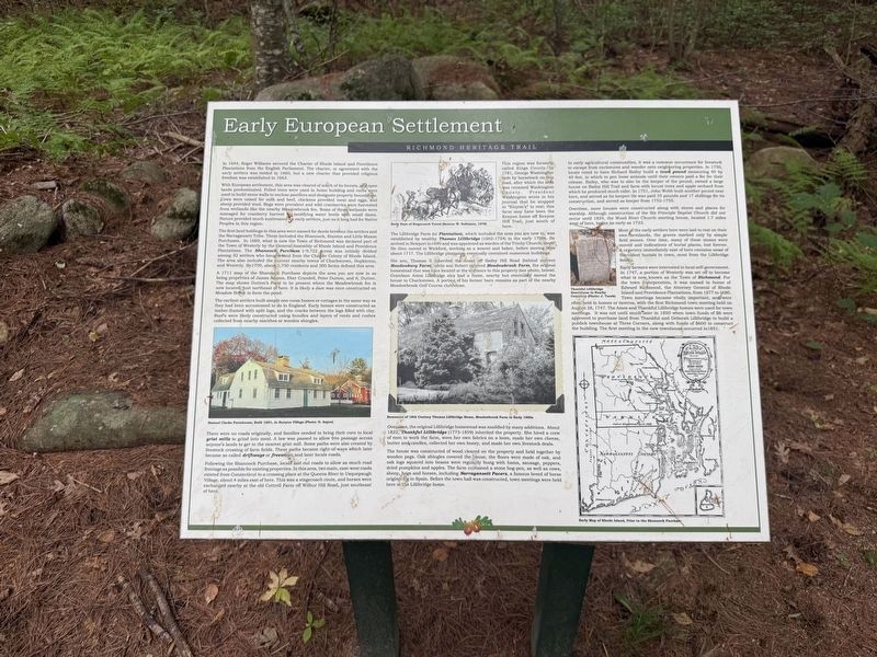
In 1644, Roger Williams secured the Charter of Rhode Island and Providence Plantations from the English Parliament. The charter, or agreement with the early settlers was voided in 1660, but a new charter that provided religious freedom was established in 1663.
With European settlement, this area was cleared of much of its forests, and open lands predominated. Felled trees were used in home building and rocks were used to build stone walls to enclose pastures and designate property boundaries. Cows were raised for milk and beef, chickens provided meat and eggs, and sheep provided wool. Bogs were prevalent and wild cranberries were harvested from wetlands like the nearby Meadowbrook fen. Some of these wetlands were managed for cranberry harvest by modifying water levels with small dams. Nature provided much sustenance for early settlers, just as it long had for Native Peoples in this region.
The first land holdings in this area were named for deeds between the settlers and the Narragansett Tribe. These included the Shannock, Stanton and Little Maxon Purchases. In 1669, what is now the Town of Richmond was declared
this page online
A 1711 map of the Shannock Purchase depicts the area you are now in as being properties of James Adams, Eber Crandell, Peter Dutton, and A. Dutton. The map shows Dutton’s Pond to be present where the Meadowbrook fen is now located; just northeast of here. It is likely a dam was once constructed on Meadow Brook to form the pond.
The earliest settlers built simple one-room homes or cottages in the same way as they had been accustomed to do in England. Early homes were constructed as timber-framed with split logs, and the cracks between the logs filled with clay. Roofs were likely constructed using bundles and layers of reeds and rushes collected from nearby marshes or wooden shingles.
There were no roads originally, and families needed to bring their
Following the Shannock Purchase, locals laid out roads to allow as much road frontage as possible for existing properties. In this area, two main, east-west roads existed from Connecticut to a crossing place at the Queens River in Usquepaugh Village, about 4 miles east of here. This was a stagecoach route, and horses were exchanged nearby at the old Cottrell Farm off Wilbur Hill Road, just southeast of here.
This region was formerly called Kings County. In 1781, George Washington rode by horseback on this road, after which the area was renamed Washington County. President Washington wrote in his journal that he stopped at "Kinyon's" to rest; this farm may have been the Kenyon home off Kenyon Hill Trail, just south of here.
The Lillibridge Farm (or Plantation), which included the area you are now in, was established by wealthy Thomas Lillibridge (1662-1724) in the early 1700s. He arrived in Newport in 1699 and was appointed as warden of the Trinity Church, there. He then moved to Wickford, working as a weaver and baker, before moving here about 1717. The Lillibridge plantation eventually contained numerous buildings.
His son, Thomas II inherited the home off Bailey Hill Road (behind current Meadowburg Farm), while son Robert received Meadowbrook Farm, the original homestead that was once located at the entrance to this property (see photo, below). Grandson Amos Lillibridge also had a home, nearby but eventually moved the house to Charlestown. A portion of his former barn remains as part of the nearby Meadowbrook Golf Course clubhouse.
Over time, the original Lillibridge homestead was modified by many additions. About 1822, Thankful Lillibridge (1773-1859) inherited the property. She hired a crew of men to work the farm, wove her own fabrics on a loom, made her own cheese, butter and candles, collected her own honey, and made her own livestock deals.
The house was constructed of wood cleared on the property and held together by wooden pegs. Oak shingles covered the house, the floors were made of oak, and oak logs squared into beams were regularly hung with hams, sausage, peppers, dried pumpkins and apples. The farm contained a stone hog-pen, as well as cows, sheep, hogs and horses, including Narragansett Pacers, a famous breed of horse originating in Spain. Before the town hall was constructed, town meetings were held here at the Lillibridge home.
In early agricultural communities, it was a common occurrence for livestock to escape from enclosures and wander onto neighboring properties. In 1750, locals voted to have Richard Bailey build a town pound measuring 40 by 40 feet, in which to pen loose animals until their owners paid a fee for their release. Bailey, who was to also be the keeper of the pound, owned a large house on Bailey Hill Trail and farm with locust trees and apple orchard from which he produced much cider. In 1751, John Webb built another pound near here, and served as its keeper. He was paid 35 pounds and 17 shillings for its construction, and served as keeper from 1752-1755.
Overtime, more houses were constructed along with stores and places for worship. Although construction of the Six Principle Baptist Church did not occur until 1824, the Wood River Church meeting house, located 1.7 miles west of here, began as early as 1723.
Most of the early settlers here were laid to rest on their own farmlands, the graves marked only by simple field stones. Over time, many of these stones were moved and indications of burial places, lost forever. A cemetery immediately east of here contains some of the oldest burials in town, most from the Lillibridge family.
Early farmers were interested in local self-government. In 1747, a portion of Westerly was set off to become what is now known as the Town of Richmond. For the town incorporation, it was named in honor of Edward Richmond, the Attorney General of Rhode Island and Providence Plantations, from 1677 to 1680. Town meetings became vitally important, and were often held in homes or taverns, with the first Richmond town meeting held on August 28, 1747. The Amos and Thankful Lillibridge homes were used for town meetings. It was not until much later in 1850 when town funds of $6 were approved to purchase land from Thankful and Deborah Lillibridge to build a publick townhouse at Three Corners, along with funds of $600 to construct the building. The first meeting in the new townhouse occurred in 1851.
Erected by Town of Richmond, Rhode Island.
Topics. This historical marker is listed in these topic lists: Agriculture • Colonial Era • Government & Politics • Settlements & Settlers. A significant historical date for this entry is August 28, 1747.
Location. 41° 30.338′ N, 71° 39.93′ W. Marker is in Richmond, Rhode Island, in Washington County. It is on Richmond Heritage Trail north of Country Acres Road, on the right when traveling west. Touch for map. Marker is at or near this postal address: 5 Country Acrs Rd, Wyoming RI 02898, United States of America. Touch for directions.

Regionally, this marker is on Narragansett Bay and in South County. It is also in the American Northeast, in New England, and on the Eastern Seaboard. Globally, it is in the North Atlantic Region, North America, the Western Hemisphere, the Western World, and the Anglosphere. Historically, it finds itself in what was once one of the original Thirteen Colonies.
Other nearby markers. At least 8 other markers are within 3 miles of this marker, measured as the crow flies: Early Town of Richmond (within shouting distance of this marker); Post-Glaciation and Native Peoples (about 300 feet away, measured in a direct line); A Maturing Town (about 400 feet away); Recent Times and the Future of Richmond (about 700 feet away); Richmond: A Town with Vision of Its Heritage and History (approx. 0.2 miles away); World War I, World War II and the Korean Campaign Memorial (approx. half a mile away); Vietnam and Desert Storm Memorial (approx. half a mile away); Depot Square Park (approx. 2.6 miles away). Touch for a list and map of all markers in Richmond.
Credits. This page was last revised on October 3, 2026. It was originally submitted on October 3, 2026, by Devry Becker Jones of Washington, District of Columbia. This page has been viewed 4 times since then. Photos: 1, 2. submitted on October 3, 2026, by Devry Becker Jones of Washington, District of Columbia.
