Richmond in Washington County, Rhode Island — The American Northeast (New England)
Recent Times and the Future of Richmond
| — | Richmond Heritage Trail | — |
Photographed by Devry Becker Jones (CC0), September 17, 2026
1. Recent Times and the Future of Richmond Marker
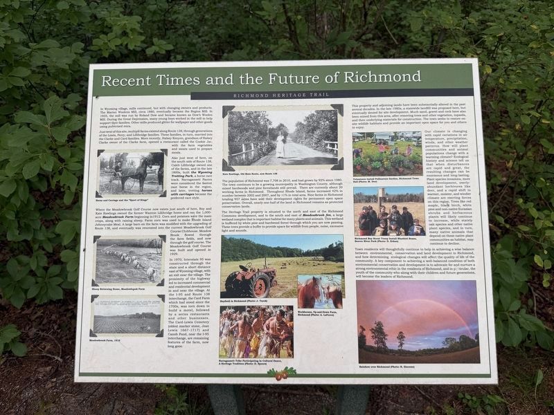
In Wyoming village, mills continued, but with changing owners and products. The Marion Woolens Mill, circa 1880, eventually became the Regina Mill. In 1935, the mill was run by Roland Dow and became known as Dow’s Woolen Mill. During the Great Depression, many young boys worked in the mill to help support their families. Other mills produced glitter for wallpaper and other goods using pulverized mica.
Just west of this site, multiple farms existed along Route 138, through generations of the Lewis, Perry, and Lillibridge families. These families, in turn, married into the Clarke and Card families. More recently, Halsey Kenyon, grandson of Halsey Clarke owner of the Clarke farm, opened a restaurant called the Cookie Jar, with the farm vegetables and meats used to prepare meals.
Also just west of here, on the south side of Route 138, Caleb Lillibridge owned one of the farms, and in the late 1800s, built the Wyoming Trotting Park, a horse race track. Narragansett Pacers were considered the fastest race horse in the region, and later, trotting horses with carriages became the preferred race style.
Where the Meadowbrook
this page online
In 1970, Interstate 95 was constructed through the state and a short distance east of Wyoming village, with an exit near the village. The proximity of the highway led to increased commercial and residential development in and near the village. At the I-95 and Route 138 interchange, the Card Farm which had stood since the 1700s, was torn down to build a motel, followed by a series restaurants and other businesses. The Card-Lewis Cemetery (oldest marker stone, Jean Lewis 1667-1717) and Canon Pond, near the I-95 interchange, are remaining features of the farm, now long
Photographed by Devry Becker Jones (CC0), September 17, 2026
2. Recent Times and the Future of Richmond Marker
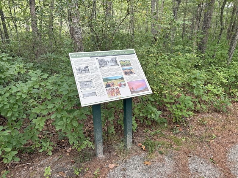
The population of Richmond was 7,708 in 2010, and had grown by 92% since 1980. The town continues to be a growing municipality in Washington County, although mixed hardwoods and pine forestlands still prevail. There are currently about 20 working farms in Richmond. Throughout Rhode Island, farms increased 42% in number between 2002 and 2007, and by 11% in total area. Nine farms in Richmond totaling 957 acres have sold their development rights for permanent open space preservation. Overall, nearly one-half of the land in Richmond remains as protected conservation lands.
The Heritage Trail property is situated to the north and east of the Richmond Commons development, and to the south and east of Meadowbrook fen, a large wetland complex that is important habitat for many plants and animals. This wetland is buffered by white pine and hardwood forest through which you are now passing. These trees provide a buffer to provide space for wildlife from people, noise, excessive light and sounds.
This property and adjoining lands have been substantially altered in the past several decades. In the late 1980s, a statewide landfill was proposed here, but eventually denied for site development. Much sand, gravel and rock have also been mined from this area, after removing trees and other vegetation, topsoils, and then underlying materials for construction. The town seeks to restore on-site wildlife habitats and provide an important open space for you and others to enjoy.
Our climate is changing with rapid variations in air temperature, precipitation, winds, and other weather patterns. How will plant communities and animal populations change with a warming climate? Ecological history and science tell us that when disturbances are rapid and great, the resulting changes can be enormous and long-lasting. Plant species invasions, more land development, overly-abundant herbivores like deer, and a rapid shift to warmer, moister, and windier climate are exerting forces on this region. Trees like red maple, black birch, white pine and non-native Eurasian shrubs and herbaceous plants will likely continue to increase, while stately oak species and other native plant species, and in turn, many native animals that depend on these native plant communities as habitat, may continue to decline.
Town residents will thoughtfully continue to help in achieving a wise balance between environmental, conservation and land development in Richmond, and how determining ecological changes will affect the quality of life of the community. A key component to achieving a well-balanced condition of both environmental conservation and development is to advocate for and nurture a strong environmental ethic in the residents of Richmond, and in particular, the youth of the community who along with their children and future generations will become the leaders of Richmond.
Erected by Town of Richmond, Rhode Island.
Topics. This historical marker is listed in these topic lists: Agriculture • Environment • Industry & Commerce • Settlements & Settlers. A significant historical year for this entry is 1880.
Location. 41° 30.235′ N, 71° 40′ W. Marker is in Richmond, Rhode Island, in Washington County. It is on Richmond Heritage Trail north of Country Acres Road, on the right when traveling south. Touch for map. Marker is at or near this postal address: 3 Country Acrs Rd, Wyoming RI 02898, United States of America. Touch for directions.

Regionally, this marker is on Narragansett Bay and in South County. It is also in the American Northeast, in New England, and on the Eastern Seaboard. Globally, it is in the North Atlantic Region, North America, the Western Hemisphere, the Western World, and the Anglosphere. Historically, it finds itself in what was once one of the original Thirteen Colonies.
Other nearby markers. At least 8 other markers are within 3 miles of this marker, measured as the crow flies: A Maturing Town (about 300 feet away, measured in a direct line); Richmond: A Town with Vision of Its Heritage and History (about 400 feet away); Post-Glaciation and Native Peoples (about 600 feet away); Early Town of Richmond (about 600 feet away); Early European Settlement (about 700 feet away); World War I, World War II and the Korean Campaign Memorial (approx. half a mile away); Vietnam and Desert Storm Memorial (approx. half a mile away); Old Stone Dam (approx. 2.6 miles away). Touch for a list and map of all markers in Richmond.
Credits. This page was last revised on October 4, 2026. It was originally submitted on October 4, 2026, by Devry Becker Jones of Washington, District of Columbia. This page has been viewed 6 times since then. Photos: 1, 2. submitted on October 4, 2026, by Devry Becker Jones of Washington, District of Columbia.
