Chattahoochee in Gadsden County, Florida — The American South (South Atlantic)
Archaeology of Nicolls' Outpost
Photographed by James L.Whitman, September 26, 2026
1. Archaeology of Nicolls'Outpost Marker
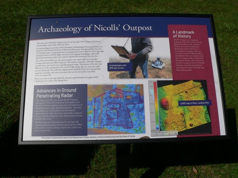
Archaeology of Nicolls' Outpost
The exact site of Nicolls Outpost was lost in the early 19th century and was not located again and nearly 200 years later.
An archaeological team from Pre-Columbian Archaeological Research Group, Inc funded by the Florida Division of Historical Resources and approved by the City of Chattahoochee, conducted extensive geophysical research here in 2024. Specially equipped drones, LIDAR (light detection and ranging technology), and GPR (ground-penetrating radar) were used to identify the remains of the lost fort.
The GPR and LIDAR were the most sensitive ever used at the site, and they revealed what previous efforts had not. The earthen ramparts of Nicolls' Outpost are still intact and can be seen atop the mound today. The interior of the fort was filled prior to the construction of a tavern in the 1820s, but the structure itself was not destroyed. The GPR also displayed the location of the fort's gunpowder magazine, barracks, and other structures that are buried under more than 3-feet of earthen fill.
When you look at the large platform mound, approximately the upper third formed
this page online
Advances in Ground Penetrating Radar
The advanced GPR unit used at Nicolls' Outpost during the 2024 survey had never been deployed in the US and was superior to previous investigations at British fort sites on the Apalachicola River. Scientists were able to see much deeper into the mound, discovering the walls, dry moat, and powder magazine of an irregularly shaped for that allowed defense from multiple directions.
The fort walls were determined to be two log walls constructed horizontally with the space between filled with earth to create a strong rampart that could resist heavy cannon fire.
A Landmark of History
Nicolls' Outpost is an important landmark of the War of 1812 and the fight for freedom on the Southern frontier. It was the northernmost British post of the Gulf Coast of New Orleans Campaign. Maroons came here to join the British military and fight for their own freedom from slavery. A large number of Seminole, Miccosukee Yuchi, and Creek towns met here to sign the Treaty of Nicolls' Outpost, one of the foundational documents óf today's Seminole and Miccosukee people.
Erected 2026
Photographed by James L.Whitman, September 26, 2026
2. Archaeology of Nicolls'Outpost Marker
Topics. This historical marker is listed in these topic lists: Anthropology & Archaeology • Forts and Castles • Indigenous Peoples and Communities • War of 1812. A significant historical year for this entry is 2024.
Location. 30° 42.036′ N, 84° 51.388′ W. Marker is in Chattahoochee, Florida, in Gadsden County. It is on North River Landing Road, on the left when traveling south. In Chattahoochee River Landing Park. Touch for map. Marker is at or near this postal address: 500 N River Landing Road, Chattahoochee FL 32324, United States of America. Touch for directions.

Regionally, this marker is in Greater Tallahassee and on the Florida Panhandle. It is also in the American South and specifically in the Deep South. Globally, it is in the North Atlantic Region, North America, a Gulf of Mexico state, the Western Hemisphere, the Western World, and the Anglosphere. Historically, it finds itself in what was once New Spain, the territory of the Mississippian Culture, one of the Confederate States of America, and the Antebellum South.
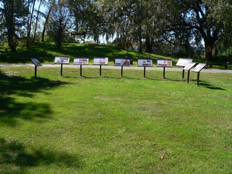
Other nearby markers. At least 8 other markers are within walking distance of this marker: Confrontation with the United States (here, next to this marker); The British Evacuation (here, next to this marker); The Front Line of Freedom (here, next to this marker); The Treaty of Nicolls' Outpost (here, next to this marker); Chattahoochee Landing Mound Group (within shouting distance of this marker); Nicolls' Outpost (within shouting distance of this marker); The Scott Massacre (within shouting distance of this marker); The Scott Battle of 1817 (within shouting distance of this marker). Touch for a list and map of all markers in Chattahoochee.
Credits. This page was last revised on October 15, 2026. It was originally submitted on October 4, 2026, by James L.Whitman of Eufaula, Alabama. This page has been viewed 9 times since then. Photos: 1, 2. submitted on October 4, 2026, by James L.Whitman of Eufaula, Alabama. • Andrew Ruppenstein was the editor who published this page.
