South Kingstown in Washington County, Rhode Island — The American Northeast (New England)
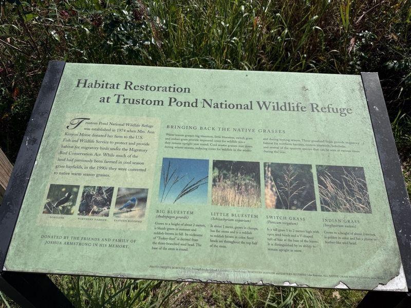
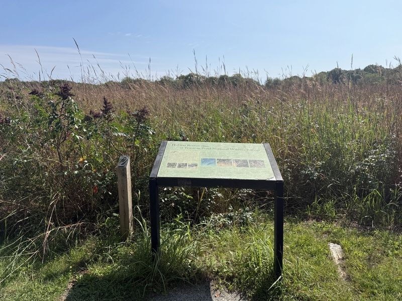
Habitat Restoration at Trustom Pond National Wildlife Refuge
Photographed by Devry Becker Jones (CC0), September 17, 2026
1. Habitat Restoration at Trustom Pond National Wildlife Refuge Marker
Trustom Pond National Wildlife Refuge was established in 1974 when Mrs. Ann Kenyon Morse donated her farm to the U.S. Fish and Wildlife Service to protect and provide habitat for migratory birds under the Migratory Bird Conservation Act. While much of the land had previously been farmed in cool season grass hayfields, in the 1990s they were converted to native warm season grasses.
Bringing Back the Native Grasses
Warm season grasses big bluestem, little bluestem, switch grass and indian grass provide improved cover for wildlife since they remain upright year round. Cool season grasses mat down during winter storms, reducing cover for wildlife in the winter and during nesting season. These grassland fields provide migratory habitat for northern harriers, eastern bluebirds, bobolinks, and several of the sparrow species that can be seen at various times during the year.
Big bluestem
(Andropogon gerardii)
Grows to a height of about 2 meters. It is bluish-green in summer and reddish-brown in fall. Its nickname of "Turkey-foot" is derived from the three-branched seed head. The base of the stem is round.
Little bluestem
(Schizachyrium scoparium)
Is
this page online
Switch grass
(Panicum virgatum)
Is a tall grass 1 to 2 meters high with open seed heads and a V-shaped tuft of hair at the base of the leaves. It is distinguished by its ability to remain upright in snow.
Indian grass
(Sorghastrum nutans)
Grows to a height of about 2 meters, is golden in color and has a plume or feather-like seed head.
Erected by the friends and family of Joshua Armstrong in his memory.
Topics. This historical marker is listed in these topic lists: Animals • Environment • Natural Resources • Parks & Recreational Areas. A significant historical year for this entry is 1974.
Location. 41° 22.944′ N, 71° 35.172′ W. Marker is in South Kingstown, Rhode Island, in Washington County. It is on Farmer Trail Loop south of Matunuck School House Road, on the right when traveling south. Touch for map. Marker is at or near this postal address: 1040 Matunuck School House Rd, Wakefield RI 02879, United States of America. Touch for directions.

Regionally, this marker is on Narragansett
Photographed by Devry Becker Jones (CC0), September 17, 2026
2. Habitat Restoration at Trustom Pond National Wildlife Refuge Marker
Other nearby markers. At least 8 other markers are within 4 miles of this marker, measured as the crow flies: Trustom Pond National Wildlife Refuge (within shouting distance of this marker); Building a Legacy (about 300 feet away, measured in a direct line); Samuel E. Perry Grist Mill (approx. 0.8 miles away); Cross' Mills Common Burying Ground (approx. 2.9 miles away); Cross' Mills (approx. 2.9 miles away); Fort Ninigret (approx. 3.1 miles away); a different marker also named Fort Ninigret (approx. 3.2 miles away); From Trawl to Table (approx. 3.9 miles away). Touch for a list and map of all markers in South Kingstown.
Credits. This page was last revised on October 9, 2026. It was originally submitted on October 4, 2026, by Devry Becker Jones of Washington, District of Columbia. This page has been viewed 7 times since then. Photos: 1, 2. submitted on October 4, 2026, by Devry Becker Jones of Washington, District of Columbia.
